
Nature Trails
More than 2,500 km of marked trails through forests, high plateaus and hidden valleys. Your exploration starts here.
Les Hautes-Chaumes
Walking & cycling routes around Le Monestier
Walking, trail-running and cycling routes that start in or pass through our home village.
Family Friendly
Easy loops for little legs and unhurried afternoons.
Peak Challenges
The highest vantage points and most rewarding climbs.
Epic Journeys
Long-distance loops and cross-park traverses.
All Trails
Find your perfect route.
378 trails
No trails match your current search and filters. Try changing or clearing one of them.
2 days of bivouac on Hautes-Chaumes
Between the jasseries, the peat bogs and the panoramas of the Alps on a clear day, here is a bivouac on the volcanic ridges of Livradois-Forez immersed in nature and accessible by train.
A Story of Water
This 8.8 km loop starts and finishes at Eglise, St-Just, with 353 m of ascent and an estimated duration of 3 hours.
Above Aubusson (Circuit No. 7)
Like circuit No. 5, this waymarked loop passes through Puymillier, where you can discover its 400-year-old mulberry, listed among France’s remarkable trees. It then climbs a little higher to the path linking La Bournélie and La Félolie, with a remarkable view of the Chaîne des Puys. A slightly technical trail behind the ruins of the former Château de Montgon descends to Aubusson and reaches the village church, home to a magnificent 12th-century Romanesque Virgin in Majesty. The route then circles the lake before reaching Tournebize and La Souche. After a quick descent, it crosses the Espinasse stream, then finishes with a climb on a path to Champblanc before following the road back to the nature centre.
Above Châteldon
This 5.6 km loop starts and finishes at Châteldon, with 124 m of ascent and an estimated duration of 2 hours.
Along the Banks of the Allier
On this walk, discover the traditional pebble-and-rammed-earth houses beside the Allier and the carbonated mineral spring of L’Ours.
Along the Batifol
This circuit overlooks the small valley where the Batifol stream winds. The first part of the route opens up beautiful views over the Ambert plain and the village of Valcivières, before crossing to the other side of the valley and continuing through beech and fir woodland.
Along the Trails of Bort-l'Étang
Start: From the car park, walk along the left-hand side of the cemetery. At the small road, climb to the left. 100 m farther on, at a left-hand bend, leave the road and climb a track on the right. On reaching the wider track, follow it to the right for 200 m and, at the crossroads of four tracks, take the track on the right to the hamlet of Les Boursis. 1. In the hamlet, climb left along the D309 (bread oven). 150 m farther on, leave the D309 and turn left towards Clairmatin. Go straight through the hamlet (bread oven on the right), remaining on the small road. At the junction, cross the road and continue opposite, then 100 m farther on take the second path on the right. 2. On reaching the wide track, follow it to the left (view of the Chaîne des Puys, the Sancy massif, the Limagne plain and Clermont-Ferrand). At the junction, where the surface becomes paved, follow the road straight ahead. After 300 to 400 m, take the track on the left into the woods. Then, 100 m farther on, turn right onto a track and right again 50 m later onto a path winding through the woods. Leave this track for a path on the left. 3. Reach a wide track, cross it and take the path opposite. At the paved road, continue opposite. Pass Château de Codignat on the left and continue straight ahead. Leave the road for a track on the left entering the woods (dangerous descent with ruts and large stones). In the village of Taloup (rammed-earth barn), turn left onto the track. 4. At the road (a shortcut back to Bort-l'Étang is possible by turning left), turn right (ignore the road on the left towards Basset) and continue straight ahead (view of Château de Mauzun ahead). Cross the D212 and take the small road opposite (towards Les Andrauds). At the entrance to Les Andrauds, beside the pond and iron cross, turn right (you can continue straight ahead to see the bread oven), then right again just after a rammed-earth barn. At the junction, turn left (view of Château de Mauzun on the right). 5. At the next junction, turn right. Where a track joins from the right, continue straight ahead to the road. Follow it to the right, then take the road on the left as far as the D309. Turn right along it for a few metres. 6. Immediately take the track on the left. Cross Lance and continue straight ahead, then follow a dirt track on the right for 1.5 km. Climb the first track on the left and, at the fork, turn left. 7. Turn onto the track on the left and, after 500 m, take a descending track on the left. Cross the small stream and continue along the main track, which bends right before climbing through the woods. At the T-junction just before the ponds, take the track on the left and continue to the D212. Cross it and take the track opposite leading to Guillaumont. 8. Just after the cross, turn right and follow the road. At the next junction, turn right again. Take the first dirt track on the left and, 250 m farther on, turn left. Opposite the karting circuit, turn left. At Chez Laire, follow the track on the right. At Le Beurrier, turn left and pass the nursery school. At the church, turn right onto the D309 to return to the starting point.
Ambert
This short circuit allows you to discover the two facets of Ambert: the natural side with the Bois de Boulogne, the Red Hen trail, the path along the Dore and the heritage side with the half-timbered houses, the round town hall, the cheese house and the St-Jean church.
Around Baffie
After walking through a wooded valley, you will admire the beech forest dominating the village. Leaving the beech forest, you will discover the picturesque hamlet of Charrier with its old granite houses. On the way back down, you will admire the view of the Dore valley and the Livradois mountains and return to the small village of Baffie which was once the high place of the lordship of Baffie. This little hike, alone or with the family, is a simple pleasure of a bucolic walk in the forest and if you do not make too much noise you may be able to come across with a little luck a deer, squirrel...
Around Malaguet Lake
Departure: From the small beach, take the path going left. Enter the meadow and follow the main path. Horses may be grazing, please close the gates after your passage. After crossing the entire community, go up into the woods to the tarmac road. Take it on the right before continuing always on the right towards the village “Le Fournet”. 1. 250m before the first building, turn right. Follow the main path (possibility of going back and forth to the viewpoint over the lake) then until you reach the track. 2. Take it to the right and turn immediately onto the path going down to the right. Keep the main path, cross the two footbridges over the stream and continue 100m to a forest track. 3. Take it on the right (possibility of going back and forth to the lake a little further) then continue until the tarmac road. Go down the road to the right and at the next intersection, turn right again on the road to find the parking lot where the hike starts.
Around Noalhat
D - From the car park behind the Noalhat town hall, take the road on the left. At the T-junction, turn right onto the D44b until the intersection with the D44. Continue on the road opposite towards Paslières. In the village of “Croix des Ferrats” take the road on the left towards Lavaure. The road becomes a path. 1 At the T-junction, turn onto the road on the right. At the next intersection, turn left then right (Église de Paslières). At the exit of the village, take the path on the right. At the next crossroads of 4 paths, turn onto the right to reach the village of “La Ville”. Then take the road on the left until the next crossroads. Cross the road and continue on the main path to the village of “La Meille”. 2 At the next crow’s foot, take the path on the left and continue to the village of “Chez Foury”. In the center of the village, take the path which goes to the right to the village of “Chez Colas”. Then take the asphalt road on the left until you find the D44. 3 Cross it and continue straight on the main road. After the village of “Champ Morel”, continue on the road opposite to reach the car park behind the Noalhat town hall.

Around the Couzon valley (circuit n°8)
Very nice, varied marked circuit, which alternates descents and climbs on paths presenting several technical passages (deep ruts, slopes, small screes). In particular, you should be particularly vigilant during the first descent between Ollières and the Mégain bridge, especially if you have not had the opportunity to warm up a little beforehand. The circuit then runs along the western part of Lake Aubusson before passing near the Notre-Dame d'Espinasse chapel built just above a miraculous spring from which water springs which can treat and cure certain skin diseases such as eczema...

Around the Maison du Parc
Departure: From the Parc Livradois-Forez house, in Saint-Gervais sous-Meymont, go up and through the village. At the exit, go up the path on the left. Leave another one on the left. 1. On a small plateau, turn right towards the houses of Combe. Go up the D254 on the left for 50 m. 2. Leave the road and go down the path on the right, then climb under the chestnut and hazel trees, on the right, after a stream. Follow the D254 on the right(view of the Dore and the foothills of Forez: grün de Chignore). 3. At Griolles, go down the path on the right. At the first split, climb to the left in the woods, then continue along the edge. 4. Turn right into Lauphant(well)and go up the small road to the plateau(view of the Forez). 5. After crossing Le Bouchet, go down the small road on the left, then follow the D254 on the right. At the crossroads, take the D259 on the left, towards Olliergues. 6. After 300 m, go up the path on the right behind a farm shed, in the woods. Always keep the same path to exit the woods (view of the Dore valley, Forez and the Puys chain). 7. At the iron cross, turn right, then immediately left along the woods until Pradat. 8. In Pradat, go up the path on the left. At the crossroads, turn left onto the perpendicular path(view of the Château de Blanchisse). Always keep the same path (view) until you reach a small road; follow her in front. 9. Before the first house in Guimoye, go down the path to the right, full slope, in the woods. 10. Cut the D259 to take the path on the left; sometimes paved, in deciduous woods, it passes a stream and small waterfalls. 11. Take the road on the right. Cross the Constancis and the Thiaudat straight on. At the fountain, go up the path on the left. 12. Turn and go down the perpendicular path, on the right. At the Croix des Pouillades, take the road on the left. At the exit of the second bend, go down the grassy path on the right. Returning to point 1, in the middle of the meadows, go right to dive towards the Maison du Parc.
Around the Pradeaux dam
Departure: From the Col des Pradeaux, take the path up to the dam. At the next crossroads, take the path uphill on the right. Before the reservoir, take the path on the right and keep the main path until you reach the woods. Cross the woods opposite and continue opposite until the crossroads of 4 paths. 1. Take the path opposite and continue to the dam. Follow the dam on the right. Towards the “tail” of the dam, take a path going down to the left. Continue to follow the dam on the right and cross the 2 wooden footbridges. 2. At the exit of the second footbridge, turn left on the path and continue to follow the dam for 600m. Cross a small stream on the 3rd footbridge, continue opposite for 300m before going up a path on the right to find the path. 3.Take it on the left and continue to pass next to the dam. At the next crossroads, turn left and keep the main path going down to the Col des Pradeaux.
Around the towers and castles
Departure: Take the alley to the left of the town hall which runs alongside the village hall. 20 m further, at the fork, take the path on the left between the stone houses. Cross the D 303, and take the road opposite. In the village of Audigier, turn right to pass between the houses. At the fork, at the exit of the hamlet, continue right on the path. At the Sardiats stream, continue on the same path (view of the Château de Mauzun on the left). 1. At the D 20, take it on the right for 400 m; then at the next crossroads, turn right towards Puy Gentil. At the hamlet, go up left to the D 152. Take it on the right to enter Neuville (view on the left of Clermont-Fd, the Chaîne des Puys and the Château de Ravel). In Neuville, opposite the church, turn left then immediately right after the fountain (direction Les Peux); then 10 m further, turn left (view on the left of the ruined Neuville tower). 2. At the next crossroads, turn right. Cross the village of Peux (view of the Mauzun castle slightly on the left, the Puys chain and the Sancy massif, Billom, Clermont-Fd). In the hamlet of Pireyre, at the crossroads, turn left. At the last houses, leave the road and take the path which goes up to the left (view of the Mauzun castle, Bongheat in the foreground and the Sancy massif in the background on the right, Château des Salles, Billom, Clermont-Ferrand, the Limagne plain and the Puys chain completely on the right). At the crossroads of 5 paths, take the opposite direction and pass next to the Château du Cheix. 3. At the D 303, take it on the right. 200 m further, turn left to enter the village of Herment. At the exit, continue to the right on the road which becomes a grassy path (view of the Mauzun castle on the left) then follow the D 303 on the left. At the level of the lake, take the sunken path which rises to the left and continue on this same path to Bel Air (100 m after Bel Air: view of the Mauzun castle opposite, the Sancy massif and the Puys chain slightly to the right). 4. At the crossroads, at the road (view of Thiers on the left, the Forez mountains opposite, the Mauzun castle, Sancy massif and Puys chain on the right) turn right. At the D 7, follow it for 50 m and turn immediately right. Cross the hamlet of La Montagne. 5. At the entrance to Mauzun, turn right, and, at the wrought iron cross, immediately go up to the left to pass between the houses then turn right to join the D 20. Take it on the right, skirt the chapel then the covered market. At the next crossroads, turn right onto the D 20 (direction Bongheat). At the Place des Grolles, (possibility of going up to the Château de Mauzun) take the path between two houses at the back of the square. At the crossroads (nice view), go down opposite and continue on this same path. 6. At the fork, continue to descend to the left (ignore the stony path). Walk along the cemetery, and at the road, turn left to enter Bongheat.

At the sources of Dolore
On this path we come across many testimonies of the past: granite crosses, St-Eloy fountain or Rameaux and Rapans crosses. The nature around the Dolore stream is also omnipresent and offers views of the Forez mountains.

Balad’heurs
This 11.2 km loop starts and finishes at Saint-Jean-d'Heurs, with 130 m of ascent and an estimated duration of 2 hr 30 min.
Bariande
This 5.1 km loop starts and finishes at Palladuc, with 179 m of ascent and an estimated duration of 1 hr 18 min.
Bas-Livradois (Road Circuit No. 4)
After admiring the Romanesque priory church at Glaine-Montaigut, pause in Billom, a beautiful medieval town, before climbing the first Livradois foothills to Château de Montmorin and the imposing fortress of Mauzun.
Beauvoir
Château de La Roue All that remains of this château is part of the enclosure wall and the square tower visible from the village. This keep, known as the “Tour de Pierrefort” in tribute to the last lord of the estate, “Hérail de Pierrefort La Roue”, dates from the 14th century and was restored in the 19th century. The original building probably dates back to the 13th century. It was then a powerful feudal château, forming part of the ring of fortifications around the county of Forez. From an early date it belonged to the La Roue family, known since the 12th century, who dominated the Ance valley from their three châteaux: La Roue, Montpeloux and La Chaulme.

Below the Grün de Chignore (Circuit No. 13)
This waymarked route climbs close to Vollore-Ville, then follows paths towards the hamlet of Chossière before rising through La Chaise Basse and La Chaize Haute, after which the track becomes much rockier. It joins the old Roman road in woodland on the slopes of the Grün de Chignore, a vast granite scree. Follow it to Montbartoux, then take a technically straightforward path to the hamlet of Fargevielle. From there, the mainly downhill return is often technical, mostly following rocky trails and tracks that can have very deep ruts in places after severe storms.
Between Crevant and Laveine
Start: From the war memorial in Square Jean Moulin, follow Rue de Laveine (D223) to the right for 50 m, then turn left onto the surfaced Chemin des Chardières. At the stop sign, take the stony track straight ahead (caution: fast traffic on the departmental road). 150 m further on, at the junction, follow the track straight ahead into the deciduous plantation. Continue on this same track alongside a meadow, then a pond. 1. At the end of the pond, at the T-junction, turn right. 20 m further on, at the next junction, turn sharply left to reach the small surfaced road (view of the hill of Montgacon and its water tower). 2. Follow the surfaced road to the right and pass between the houses; take the first track on the right. At the crossroads of 4 tracks, turn left. 3. Turn right (an optional return trip straight ahead leads towards the château, which is private property), ignoring two tracks on the right. At the junction, continue straight ahead. 4. At the fork, take the left track. 20 m further on, leave the main track and turn left into Grand Bois. 5. At the D94 (view of the Massif des Bois Noirs), follow it for 50 m, then take the first track on the right until you rejoin the D94; follow it to the right again for a few metres, then take the first track descending to the right (view of the hill of Montgacon straight ahead). 6. At the D4, cross it and take the surfaced street straight ahead (view of the Vinzelles bell tower in the left foreground, with the Chaîne des Puys and Massif du Sancy straight ahead). At the junction by the wrought-iron cross, continue straight ahead. At the T-junction (view of the Vinzelles bell tower on the left), take the earth track on the right (view of the Chaîne des Puys on the left and the Crevant-Laveine bell tower in the foreground). Ignore the first track on the left and continue straight ahead. 7. At the junction (view of the Crevant-Laveine bell tower in the foreground, the Massif du Sancy beyond and the Chaîne des Puys), turn left. At the junction beside the Allier, turn left for 30 m, then immediately take the track on the right to follow the Allier. At the reservoir, bear slightly right and continue alongside the Allier. 8. At the next junction, turn left to reach the D4. Cross it to enter the hamlet of Les Blanchards straight ahead (ignore the road on the left leading to the hamlet of Les Reynauds); continue straight ahead on the surfaced road. Pass the wash house and continue straight ahead; the road becomes a track. At the top of the hill, turn right and pass the wash house; at the next junction, climb to the left to reach the D223. 9. Cross the D223 straight ahead to enter Crevant-Laveine. Then turn right onto Rue de la Mairie towards the church. Just before the church, turn left into Rue Bajolet. After the church, at the next junction by Goutte d’Orgiat, continue to the left. At the give-way sign, turn left to return to Square Jean Moulin and the war memorial.
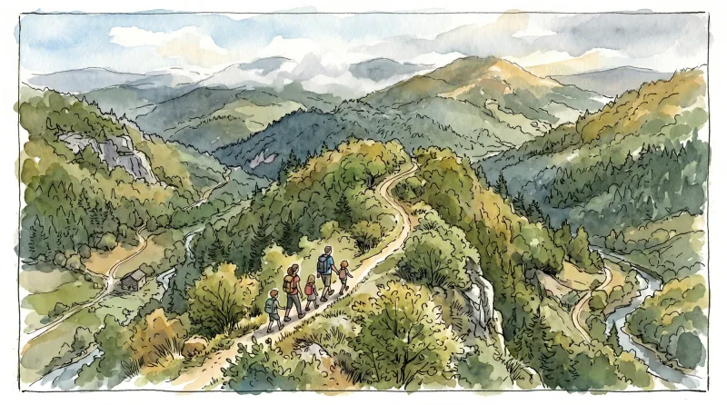
Between the Allier and the Dore
This 9.8 km loop starts and finishes at Charnat, with 61 m of ascent and an estimated duration of 2 hr 45 min.
Between Towers and Châteaux
A fairly long route, but without major difficulty, across much of the “Entre Dore et Allier” area.
Black route 22 - Between mountain passes and reservoir
Starting from Ambert station (the mountain biking and trail-running base), this route takes you onto the Allebasses mountain, following part of the Ambert Trail route. You will discover a landscape of heather and low vegetation that contrasts with the forest setting on the lower slopes at the beginning and end of the route. Its length makes this a demanding route, which should be completed in fine weather.
Blue route 20 - The Papermakers
Starting from Ambert station (the mountain biking and trail-running base), this route has no technical difficulties and follows the traces of the paper-making activity that shaped life in Ambert for more than three hundred years, between the 15th and 18th centuries. At that time, more than 40 mills across the area helped produce Ambert paper, commissioned by prestigious customers in France and elsewhere in Europe. Along the way, you will discover mills that remain from this period, in an inviting setting of forests and waterways.
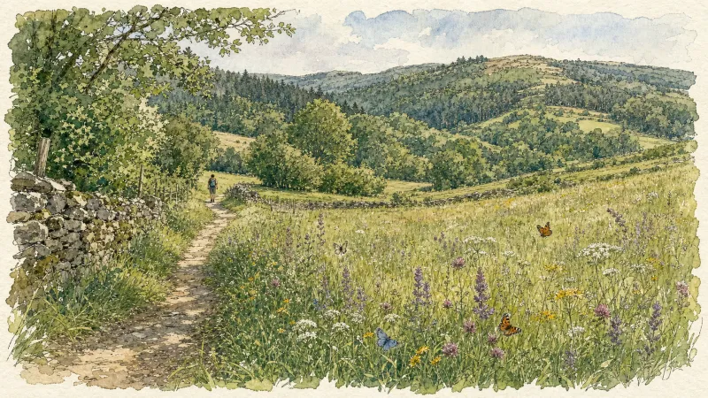
Bois de Bord
This 13.2 km loop starts and finishes at Sugères, with 256 m of ascent and an estimated duration of 3 hr 45 min.
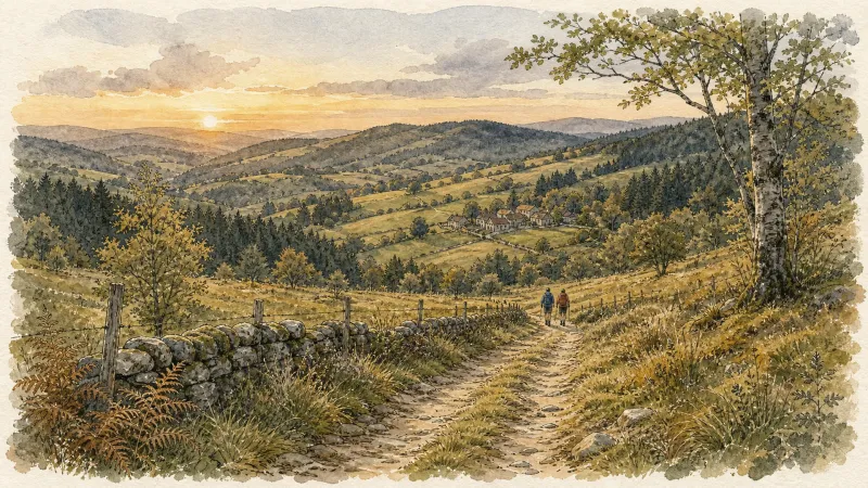
Bois de la Faye
Between the ponds and Bois de la Faye, numerous viewpoints look towards the Forez mountains, Pierre-sur-Haute, Puy de Dôme and Château de Mauzun.

Bois de la Plaine (Circuit No. 3)
The Quatre Vents nature centre stands on the first plateau above the Dore valley, where the Bois de la Plaine woodland once belonged to Château de Vollore-Ville. This waymarked walk therefore offers a lovely view of the village and its château before providing welcome shade beneath the trees.
Botany at La Renaudie
Numerous interpretation panels about the trees and shrubs of Livradois-Forez line this trail for an essential botany lesson, enriched by at least two discoveries: a dolmen and a panorama from Rocher des Bergères.
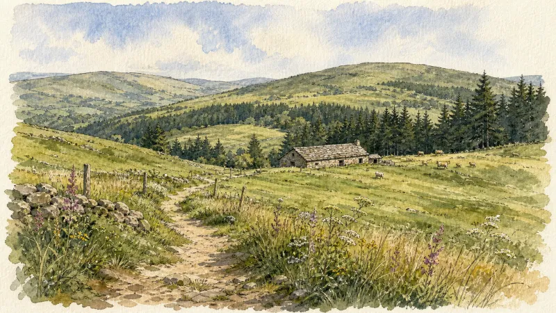
Boutonnargues
A woodland walk with numerous views of the Forez mountains, the Dore valley and the Hautes-Chaumes moorland. With its château, Boutonnargues was once a major lordship overlooking the valley and the many mills along the Dore.
By the stream
Departure: From the church square in Aix-la-Fayette, go down the main street (D58), then, around the bend, follow the small road on the right (direction La Bessière). 250 m further, take the first grassy path on the right. Continue straight ahead, ignoring two paths on the left. 1. At the hamlet of La Fayolle, turn left and walk alongside the house (directional post) to access the “Aulnaie de la Fayolle” desk. Retrace your steps, then turn left on the road to cross the hamlet. At the last house, go up the road on the right which quickly becomes an ascending path through meadows. At the crossroads, continue straight. 2. Cross the D58 and continue to climb opposite (viewpoint over the town of Aix-la-Fayette). At the crossroads, continue to go straight on. In Limoges, follow the D58b on the left for 10 m, then turn onto the small road on the right to cross the hamlet. Join the D58b again and follow it to the right for 80 m. 3. At the last house, go left on the small road which quickly becomes a path. Always keep the main path until you reach a fork. Then turn right. 250 m further, turn right onto a small path in the woods. Go 500 m and turn left (directional post); turn immediately right and follow the track. Pass over the footbridge, in front of the “Tourbière de Sagnerade” desk and continue on the small path until you reach a more marked path. Then follow it to the left until you reach the road. 4. Turn left on the D58b and go 300 m. Then turn right and immediately take the first path, always on the right. At the crossroads of several paths, turn left. At the crow's feet, just after the stream, turn right. 350 m further, leave the main path to turn right. At the exit of the woods, continue opposite to Martinanches. Cross the hamlet. 5. Follow the D58b on the left for 250 m, then turn onto the first road on the left. Cross Les Fougères by road then continue on the path. At the bottom of the descent, at the level of the stream, turn right onto the grassy path (viewpoint over the Chaîne des Puys). Always keep this path until you reach a small road. Cross it and continue opposite. 6. Follow the D58 on the right for 15 m; go down the small road on the left, then turn immediately right. Follow the main street to reach the starting point.
Chapelle des Fialins
D. From the square in Le Vernet-la-Varenne, take the road to the left of the start information panels. At the junction, continue straight ahead, passing the church on its left. Then take “Chemin des Nations” straight ahead. At the T-junction, continue straight ahead, follow the bend to the left and take the first surfaced road on the right. The road becomes a track. Stay on the main track to the village of “La Faye”. 1. Follow the road to the right for 50m, then continue on the track climbing straight ahead. Pass the reservoir on its left (views of the Massif du Sancy, Chaîne des Puys and Plomb du Cantal). At the crossroads of 4 tracks, take the track straight ahead. At the next fork, take the track descending to the right. Then take the track on the right and continue straight ahead to the village of “Les Vialettes”. Turn right onto the road to cross the village. On leaving it, take a track heading left and continue to the village of “Fridevialle”. 2. In the centre of the village, follow the road to the right for 50m, then climb the first road on the left. The road becomes a track. At the crossroads of 4 tracks, turn right and continue straight ahead to the surfaced road (views of Plomb du Cantal and the Chaîne des Puys). Cross it and stay on the main track to the village of Pégotard. Then turn onto a narrow street on the right in the village and branch right again onto the surfaced road (views of the Chaîne des Puys and Massif du Sancy). 3. Descend the road (optional return trip to “Chapelle des Fialins” on the left) and take the second road on the left towards “La Bourgne”. Cross the village on the main road. At the T-junction, turn left for 100m, then branch right and cross the village of “La Richardie”. At the next T-junction, take the road on the right, then turn onto the vehicle track on the left just after the sawmill. Continue on the main track. 4. After the climb, take the track on the right and continue to the road in the village of Losmond. Cross the road and stay on the track alongside a field that descends towards the Châteauneuf stream. Follow the stream for 50m before crossing it to the left. The track climbs steeply to a crossroads of 4 tracks. Take the track on the right and continue climbing to the village of “Rodel”, which you cross. 5. On leaving the village, take the track on the right (views of Le Vernet-la-Varenne and the Massif du Sancy). In the village of Vernadet, cross the surfaced road and continue straight ahead. Stay on the main road to the entrance to Le Vernet-la-Varenne. 50m before the stop sign, take “Chemin des Jardins” on the left. At the crossroads of 4 roads, turn right, then right again to return to the starting car park and the Le Vernet-la-Varenne tourist office.

Château de la Barge (Circuit No. 4)
This waymarked loop reaches Château de la Barge along paths and tracks with no technical difficulty, apart perhaps from the first descent after leaving the nature centre. Please note that Château de la Barge is private property. Visits to its lovely chapel and gardens are offered only during summer, or by prior request for groups. On the return, a long track climbs through the Bois de la Plaine.
Château de la Faye
On the left bank of the Faye stream, on a terrace below the Forez ridges, attractive paths wind beneath the fayards—the beech trees of Auvergne.
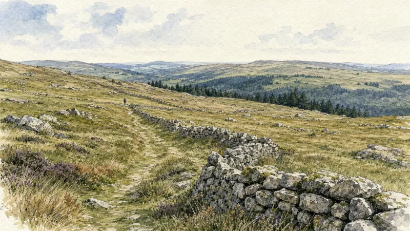
Château de La Fayette
This route is dedicated to the château belonging to the family of the famous General Lafayette. From a typical Livradois village of granite houses, it looks out over the Cézallier and Sancy. The woodland route passes close to a former amethyst quarry.
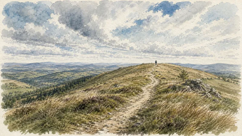
Château de Liberty
A route for lovers of châteaux, mills and great trees, and for understanding how the landscapes of the Haut-Livradois changed over the course of a century.
Château de Mauzun
On land inhabited since prehistoric times, Château de Mauzun, once a residence of the bishops of Clermont, overlooks farms and hamlets scattered across the poor soil.
Château de Mons
This route explores the heights above Arlanc, with numerous viewpoints over the town and the plain.
Châteaux and Villages in Queen Margot Country (Loop No. 7)
This 60.5 km loop starts and finishes at Sauxillanges - Place de la Promenade, with 1062 m of ascent and an estimated duration of 4 hr 30 min.
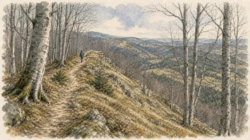
Chauriat, a Petite Cité de Caractère
Chauriat, a village more than a thousand years old, welcomes you. Built around the churches of Sainte-Marie and Saint-Julien, the town was strongly shaped by the Middle Ages and has continued to grow around many hidden treasures.
Circuit bleu - Porte de Prabouré
Discover this trail through the heart of Livradois-Forez.

Circuit bleu - Porte des Pradeaux
Discover this trail through the heart of Livradois-Forez.
Circuit bleu - Porte des Supeyres
Discover this trail through the heart of Livradois-Forez.
Circuit Chabonne
Discover this trail through the heart of Livradois-Forez.
Circuit des moulins
Discover this trail through the heart of Livradois-Forez.
Circuit enduro n°1 Myrstihl
Discover this trail through the heart of Livradois-Forez.
Circuit enduro n°2 Fougeair
Discover this trail through the heart of Livradois-Forez.
Circuit enduro n°4 Tricot
Discover this trail through the heart of Livradois-Forez.
Circuit enduro n°5 Bamby
Discover this trail through the heart of Livradois-Forez.
Circuit enduro n°6 La Vaisse
Discover this trail through the heart of Livradois-Forez.
Circuit n°1 Au fil de l’Ance
Discover this trail through the heart of Livradois-Forez.

Circuit n°10 Cols du Dansadoux et de Pramort
Discover this trail through the heart of Livradois-Forez.
Circuit n°11 Les Orgues de Montpeloux
Discover this trail through the heart of Livradois-Forez.
Circuit n°12 Grand Tour en Vallée de l’Ance
Discover this trail through the heart of Livradois-Forez.
Circuit n°13 Boucles des 7 cols (départ Col des Pradeaux)
Discover this trail through the heart of Livradois-Forez.
Circuit n°14 Les Myrtilles
Discover this trail through the heart of Livradois-Forez.
Circuit n°15 Barrage des Pradeaux
Discover this trail through the heart of Livradois-Forez.
Circuit n°16 Col du Beal
Discover this trail through the heart of Livradois-Forez.
Circuit n°2 Le Bois du Clovis
Discover this trail through the heart of Livradois-Forez.
Circuit n°21 Tour d’Ambert
Attention, tracé dévié au niveau du sentier de l'âne bleu à Pellegrole.
Circuit n°22 Les Gourgougnes
Attention, tracé dévié au niveau du sentier de l'âne bleu à Pellegrole.
Circuit n°23 Vallée des Papetiers
Discover this trail through the heart of Livradois-Forez.
Circuit n°24 Montée/descente des Pradeaux
Discover this trail through the heart of Livradois-Forez.
Circuit n°25 Les Bords de Dore
Discover this trail through the heart of Livradois-Forez.
Circuit n°26 Les villages de Marsac
Discover this trail through the heart of Livradois-Forez.
Circuit n°27 Les balcons
Discover this trail through the heart of Livradois-Forez.
Circuit n°28 De Thiollières à La Forie
Discover this trail through the heart of Livradois-Forez.
Circuit n°29 Les côtes du Livradois
Discover this trail through the heart of Livradois-Forez.
Circuit n°3 Autour de St-Anthème
Discover this trail through the heart of Livradois-Forez.
Circuit n°30 Au-dessus d’Ambert
Discover this trail through the heart of Livradois-Forez.
Circuit n°31 La vallée de la Dore
Discover this trail through the heart of Livradois-Forez.
Circuit n°32 Le bois de Chanabert
Discover this trail through the heart of Livradois-Forez.
Circuit n°33 Zol et Rodde
Discover this trail through the heart of Livradois-Forez.
Circuit n°34 Sommet du Livradois
Discover this trail through the heart of Livradois-Forez.
Circuit n°35 Balade en Livradois
Discover this trail through the heart of Livradois-Forez.
Circuit n°36 Le Tour d’Arlanc
Discover this trail through the heart of Livradois-Forez.
Circuit n°37 Le Procureur
Discover this trail through the heart of Livradois-Forez.
Circuit n°38 Aller/retour à La Chaise Dieu
Discover this trail through the heart of Livradois-Forez.
Circuit n°4 Prabouré/Col des Pradeaux
Discover this trail through the heart of Livradois-Forez.
Circuit n°40 Bellevue et le bois de la Vierge
Secteur Saint-Germain-l'Herm
Circuit n°41 Etang de Marchaud
Secteur Saint-Germain-l'Herm
Circuit n°42 La Panoramique
Secteur Échandelys
Circuit n°43 Belvédères des Deux Frères
Secteur Échandelys
Circuit n°44 Les Cimes du Livradois
Secteur St-Amant-Roche-Savine
Circuit n°45 Le Tour des Sucs
Secteur St-Amant-Roche-Savine

Circuit n°46 Le Val de Mende
Secteur Cunlhat
Circuit n°47 Tour de Cunlhat
Secteur Cunlhat
Circuit n°5 Les Allebasses
Discover this trail through the heart of Livradois-Forez.
Circuit n°6 Les Hautes Chaumes
Discover this trail through the heart of Livradois-Forez.
Circuit n°7 Les moulins de l’Ance
Discover this trail through the heart of Livradois-Forez.
Circuit n°8 Vues sur Viverols
Discover this trail through the heart of Livradois-Forez.
Circuit n°9 De Chemintand à Viverols
Discover this trail through the heart of Livradois-Forez.
Circuit rouge - Porte de Prabouré
Discover this trail through the heart of Livradois-Forez.
Circuit rouge - Porte des Pradeaux
Discover this trail through the heart of Livradois-Forez.
Circuit vert - Porte des Pradeaux
Discover this trail through the heart of Livradois-Forez.
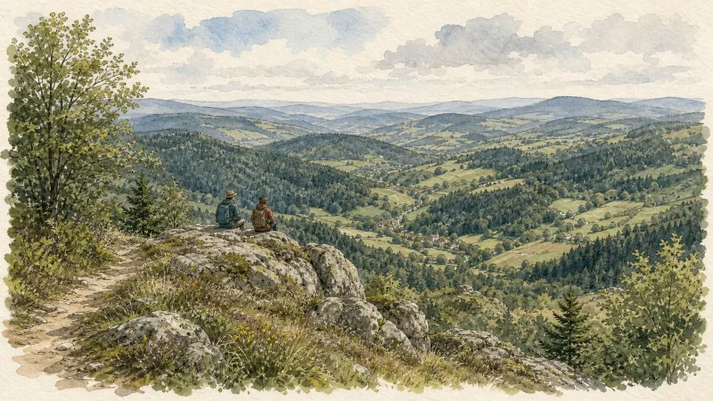
Circuit vert - Porte des Supeyres
Discover this trail through the heart of Livradois-Forez.
Cité Thiernoise (circuit n°49)
Discover this trail through the heart of Livradois-Forez.

Clavelier
This 1.8 km loop starts and finishes at saint-Sauveur-La-Sagne (Clavelier), with 45 m of ascent and an estimated duration of 30 minutes.
Climb to Pierre-sur-Haute
This beautiful long hike leads to the summits of the Forez mountains, with Pierre-sur-Haute—the highest point in the range at 1,634 m—as its objective.
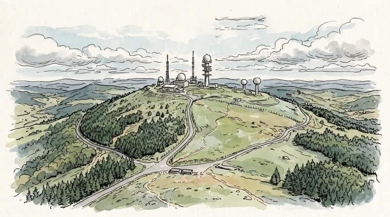
Climb to the Summer Pastures
This route leads through woodland towards Les Hautes-Chaumes, the high moorland and meadows where herds of cattle and sheep graze during the summer season.
Col de Pramort
This 15.1 km loop starts and finishes at Sauvessanges, with 366 m of ascent and an estimated duration of 4 hr 30 min.
Col des Pradeaux
Starting from the mountain pass, this route follows broad paths alongside meadows and opens up numerous views over the Ambert plain and the Livradois hills.
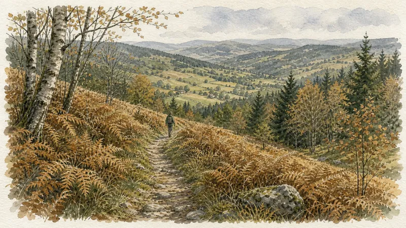
Col du Béal
This 4.8 km loop starts and finishes at Col du Béal, with 156 m of ascent and an estimated duration of 1 hr 30 min.
Col du Béal (circuit enduro n°78)
Discover this trail through the heart of Livradois-Forez.
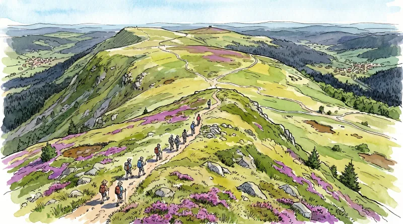
Connection Quatre Vents nature center / Place Jean Payre de Courpière (circuit no. 2)
Several circuits of the mountain bike base depart from Courpière (Place Jean Payre), this signposted connection allows you to reach Courpière by the track which goes down the slopes of Puissauve then by the municipal road of Taillades before crossing the Lasdonnas park to reach the Place Jean Payre. On the way back, we pass through the boulevards which border the medieval districts of the town before crossing the bridge which spans the Dore. The route then heads due north towards the Château de la Barge to go up to the Quatre Vents plateau, passing through the less steep paths and municipal roads in the area.
Creux-de-l’Oulette
Discover this trail through the heart of Livradois-Forez.
Croix de Fer
This 8.8 km loop starts and finishes at Eglise de la Renaudie, with 298 m of ascent and an estimated duration of 2 hr 30 min.
Dallet, Along the Allier
Dallet is a fine example of a former wine-growing village. It stands where the banks of the Allier, the slopes of Puy de Mur—rising above it to 603 m—and the fertile Limagne plain meet. Together, these features supported the site’s prosperity from prehistoric times onward.
Découverte de Randan et Maringues (circuit route n°28)
Discover this trail through the heart of Livradois-Forez.
Découverte des villages
Départ : A la sortie du parking, prendre à droite l’allée du stade. En haut de la côte, à l’intersection, monter à gauche jusqu’au lieu-dit Le Calvaire (croix et table d’orientation, point de vue : Roc du Guet, Pierre Pamole, Pierre-sur-Haute, Grün de Chignore, monts du Livradois, monts du Cantal dans le lointain, chaîne des Puys, massif du Sancy, Clermont-Ferrand, au premier plan, bourg de St-Rémy). Emprunter le chemin à droite derrière les croix (bois de bouleau). A la route goudronnée, l’emprunter à droite. Au carrefour (croix de Mission dite «croix Rouge»), continuer tout droit. A la patte d’oie, rester sur le chemin montant à droite. 1 - Au croisement avec une route goudronnée, monter le sentier en face. Garder le chemin décrivant une courbe à droite puis à gauche. Au croisement, à la croix en fer forgé, continuer tout droit. A l’intersection suivante, emprunter la route goudronnée à gauche. Traverser le hameau de Barnerias (deux fontaines, ignorer les chemins partant à droite et à gauche). 200 m après le village, dans le virage, à la patte d’oie, emprunter le sentier qui monte à gauche. Au carrefour suivant (bois de chênes), prendre à gauche. Continuer en face sur le chemin qui redescend. Au carrefour suivant, tourner sur le chemin carrossable à droite. 2 - Au carrefour en bas de la descente, tourner à droite (point de vue : plaine de la Limagne, Clermont-Ferrand, le Puy de Dôme, le Sancy, le massif du Cantal, les butes volcaniques de la Comté). A la patte d’oie suivante, laisser le chemin qui descend et prendre celui le plus à droite, ignorer la sente qui part à droite. Traverser la route pour entrer dans le village de Chabrol (dans le village : bâtiments avec linteaux et jambages en granit blanc), descendre dans le village. A la maison au toit à quatre pans, descendre à droite de celle-ci. A 200 m après le hameau, au carrefour, tourner à gauche (point de vue : monts du Livradois). Passer à côté de la maison isolée du Cheix. 200m après Le Cheix, à la patte d’oie, quitter le chemin principal et descendre sur le chemin à droite. 3 - Au carrefour, laisser le chemin partant à droite et continuer toujours tout droit sur la piste principale (point de vue : massif du Sancy, Clermont- Ferrand, chaîne des Puys). A l’entrée du village de Morel suivre la route à droite (point de vue : monts de Forez, chaîne des Puys, massif du Sancy, massif du Livradois). Au carrefour, prendre la route à gauche en direction du hameau de Prudent, continuer tout droit (ignorer la route à droite). Au carrefour suivant, monter à gauche pour entrer de nouveau dans Morel (habitat traditionnel en granit). A la sortie du hameau de Morel, continuer sur la route tout droit (point de vue : Pierre Pamole, Grün de Chignore, Roc Blanc, rocher du Calvaire au-dessus du village de St-Rémy). 4 - Arrivée à la D325, la traverser et emprunter le chemin bordé de chênes. Au carrefour suivant, prendre à droite puis 50 m plus loin, à la patte d’oie, continuer sur le chemin à droite. Au croisement, prendre la route à gauche. Au carrefour, continuer tout droit. Au deuxième carrefour, à la croix, tourner à droite direction Thiers sur la D201 (passer au-dessus de l’autoroute). Après le pont, prendre à gauche. 50 m plus loin, ignorer le chemin qui monte à droite et emprunter le chemin qui longe l’autoroute, garder le chemin (laisser celui qui part à droite). Passer sous l’autoroute par un tunnel à gauche. Au bout du chemin, prendre à droite par un chemin très raide puis à la route l’emprunter à gauche. Emprunter une sente herbeuse à droite. A la route, prendre à droite, puis à gauche pour retrouve
Des Hautes-Chaumes au Livradois (circuit route n°8)
Discover this trail through the heart of Livradois-Forez.
Des Margerides au Grun de Chignore (circuit route n°7)
Discover this trail through the heart of Livradois-Forez.
Dore Loop
The Livradois-Forez Regional Natural Park, a land of grassland and woodland, promises a memorable journey between valleys and ridges.
Du col de la Loge au col du Béal (circuit route n°6)
Discover this trail through the heart of Livradois-Forez.
En passant par Olliergues (circuit route n°15)
Discover this trail through the heart of Livradois-Forez.
Entre Comté et Pays d'Issoire (circuit route n°17)
Discover this trail through the heart of Livradois-Forez.
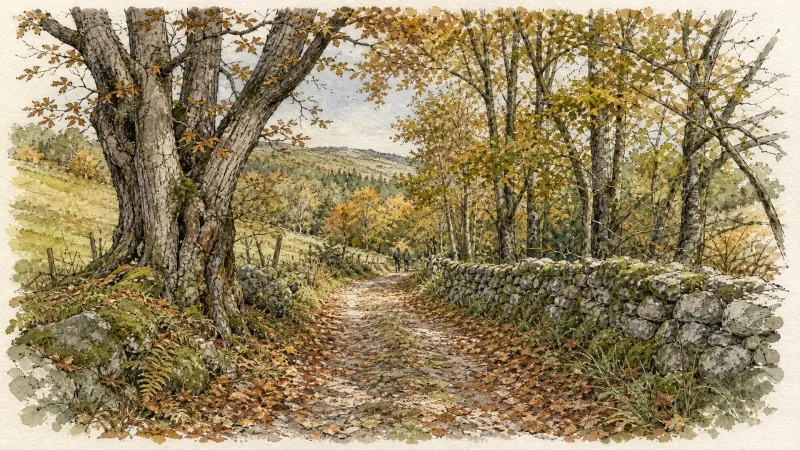
Entre Dore et Allier (circuit route n°1)
Discover this trail through the heart of Livradois-Forez.
Espinasse
This 7.9 km loop starts and finishes at Aubusson d'Auvergne, with 242 m of ascent and an estimated duration of 2 hr 15 min.
Fairy Walk
Departure: church square. Walk past the church then follow the road to the railway line. Before this, turn right and follow the street for 500 m. Head towards the D 906. Cross it to take the road opposite, be careful of fast traffic (direction la Brousse). Turn left and join La Brousse. 1. In the hamlet, take the path on the left, just after the fountain. Continue on this same path to the village of Chaumies (viewpoint over the Forez mountains). At the first houses, take the path opposite. The path becomes a road that we always follow. At the last house, leave the road and take the path opposite. Leave the first path on the right which goes down into the woods. 2. At the top of the hill, at the crow's feet, take the path on the right (viewpoint). Go down towards the stream and continue along the same path. Arriving at the road, turn right towards the hamlet of l'Eschalier. At the first houses, turn left to join the road. Cross it to take the small road opposite. 3. At the transformer, turn right onto the road then, 150 meters further, follow the D44 on your left for approximately 1.5 km. 4. At the cross, continue to the right on the D 308 and join the D 906 (be careful of fast traffic). Cross it to reach the church square in Néronde-sur-Dore.
Fontbonne (circuit n°29)
Discover this trail through the heart of Livradois-Forez.
Forez circuit - Discover local skills and crafts (loop no. 6)
This circuit invites you to discover the skills and crafts of the Livradois through the themes of water and nature.
Forez Circuit — Les Hautes-Chaumes (Loop No. 5)
This route reveals nature that is still wild in places: Livradois-Forez and its vast, rolling upland plateaus, including Les Hautes-Chaumes.
From Gargantua’s Footstep to the Three Drops of Blood
Bracing himself in the La Palle stream, Gargantua carved a rock known as the “Pas de Gargantua”. People, meanwhile, left a substantial built heritage: a church, calvary, carved doorway, wrought-iron or granite crosses, bread oven, fountains and washhouse.
From La Credogne to Étang Tuilier
This 10.0 km loop starts and finishes at Puy-Guillaume, with 115 m of ascent and an estimated duration of 3 hours.
From La Faye to the Couzon
Start: Church square (Place du Marthuret). Take the main street opposite the war memorial, then at the junction take the D 45 straight ahead (towards Olmet/Le Brugeron). At the second junction, continue straight ahead on the same road (towards Olmet/Le Brugeron). 350 m further on, take the track heading left behind the sawmill and reach Clos Granet. Pass the isolated house, then follow the track descending to the right. At the road, turn left towards La Forie. Cross the village and immediately take the track on the left climbing to Poyet-Haut. Pass below the village; at the lime tree, turn right as far as the cross, then continue right to the junction. Continue on the D 42 (towards Vollore-Montagne). 1. 120 m further on, take the track heading left (viewpoint over the Chaîne des Puys). At the first junction, continue straight ahead on the grassy track. At the next junction, take the track climbing to the left. At the fork, continue to the right to reach the hamlet of Le Masdorier. 2. At the surfaced section at the entrance to the hamlet, turn left between the houses, then left again onto the small road descending. 100 m further on, the road becomes a track; follow it to the hamlet of Gourgoux. Descend straight ahead towards the iron cross, then reach the D 311. Cross it and take the track straight ahead. At the surfaced road (D41), turn right and follow it to La Roche. 3. Cross the hamlet, then turn onto the grassy track on the left just after the last house (viewpoint). Continue for 300 m. Turn left and descend the track to the D 41. Follow it to the right to enter the village of Aubusson-d’Auvergne. Pass the fountain, then the sawmill, and continue on this road to the village of La Prade. 4. Cross the village; continue for 200 m, then leave the road to the left via the wooden footbridge to enter the lake site. Continue to the left along the bird trail (passing close to the hide). Still following the lakeside, continue on the sandy track. At the junction, before reaching the dam, take the stone track climbing to the left. At the surfaced road, turn right and reach Commiot. 5. At the entrance to the hamlet, take the grassy track on the right for 400 m. At the junction by the transformer, take the track straight ahead alongside a meadow. Follow the surfaced road to the left as far as La Coudercie. 6. Cross the village, then stay on the same road for 400 m (view of the village of Augerolles). At the wastewater treatment plant, turn right, then return to the village of Augerolles and the church square.
From La Ligonne to the Ance
This 10.3 km loop starts and finishes at Viverols, with 237 m of ascent and an estimated duration of 3 hours.
From Lachaux to Étang de Malforêt
Start: From the main square in Lachaux, follow the D63 to the left towards Lachaux town hall. At the junction of several roads, head onto the D331 towards La Guillermie. Just before the village of “Plan Pannetier”, turn onto the track on the left towards “La Querie”. Continue straight ahead to the D63. Cross it and take the road opposite. Cross the village of “Plan Bigay” and continue descending on a track until you rejoin the D63. Follow it to the left for 20m, then descend a path on the right. Stay on the main track to Croix des Peux. 1 - Cross the D63 again and take the vehicle track straight ahead. At the fork, continue on the lower track. Stay on the main track as it climbs to the left. At the T-junction, take the track continuing uphill to the right. By the village of “Chez Duret”, the track becomes a road. Then cross the village of “Chez Pion” and, at the junction with a picnic table, continue to the right to the village of “Terrasson” (view of the Chaîne des Puys). In the centre of the village, take the track on the right between the houses. 2 - At the surfaced road by the sports ground, follow it to the right. 300 m after the right-hand hairpin bend, turn onto the road on the left towards the village of “Les Caves”. Pass alongside the village, following the track to the right. Continue on the main track until you reach a broad track. Follow it to the left to Étang de Malforêt. Follow the entire length of the pond on its left. Then continue on the main surfaced road. 3 - After 1 km, take the track climbing to the left straight ahead. Stay on the main track to the surfaced road. Turn right onto the road and continue straight ahead to the D43. Follow it to the left for 80 m, then turn onto the first road on the right towards the village of “Chez Morel”. In the centre of the village, take the road on the left. It passes between the houses and becomes a track. Stay on the main track to the village of “La Vignole Basse”. Descend the road to the right as far as the D63. 4 - Cross it and take the track straight ahead. At the next junctions, continue on the track straight ahead to the village of “Le Sapet”. At the T-junction in the centre of Le Sapet, take the road climbing to the left. Stay on the main road through the village of “La Bretonne”. 500 m after the village of “La Bretonne”, take a track on the left. Stay on the main track as it descends and then climbs to the village of “Gimet”. Continue uphill on the road to the right to the D63. Cross it and take the vehicle track opposite. At the T-junction, turn onto the track on the right until you rejoin the D63. Follow it to the left into Lachaux and continue straight ahead to return to the starting car park.
From Les Ribes to the Miodet
The fine fortified church of Saint-Dier, granite villages with immaculate coudercs, and the lively Miodet, once lined with mills, are the highlights of this walk through livestock-farming country.
From Montpeyroux to Pas du Loup
Start: From the town-hall car park in Paslières, head towards the D906. Cross it and take the paved road opposite. At the fork in La Croix Rouge, keep left on the main road to the D85. Follow it left towards Montpeyroux, with its former abbey. 1. Climb the paved road on the right after the restaurant. Pass between two houses as the road becomes a track. Continue straight to La Vernelle, then turn right on the road to Le Canelier. Cross the village and take the road left beside a well. At the next T-junction, climb left to Fagot Marnat. 2. In the village, continue left and follow the sharp bend right. At the four-way junction, take the track left. At the fork, continue uphill right for 150 m, then turn onto the track right beside the private-property sign. Keep to the main track to Bois Blanchet. At the bottom of the descent, take the track left and continue to Pas du Loup. 3. Descend on the track right, pass a reservoir and continue straight to the paved road. Cross it and take the track opposite to the D85. Cross and continue straight on the main track to La Croix Rouge. Take the road left and continue to the D906. Cross it to return to the town-hall car park.
From the Allier to Puy de Mur
This 5.7 km loop starts and finishes at Dallet, with 187 m of ascent and an estimated duration of 1 hr 45 min.
From the Creux de l’Enfer to the Grinding Workshops
This route is a journey back through the history of cutlery and industry in Thiers.
From the Lake to the Viewpoint Indicator
This short family circuit explores Lac des Prades and offers a magnificent panorama over Saint-Rémy-sur-Durolle.
From Vauziron to La Chasserelle
This 8.6 km loop starts and finishes at Châteldon, with 293 m of ascent and an estimated duration of 2 hr 30 min.
From Vollore to the Lake
Start: Place de la Conche. Pass the town hall and descend to the D7. Cross the departmental road and, just after the garage, turn left towards Le Fraisse (view of Grün de Chignore straight ahead). In the hamlet, turn right, then take a track between 2 houses on the left. Continue straight ahead to the surfaced road. The track descends and then climbs to a surfaced road. Immediately take the track descending to the left as far as the D45. Follow it to the left for 250m, then turn onto the first track on the left. At the following junctions, continue climbing on the main track to the village of Montmiot. 1. Cross Montmiot on the road to the left and continue to the T-junction. Take the track straight ahead and stay on the main track to the surfaced road. Follow it to the right. At the hairpin bend, follow the road climbing slightly to the left to Fontcuberte. Cross the village and, by the last house, take the track climbing to the left. At the junction, turn right, then 10 m further on take the earth track on the left to the road (view of the Forez ridges). Follow the road to the right to the D 313 (views of the Chaîne des Puys, Sancy and Monts du Forez). Cross it and continue straight ahead to the hamlet of Le Besset de la Pause. Cross the village. 2. On leaving, take the earth track to the left of the wrought-iron cross (view of the Chaîne des Puys on the right) and descend to the hamlet of La Félolie (view of Lac d’Aubusson-d’Auvergne). Cross the hamlet, then at the fork descend the road to the left as far as Le Bost. At the bottom of the road, by a house, take the sunken track to reach the church in Aubusson-d’Auvergne. Pass alongside the church, then enter the village. Pass beneath the gateway and descend to the left of the fountain. Continue slightly right between two houses; pass alongside the sawmill. Climb the 1st surfaced road on the right. Follow the D41 to the right, then immediately turn left onto the first track behind the town hall. At the next junction, turn left. 3. 100 m further on, turn right and cross the hamlet of La Chosserie. After 350 m, on leaving a left-hand bend, climb the path on the right. At the top, take the track on the left to the hamlet of Puymillier. Cross the hamlet (large mulberry tree). On leaving, 100 m after the last house, take the path on the right. Descend to a broader track. Follow it to the left and continue straight ahead to the D45. Cross it and branch onto the second vehicle track on the right. Stay on this track to the D7. 4. Follow it to the right before crossing the D45 to take the surfaced road straight ahead (no-entry direction). Turn left onto the first track and continue straight ahead to the hamlet of Rongeron. At the junction, head towards Vollore-Ville, then 150 m further on take the surfaced road descending to the left towards the hamlet of Barbat. Cross it. 150 metres further on, climb the surfaced track on the right. Pass below Château de Vollore and, 200 metres further on, turn right onto the earth track and climb to Place de la Conche.
Gaspard's forest
Departure: From the start of the hike, take the left uphill path. 1. At the top of the hill, at the hut, turn onto the path on the right. Keep the main path which turns right to return to the starting point.
George's Cross
Departure: From the car park, follow the D906 on the left towards Ambert. Turn onto the first tarmac road on the left just after the Hôtel de la Dore. At the T-junction, turn right towards Florasse. Cross the village, after 300 m, take the first path on the right. 1. In the village of Les Chassaings, turn left onto the road on the left until you reach the tarmac road. Cross it to enter the village of Cognol. At the exit of the village, take a path going up to the left and keep the main path which goes up to a cross. Then take the path on the right to the village of Tarrit. At the exit of the village, turn onto a path going up to the left until you reach the Croix de Georges. 2. Continue on the path which runs alongside this cross. Go down the tarmac road to the first houses of the village of Bétonasse. At the hairpin bend, take the path on the right to go down to the village. Then follow the road to the right and 200 m after leaving the village, take the road which goes off to the right. Cross two tarmac roads simultaneously to take the descending path opposite. 3. In the village of Garret, recross the D268 and continue opposite. At the next crossroads, continue on the right road and go alongside the Vertolaye cemetery. Then go down the main street of Vertolaye on the left. Take opposite the roundabout towards Ambert and continue on the road to find the parking lot at the start of the hike.
GR®3 — The Forez Mountains
The GR®3 is a legendary long-distance trail following the Loire, one of Europe’s last wild rivers, for 1,200 km. It begins at the river’s source on Mont Gerbier de Jonc and continues to its estuary near Guérande. The section across the Forez mountains unfolds through a succession of striking panoramas, peat bogs, moorland, winding rivers and vast open spaces.
GR®89 Le Chemin de Montaigne
Discover this trail through the heart of Livradois-Forez.
Grand Tour of Lac d’Aubusson (Circuit No. 18)
This waymarked route alternates descents and climbs to Lac d’Aubusson via the villages of Le Mégain, Le Bertrix and Loumas. The following descent is enjoyable but requires care because of ruts and a small scree section near its end. The route then reaches the lake and circles almost all of it before climbing steeply around Le Gât to La Guétie. It soon arrives at Aubusson-d’Auvergne, followed by a climb of almost 115 m in less than 1 km, with an interesting view of the lake and dam. The route descends via La Bournélie, turns towards Bardinaud and continues downhill beside the Bois de la Plaine to Lorille. It then crosses the woodland while climbing to the Chèvrerie de la Plaine.
Great Livradois-Forez Mountain-Bike Traverse
In the heart of Auvergne, the Great Livradois-Forez Traverse takes you around the Livradois-Forez Regional Natural Park, between two mountain ranges rising from 400 m to 1,600 m.
Happiness Is in the Woods
This 4.6 km loop starts and finishes at Tilleul de Sully, place de Saint Romain, with 139 m of ascent and an estimated duration of 2 hours.
Happy people walking
Departure: church square. Head towards the D 906. Cross it to take the road opposite (D 308 - Be careful with fast traffic). At the cross, continue straight ahead and reach Bel-Air. In the hamlet, go down the grassy path opposite. 1. Take the D 44 on the left; cross the bridge and, 100 m further, go up the small road on the right. Cross Genestoux along the castle and keep the same road. The road becomes a path that we follow straight on. Always follow the main path. At the tarmac road, turn left and join Les Pierres. 2. In the hamlet, pass between 2 houses then turn left onto the road towards Gaillard. In the bend, continue on the road to the right. Cross the town; at the exit, just after the last house, turn right. At the entrance to Coussat, before the first house, take the path on the left. Go down to the bottom of the village and take the path which goes to the right between the houses. At the first intersection, turn left. At the next intersection, continue straight on then, at the next one, continue straight on. 3. At the road, turn left then, 30 meters further, turn right. In the hamlet of Bournoux, continue straight on. At the bread oven, continue to the right. At the bottom of the village, at the road, turn right towards Coulaud. Before the first houses, at the “Give way” sign, turn left. Follow this path (steep climb) to the hamlet of Provarel. Cross the hamlet then, after the last house, leave the road which goes up to the right and take the path on the left (viewpoint over the Puyde-Dôme and the Puys chain). 4. At the hamlet of C h e i x, continue straight on the path which goes down, then up. At the road, turn right. 50 meters further, at the transformer, take the road on the left. Follow the D 44 on the left. 200 meters further, leave the road and take a path on the right in the fields. At the crossroads, follow the path on the right. In the hamlet, take the road on the right. 5. 500 meters later, at the crossroads, turn right to cross La Brousse (bread oven) and continue straight on the tarmac to join the D 906 (be careful with fast traffic). Cross it to take the street opposite. Walk alongside the “Les Toits de la Dore” housing estate, the cemetery and continue to the railway line. At the railway line, turn left and reach the church of Néronde sur Dore.
In the footsteps of Gaspard des Montagnes
An emblem of the region and an unfailing hero, Gaspard is a vigilante created by the writer Henri Pourrat in 1948.
In the Footsteps of Jean de la Nuit
This 4.9 km loop starts and finishes at Egliseneuve-Près-Billom, with 156 m of ascent and an estimated duration of 2 hours.
In the Footsteps of Marie-No
Start: From the town hall square in Tours-sur-Meymont, follow the D225 to the left for 50 m. At the junction, take the surfaced road towards Saint-Gervais-sous-Meymont. Then take the first track descending to the left alongside the Tours-sur-Meymont heritage orchard. At the crossroads of 4 tracks, continue straight ahead and stay on the main track to the Minchoux stream. 1. Cross the stream and, after climbing for 50 m, take a path between 2 fields. At the T-junction, turn onto the track on the right. Cross the village of La Calendre and continue on the main track to the surfaced road. Cross it and take the road climbing towards the village of Bouget. 2. At the cross in the village, continue on the track to the right. 200 m before the entrance to the village of Les Fraisses, take the track on the right. At the T-junction, turn left. 100 m further on, at the second T-junction, take the surfaced road to the right. On leaving the village, take the track descending to the right. Cross the stream and, at the crossroads of 4 tracks, continue straight ahead (an optional there-and-back leads to the statue of the Virgin at Piedmont) to the village of Vol. 3. Follow the surfaced road to the right. At the junction, continue straight ahead, then take the first track descending to the left. Continue on the main track to the village of Campines. At the junction, continue to the right on the vehicle track. At the fork, continue climbing to the left to the crossroads of 4 tracks. 4. Take the track on the right and follow it to the D225 (views of the Chaîne des Puys and the Massif du Sancy). Cross the D225 and continue straight ahead to the village of La Gorce. Enter the village to the right. In the centre of the village, take the road to the right and continue straight ahead. The road becomes a track. At the T-junction, turn left. Then take the first track on the left to the D259. 5. Cross the road to enter the village of Bourdelles. Continue on the track straight ahead to the surfaced road. Turn right to climb back into the village of Tours-sur-Meymont. At the church, follow the D225 to the right to return to the car park.
In the Footsteps of Saut du Loup
This 3.3 km loop starts and finishes at Ris, with 144 m of ascent and an estimated duration of 1 hr 30 min.
Isle sur Dore
Departure: in front of the village hall. Park in the parking lot. Go down the village street and take 30 m further down on the right towards Charmène. At the entrance to Charmène, take the path on the right, going around the small body of water. Then join a tarmac path that you go up to the right to arrive at Chavaroche. 1.Continue straight then left on the path between the old buildings and continue on this path which becomes grassy, goes down in the middle of the meadows to find the bitumen at a farm (viewpoint over the Forez). Continue to descend for 500 m. Turn right to take the path which leads into the woods; go down to the stream then go back up. Arriving at the summit, continue to the right to reach the Croix du Sangle crossroads. 2. Then go down 50 m to join the D 304 (Courpière-Domaize) which you follow towards Domaize for 200 m. Then head towards the village of Le Sangle on your left. On the square, at the entrance to the hamlet, take the path on the right (in front of a building) which leads between the meadows. Leave the first path on your right, and take the second. Go down through the woods to the Sauviat dam (like the people from St Flour who worked at the EDF factory did). Join the road just before the bridge over the Dore. 3. Climb this very steep little road for 500 m. Take a small path on the left (former Chemin de Domaize) which goes deeper into the woods, passes by a place called “le Cimetière des Donkeys” and joins the road at a place called Moulin Neuf. Take your right for 30 m and turn left to go up to Fontbertasse. 4. Cross this hamlet. At the exit, leave the road and take the dirt road on the right which will take you to Le Clos. Just before this village, turn completely left onto a path between meadows. Continue on this path on a slight hill until the small crossroads of the Croix de Pintrand (you have just passed the highest point of the town: 561 m. Viewpoint over the Puys chain and the Forez mountains). Take the road on your right which goes down to the village passing through Chassaing. When you are at the crossroads in front of the school, the starting point is 50 m on your left.
Issandolanges
Issandolanges, one of the treasures of the Pays d’Arlanc! Inhabited until the 20th century, this village bears witness to local history and holds many treasures. To reach it, you pass through the Dolore gorges, close to numerous mills.
L'appel de la forêt (circuit n°28)
Discover this trail through the heart of Livradois-Forez.
La Baffie
A walk from Fayet-Ronaye, whose Romanesque church was altered in the 14th century, across steep, extensively wooded slopes with views over the surrounding forested hills. Ronaye has a beautiful granite cross dating from the late 14th century.
La Chabasse Church
Start: From the main square in Olliergues, behind the town hall, take the walled path right around the château. Continue towards the church, go around it to the right and follow Rue de la Chaussée right. Pass the gendarmerie and climb the steps opposite to the D906. Follow it left. On the bend leaving Olliergues, take the road climbing right. At its top, climb the track opposite, slightly right. At the road follow the track right to the D87. Turn left towards La Chabasse church (view of the Forez mountains and Pierre-sur-Haute). 1. At the church, (short-cut: turn right towards Camping des Chelles, then right after 200 m) continue straight on the D87. After 200 m, descend left to Les Chaux. Continue on the road right through the hamlet. After 500 m descend on a woodland track left. Continue through the valley, cross the bridge right and climb to the paved road (view of Saint-Gervais-sous-Meymont). Follow it left towards Meymont. 2. Walk around the village (view of the Chaîne des Puys), retrace your steps and climb the track opposite. At the paved road continue straight (view of the Dore valley and Forez mountains). Turn left towards Lavest. Entering the hamlet, climb the track right. At the junction climb right to the D87 and follow it left. At the fork turn right and climb the track left. Keep to this main track to the paved road. 3. Follow the road left, ignoring the road to Camping des Chelles. At the next fork take the track left. Cross the road to the track opposite. 4. At the junction before the electrical substation turn right. After 350 m, follow the road left for 10 m, then turn right down the dirt track. After a bend, continue on the descending road opposite beside the secondary school. Cross the road and descend the paved street opposite. After the fountain keep right to the main street (view of Olliergues and its château). Turn right to return to the town-hall square.
La Chapelle-Agnon
Start at the church in La Chapelle-Agnon. Descend on the D267 and take the first left. At the cemetery, go straight ahead, then turn right by a stone cross. (1) At the junction turn right, then right again at the fork towards La Collange. (2) Before the hamlet, follow the paved track left and continue straight. Descend on a path to the junction beside an isolated house. (3) Turn left and continue north, ignoring several tracks on both sides. (4) Staying on the hillside, cross La Combas and Le Mouhet, take the road left to Le Paton, then bear left within the hamlet. (5) On leaving Le Montel, take the track left and climb along the forest edge. Continue to the road above Le Varrat. Follow it left, ignoring forestry tracks. (6) At Le Crouhet, take the path descending into the valley in front of the house on the right. Cross the Sardie stream and climb below Farnouze. (7) At the junction turn left, cross a small stream, climb and continue on the track right. After the large ruined building, turn left. (8) At Farges, follow the edge of the hamlet and take the path descending left to the stream. Cross it and climb to the D37, following it for 100 m. At the fork turn left to return to the cemetery and church.
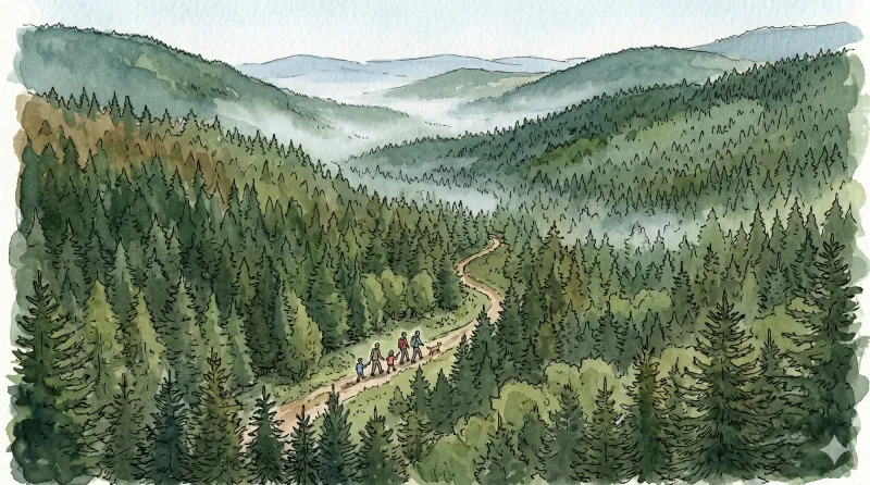
La Chapelle-sur-Usson
Departure - Take the direction of Coupe-Gorge then go down left towards Solignat. In Solignat, leave the tarmac path and go down left to reach a crossroads planted with a chestnut tree at La Chapelle-sur-Usson (Romanesque church of Saint-Julien; panorama of the Cézallier mountains). 1 - Continue straight ahead to arrive at the wash house at the crossroads at the entrance to Perrier. 2 - Take the center to enter the village. 10 m before the water point on the left, go down to the right along a tarmac path. At the wastewater treatment plant, continue to descend to the right and follow the Pendillières stream overlooking it; cross the Mines stream by bridge to go up to the D703. 3 - Take it on the right for around 800 m. Go up a path on the left which joins a tarmac road. Take it on the right for 100 m. 4 - Cross the D703 again and go down a grassy path opposite. Facing an old well, go left. At Les Martres, cross a tarmac path to take the road opposite (old fountain from 1889). At the end of the village, turn off onto a path on the right below the D75 road. At Solignat, go up the path previously taken to the left to reach Coupe-Gorge and the car park.
La Chaulme Montarcher
D: Opposite the town hall, take the road on the left and follow the first stone path on the right. Cross a stream then continue on a forest track to join the D258. 1. Continue opposite, and turn right onto a path which leads to the Borel stream (border between the Puy-de-Dôme and Loire departments). At the crossroads, turn left to go up to Montformont. 2. Arriving at the place, turn right on the road, leaving the path going down to the right. It becomes a path through the forest to reach Mandon. Go up the road on the left to cross the D44. Follow a path opposite then cut the D14 in the direction of Le Vernet. 3. At the intersection, turn left to cross La Guette. At the next intersection, go up to the right to visit the village of Montarcher following the GR3 (12th century Romanesque church, views of the surrounding mountains). At the exit of the village, turn left into the car park to join a path which goes down passing near the wash house. Come out and then follow the D14.5 on the left for 300 m. 4. Cross the village on the right and before the exit, turn left onto the road which becomes a path. At the intersection, go down to the right towards Monty (before the hamlet, viewpoint towards the East and South over Pilat, the Alps, Velay and Vivarais). In the village, continue left to reach the D14. 5. At the corner of the house, turn left onto the D14 for 80 m then turn right, direction La Faye. Cross the Andrable river. At the top of the place, follow a balcony path on the left which enters the woods. Continue on a slightly steep path which climbs sharply. At the crossroads, head straight ahead to join the D96. 6. Cross the D96 opposite and continue until the road which you follow to the left for 100 m. Take a path on the right which leads to the Chapel of Notre-Dame-de-Toutes-Grâces. Then join La Chaulme.
La Couzanaise (enduro circuit n°77)
Discover this trail through the heart of Livradois-Forez.
La Jalonne
Departure: From the car park at the entrance to the hamlet of Chanier, go up towards the hamlet then, at the intersection, follow the small road on the right which goes up into the hamlet (direction Chanier). On the square with the fountain, go up opposite along the old school. Continue to the last house. 1. Then take the path going up to the right (viewpoint over Puy-de-Dôme and the Puys chain). Continue on the same path (viewpoint over the Sancy massif and the Puys chain) until Pradel. 2. In the village, follow the road opposite. Continue on the road (viewpoint over the Sancy and the Puys chain) and reach the hamlet of Trois Lindes. After the last house, turn right and, 10 m later, leave the road to take the path on the right. Always keep the same path until Fauvelles. 3. Cross the hamlet and, at the exit, leave the road on the left and follow the path slightly to the right. At the intersection, continue straight on until Moulin Jalonne. 4. At the house, take the stony path which goes up to the right. 20 m further, follow the path slightly to the left. Keep this beautiful trail for 1.6 km. 5. When the track makes a good left turn, take the path opposite to Chanier. Then go down into the village then reach the starting point by the same road as on the way out.
La Ligonne
Departure: From the church, go up the main street on the left towards the castle. Turn left into a street then immediately right into the alley which becomes a path (viewpoint on the left over the Château de Viverols). Find the road again and follow it to the right until you reach the D205. 1. At Maisons-Neuves, take the D205 on the left for 30 m, then turn left again on a descending path. Turn left onto the road, then right onto the path. At the fork, stay left. Go along then cross the Ligonne stream to Gorce and cross the village. 2. At the exit, take the left path. At the intersection, turn left onto the forest road. At the bend, turn right onto a path that rises into the woods. At the next fork, go back down to the right along a stony path until you reach a road. 3. Turn left onto the D111. After 50 m, abandon it for a wide path on the left. At the intersection, turn left onto the path which again joins the D111 and Étruchat. 4. Cross the hamlet then at the exit, turn left at the cross. Cross the Ligonne by the bridge to return to the church square via the alleys of Viverols (medieval historic center, the Stone Bridge, house of the bell founder).
La montagnette (circuit n°65)
Discover this trail through the heart of Livradois-Forez.
La Morille
This 6.1 km loop starts and finishes at Château de Ravel, with 86 m of ascent and an estimated duration of 1 hr 45 min.
La pierre branlante (circuit n°13)
Discover this trail through the heart of Livradois-Forez.
La pierre Pamole (circuit n°38)
Discover this trail through the heart of Livradois-Forez.
La Sapinière (circuit enduro n°75)
Discover this trail through the heart of Livradois-Forez.
La Virée des Rocs (Full Circuit)
Start: From the esplanade below Viscomtat, follow the D42 to the left. At the junction, continue opposite towards Grimond. Pass the fire station and cemetery. At the fork, remain on the road to the right. The road becomes a track. At the crossroads of 4 tracks, continue along the track opposite. 10 m before the paved road, turn onto the track on the right. 1. Continue along the track to Les Lignières Vieilles. Pass to the right of a building and take the first track on the right. 10 m farther on, at the fork, take the track on the left. Remain on this main track to the D42. Cross it and follow it to the left for 150 m before taking a small path descending to the right. At the end of the path, turn onto the track on the left and climb the steps onto the bridge. 2. Turn right onto the D322 and cross the village of Cornillon. 50 m after the last house, take the track climbing left to the paved road. Follow the road opposite for 50 m, then turn onto the track climbing to the left. At the crossroads of 4 tracks, continue along the track opposite to the village of Boulay. 3. Beside the first houses, take the track on the left and remain on the main track to the paved road (view of the Bois Noirs and the village of Celles-sur-Durolle). Follow it to the right for 50 m, then turn onto the track on the left. Continue along the forest track to a parking area at a crossroads of 4 tracks. 4. Take the track on the right and, 50 m farther on, climb the first track on the right. Follow the main track to the crossroads of 4 tracks. Continue opposite to Roc du Guet (view of the Bois Noirs and the Chaîne des Puys). Continue along the main track as it descends. At the T-junction, continue descending on the track to the right until you reach the paved road. Follow it left to Col des Sagnes. At the col, cross the D86 and continue along the climbing track opposite. 5. At the fork, descend the track on the left and remain on the main track to the Maison du Trésor junction. Then take the 2nd track climbing on the right. At the crossroads of 4 tracks, continue climbing opposite to the cross marking an aircraft crash. Continue along the track opposite to another crossroads of 4 tracks. At the junction, begin the descent by continuing straight ahead and remain on the main track to the Croix du Gât junction. 6. Then take the track branching right to the paved road in the village of Vachon. Take the track on the right to reach the D101. 7. Follow it straight ahead to cross the bridge. Then follow the first paved road climbing left to the village of La Forêt. On leaving the village, take the track on the left, then after a few metres turn onto the path climbing right through the woods. Remain on the main path until you reach a forest track. 8. Follow it left for 20 m and, at the junction, take the track on the left leading to the fine little village of Seychal. Cross the village, keeping to the track on the right (warning: close the gates securely). Continue along this track until you reach a forest track. Cross it and take the path climbing opposite, which emerges again on the forest track. 9. Follow it to the right for 15 m, then turn onto the path on the left through the plantation. Remain on this path to Cheix Blanc (a short out-and-back to the left leads to the scree for a view of the Bois Noirs, the Chaîne des Puys and Mont Blanc). Continue along the main path as it descends through a plantation to the second rocky outcrop, Cheix Petit (an out-and-back to the right leads to the scree with a cross and a view of the Bois Noirs and Noirétable). The path continues descending to the left until it reaches a track. 10. Follow this track to the left for 20 m to the fork. Continue straight ahead to the forest track. Follow it to the right and remain on the main track to the Pierre Pamole car park. Then turn onto the track on the right climbing to the summit of Pierre Pamole (viewpoint indicators with views of Pierre-sur-Haute, the Sancy massif, the Chaîne des Puys, the Bois Noirs, the Monts du Livradois, Lac d’Aubusson and Mont Blanc). 11. At the summit, take the path descending after the second interpretation panel, which meets a track lower down. Take the track on the right and remain on the main track until you reach Col du Pertuis. 12. Cross the D42 and take the paved road opposite. At the fork, take the road on the left and cross the village of Les Raillères. On leaving the village, take the path climbing to the right. At the crossroads of 4 tracks, continue opposite to reach the forest track. 13. Follow it to the left. At the first junction, turn right. At the next fork, remain on the tracks to the right to climb to Roc Blanc. Continue along the main track (an out-and-back to a viewpoint on the right offers views of the Chaîne des Puys, the Sancy massif, the Bois Noirs and Mont Blanc), then turn onto a path descending left along the edge of the Ayguebonne state forest. Cross the end of a track and continue descending opposite along a path until you meet a bend in the forest track. 14. On the bend, take the track branching right (view of the Chaîne des Puys and the Sancy massif). At the T-junction, take the track on the left to the forest track and follow it to the right. Then climb the first track on the right. Continue straight ahead along the main path (view of the Chaîne des Puys, the Sancy massif and the Bois Noirs) to a fork. Take the path branching left into the beech forest and remain on this main path until you reach the paved road. 15. Follow the forest track opposite for 1.5 km. At the junction of 3 tracks, leave the track on the left and take the driveable track opposite. At a right-hand bend, take the track straight ahead. At the next junction, continue straight ahead, passing to the right of the drinking-water reservoir, and remain on the main track to the D102, which you follow to the left. 16. On the road bend, turn onto a track descending right between fields. At the D321, take the paved road to the right towards Rambaud. Beside the house, the road becomes a track and descends until it meets the D321 again. Cross it and continue along the main track to the Glay football ground. Pass alongside the pitch and take the track between the houses of Glay. Continue along this track to the village of Le Cheix, which you cross uphill on the paved road. 17. On leaving the village of Le Cheix, take the track on the left. Remain on it to the road and follow the road to the right. At the junction of several roads, head left towards the village of Grimond. Then turn onto the first road on the right. At the next junction, keep right to pass the Viscomtat fire station. At the junction in the village centre, take the D42 opposite to return to the car park below.
La Virée des Rocs (Pierre Pamole)
Above the picturesque village of Seychal, Cheix Blanc and Cheix Petit reveal magnificent panoramas—a foretaste of the views awaiting at the summit of Pierre Pamole.
La Virée des Rocs (Roc Blanc–Rochemulet)
Discover the final remarkable viewpoints of La Virée, from Roc Aiguille to Rambaud via Rochemulet: a finale that makes you wish the route would continue.
La Virée des Rocs (Roc du Guet)
At the edge of Viscomtat, from the Cité de l’Abeille past Domaine de la Planche to Roc du Guet, discover the first panoramas of La Virée des Rocs.
La Virée des Rocs (Rocher de Pierre Beille)
Discover the Maison du Trésor and nearby royal boundary stones beside the path. Continue to Pierre Beille, a place marked by the sad memory of an air disaster, then return beside a hydroelectric dam.
Lac d’Aubusson (Circuit No. 5)
This waymarked route uses very few roads. Leaving the nature centre, it crosses “la plaine” before reaching Puymillier by a fairly steep but shaded path. This small village is known for the “Chevalier mulberry”, a remarkable tree with a circumference of 4.18 m measured 1.30 m above the ground. It is estimated to be 400 years old. Beyond the village, a narrow trail with several rocky “steps” requires a minimum level of technical skill to avoid difficulty. The route then reaches Aubusson-d’Auvergne before descending to the lake. It circles the lake on stable, shaded paths and leaves it beside the beach, which now holds the Blue Flag label.
Lake and Woodland
This 5.4 km loop starts and finishes at Lac d'Aubusson, with 141 m of ascent and an estimated duration of 1 hr 30 min.
Le barrage de la Muratte (circuit 25)
Discover this trail through the heart of Livradois-Forez.
Le bourg de Chalmazel (circuit n°66)
Discover this trail through the heart of Livradois-Forez.
Le calvaire (circuit n°33)
Discover this trail through the heart of Livradois-Forez.
Le château de Mauzun (circuit route n°9)
Discover this trail through the heart of Livradois-Forez.
Le Cheix Blanc (circuit n°37)
Discover this trail through the heart of Livradois-Forez.
Le circuit "Castel-Ondon", chemin de l'Histoire du bourg
Discover this trail through the heart of Livradois-Forez.
Le circuit pour la famille (circuit n°57)
Discover this trail through the heart of Livradois-Forez.
Le col des Supeyres (circuit n°26)
Discover this trail through the heart of Livradois-Forez.
Le Col du Béal (circuit route n°16)
Discover this trail through the heart of Livradois-Forez.
Le débutant (circuit n°14)
Discover this trail through the heart of Livradois-Forez.
Le Forez (circuit route n°2)
Discover this trail through the heart of Livradois-Forez.
Le Grand Bois (circuit n°16)
Discover this trail through the heart of Livradois-Forez.
Le Haut-Forez (circuit n°64)
Discover this trail through the heart of Livradois-Forez.
Le lit de la vierge (circuit n°39)
Discover this trail through the heart of Livradois-Forez.
Le Magot (circuit n°30)
Discover this trail through the heart of Livradois-Forez.
Le Mas, a Wine-Growing Village
This 4.6 km loop starts and finishes at Egliseneuve-Près-Billom, with 98 m of ascent and an estimated duration of 1 hr 15 min.
Le Mont Sauvy (circuit n°32)
Discover this trail through the heart of Livradois-Forez.
Le novice (circuit n°61)
Discover this trail through the heart of Livradois-Forez.
Le Péage
This 9.0 km loop starts and finishes at Place du village de Sainte-Agathe, with 229 m of ascent and an estimated duration of 3 hours.
Le Pélady
This 3.6 km loop starts and finishes at Saint-Alyre d'Arlanc, with 84 m of ascent and an estimated duration of 1 hour.
Le Pradal (circuit n°44)
Discover this trail through the heart of Livradois-Forez.
Le puy Snidre (circuit n°55)
Discover this trail through the heart of Livradois-Forez.
Le roc du Guet (circuit n°21)
Discover this trail through the heart of Livradois-Forez.
Les berges de la Dore (circuit n°45)
Discover this trail through the heart of Livradois-Forez.
Les Chelles
This 5.2 km loop starts and finishes at Les Chelles, with 161 m of ascent and an estimated duration of 1 hr 30 min.
Les Choristes (circuit route n°26)
Discover this trail through the heart of Livradois-Forez.
Les Cols des Bois Noirs (circuit route n°11)
Discover this trail through the heart of Livradois-Forez.
Les Cols des Crêtes du Forez (circuit route n°31)
Discover this trail through the heart of Livradois-Forez.
Les deux boules (circuit n°62)
Discover this trail through the heart of Livradois-Forez.
Les deux cols (circuit n°63)
Discover this trail through the heart of Livradois-Forez.
Les Fougères (circuit n°58)
Discover this trail through the heart of Livradois-Forez.
Les fruits rouges (circuit n°12)
Discover this trail through the heart of Livradois-Forez.
Les Grimardies
This 10.1 km loop starts and finishes at Augerolles, with 239 m of ascent and an estimated duration of 3 hours.
Les Hautes-Chaumes
Start: From the car park at the Jasserie du Coq Noir, follow the D106 to the right for 300 m. On the bend, leave the road and take the path on the left that climbs through a grazed meadow. Cross the stream and continue along a contour path, crossing another stream. 1. At the fork, climb to the right after crossing one final stream in the Bois du Grand Goulet. On leaving the wood, continue straight ahead to the fence, then follow it to the right as far as the Jasseries de Pégrol. 2. At the end of the fence, turn left and continue to the signpost. 3. Turn left and continue to the Trois Fontaines du Saut du Goulet. 4. Follow the road to the left as far as the col des Supeyres (an alternative is to climb to the top of the hill via the small footbridge: viewpoint from the summit). 5. Cross the road (take care!) and take the path climbing opposite. At the first fork, turn left, then left again at the second. 6. Descend through the heather, keeping left. 7. Before the stream, turn left onto a contour path and keep left on the descent. 8. At the junction, turn left and pass the jasserie at Clos. When the road comes into view, continue along the small path to the right, parallel to the road, to return to the Jasserie du Coq Noir.
Les jasseries (circuit n°59)
Discover this trail through the heart of Livradois-Forez.
Les Jonquilles (circuit enduro n°76)
Discover this trail through the heart of Livradois-Forez.
Les Lèches beurriers
A peaceful loop through the land of the “Lèches beurriers”, the people of Le Monestier known for their love of good living, in Henry Pourrat country. At the top of the village, the Rocher de la Vierge offers views over the valley and the Forez mountains, as well as an orientation table.
Les Pierres Folles
Start: At the Azureva holiday village, climb the road left between the bungalows. At the end, bear left onto a dirt track leading to Terreneyre. 1. After the houses, take the D105 left, cross the paved-road junction, then turn right 20 m farther on onto a track beside the woods. Follow the main track and, at the second junction, leave the yellow Deux Frères route on the right. Continue straight uphill to Les Pierres Folles (to see Pierre du Lit, off the route: take the descending track left, then retrace your steps to resume the walk). 2. After Les Pierres Folles, continue straight to the Maison Forestière de Bois-Grand and take the road left. After 600 m, take a track left through the woods and follow it straight to the road, ignoring tracks on the right. 3. Follow the road left for 30 m, then take a track right between the trees. Before reaching a meadow, take the discreet descending path left. It widens beneath plantations and returns to Fournols. Pass the town hall and war memorial, turn left into the narrow lane beside the café leading to Croix Notre-Dame, then descend on the track to the right of the cross.
Les Piqueurs
Start: From the church, walk around the apse and descend the steps. Take the first narrow street on the right. At the D 253, turn right, then at the junction (ignore the D 53), take the small road straight ahead (towards La Serre). Pass the farm at La Serre (view of the Monts du Forez and, straight ahead, Château de Mauzun). 1. Leave the road and take a grassy track on the left. At the Chavarot leisure and holiday centre, turn left onto the small road, then follow the D 7 straight ahead for 300 m, ignoring the two roads on the right (one leading to Josserand and the other to the tennis court). Leave the D 7 to enter the village on the right. 2. By the pond, climb the small road bearing slightly left (an optional detour to the right leads to Tour de Croizat: after a house, follow the grassy track on the right, then enter the woods and follow the narrow path; on leaving the woods (view of the tower), return by the same route). At the road, climb to the right and, 20 m further on, leave the road for the tree-lined track straight ahead (tennis court on the left). The track emerges onto the D 7; follow it to the left (view of the village of Saint-Jean-des-Ollières). Branch onto the first track descending on the right-hand side of the road, pass the wash house and continue on the same track. 300 m after the wash house, on the right, are the ruins of an old windmill; at the junction, continue on the track to the left, which descends to the D 7. 3. At the D 7, cross it and take the stony track straight ahead. At the junction, turn left onto the road towards Vacher. At the top of the road (an optional detour to the right leads into the hamlet of Vacher). 4. Climb towards Saint-Jean-des-Ollières (view of Puy de Courdeloup in the foreground and the Massif du Sancy in the background). 5. By the wash house, leave the road and take the track on the right. At the D 253, follow it to the right for 250 m, then take the first road on the left towards Le Theil. 6. Cross the village of Le Theil, staying on this small road to return to Saint-Jean-des-Ollières. Ignore the road heading right towards Le Viallard and continue on the small road. At the entrance to Saint-Jean-des-Ollières, turn left to pass alongside the retirement home and arrive below the church.
Les Prats de la Chau
This 13.9 km loop starts and finishes at Place de l'Aubépin, Saint-Anthème, with 433 m of ascent and an estimated duration of 4 hours.
Lezoux, capital of ceramics (route route n°21)
Discover this trail through the heart of Livradois-Forez.
Lezoux, Land of history
Departure: From the ceramic museum parking lot, take the road on the left and pass in front of the museum. Continue to the next roundabout and turn right onto rue de la Baronne. Take rue Raymond Joyon on the right for 50 m before following the wall on the left rue du Pont Bourlier. Then turn left into the small park, go around the media library and go up rue du Docteur Grimaud to Place de Prague. Cross it to turn right into rue Saint Georges and pass under the porch. 1. Arriving in front of the Maison du Peuple, take rue du Maréchal Leclerc to the town hall. Then turn left onto rue des Augustins and turn immediately right onto rue de Sarsina. Continue opposite and take the second street on the left. Go down Rue des Aises on the left to take Allée des Chalards on the right. Cross Place des Chalards to reach Rue Gaubert opposite. Leave the wastewater treatment plant on the left. The road turns into a path, follow it on the right until the D20. 2. Take it to the right for 100 m before taking the first path on the left. Continue on the main path until you reach Allée de Ligonne. At the crossroads of several roads, take the path to the Etang de l’Isle. Just before the pond, turn onto the left path and go around the pond. Then cross the road to take Allée de la Valeyre. Take Allée de Ligonne on the left for 50 m before turning right onto Rue Gabriel Marc. 3. Cross Place Georges Raynaud (viewpoint on the right over the Limagne plain, the Chaine des Puys and the Massif du Sancy) and take Rue Saint Taurin before turning onto Rue du Docteur Plicque on the left. Turn immediately right into Impasse Pasteur before taking Rue Pasteur on the left. Go around the retirement home and take Rue de la République on the right to Place Jean Rimbert. 4. Turn onto the street on the left and continue (opposite) to the people's house. After the bookstore, go under the porch and take rue du Fort. Turn onto the second street on the left. Follow rue de Malintrat before turning right onto rue des Bourgauds. Continue opposite to find the ceramic museum parking lot.
Livradois Circuit — The Châteaux of Livradois (Loop No. 4)
This circuit offers a journey through time, from the Gallo-Roman period to the age of knights.
Margault, the Fario trout
A very natural path, often in the undergrowth, always in contact with water... behind Margault, the brown trout. Explanatory panels and terminals enrich this circuit intended for both parents and children.
Masselèbre
This easy family walk leads from the Chaumont-le-Bourg priory to the lovely little village of Masselèbre, known for its bridge beneath which no river now flows.
Medieval Thiers
A walk through the upper town and down towards the Durolle. Timber-framed houses, townhouses and factory remains reveal the character of a town whose prosperity from the 15th century rested on making and trading metal goods—above all, knives.
Miallet (circuit n°46)
Discover this trail through the heart of Livradois-Forez.
Montboissier
This 11.3 km loop starts and finishes at Place de l'église, Brousse, with 331 m of ascent and an estimated duration of 3 hr 45 min.
Montférie, Ojardie
Departure: From the village of Viscomtat, at the intersection of the D42 and the D321 (parking on the esplanade, 50 m below the Post Office), take the D321, which goes up to the exit of the village in the direction of Sainte-Agathe. 1. Walk past the car garage then, just after it, take the tarmac path on the left towards La Barrière (view of the basin where the town of Viscomtat is located). At the top of the hill, take the grassy path opposite between the two roads to Chez Bertrand (remains of an old chestnut alley). 2. Walk past the isolated barn and continue on the path rising slightly to the right (viewpoint on the right over the Puy de Montoncel). At the next crossroads, turn onto the left path to reach Montférie. 3. In the center of the hamlet, continue on the dirt road opposite between the houses. Follow this path bordered by a small stream (ruins of a mill). 4. At the road, follow it to the left for a few meters and turn right into the woods. At the intersection, continue to go up to the right. Before arriving at Le Pertuis, at the forest track, take it on the left for more than 1 km (view of Viscomtat and the Puy de Montoncel), then go back down via the second small, barely visible path which goes down to the left to Ojardie. 5. In the hamlet, go down slightly to the left; pass in front of the wash house then follow the small road which goes down. Take the D42 on the right, then, leaving the village, take a path on the left. At the crow’s feet, continue on the path on the right until you reach the D42. 6. Just before joining the D42, take the small asphalt road which goes down slightly to the left to cross the village of Le Rabéré and go back up to the D42. Take it on the left. In the village of Mondière, take the second road on the left just after the wash house (no entry sign). In the town of Viscomtat, find the D42 which you take on the left to find the car park.
Montlune
Leaving Arconsat above the Durolle valley, the trail reaches the col Saint-Thomas, where “France ends” and “Auvergne begins”.
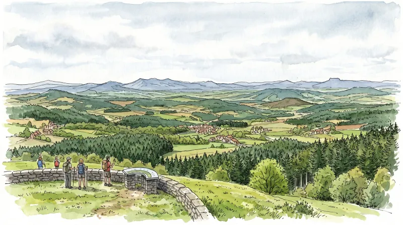
Montlune (circuit n°24)
Discover this trail through the heart of Livradois-Forez.
Montravel
This walk leads to the heights of the Forez and the site of Montravel, with its wide panorama over the Dore valley and the Livradois mountains.
Montvianeix (circuit n°48)
Discover this trail through the heart of Livradois-Forez.
Moulin de la Rode
D. From the square in Le Vernet-la-Varenne, take the street climbing to the left of the start information panel. In front of the church, turn left (view of Château de Montfort) and continue straight ahead on the D75. In front of the cemetery, descend a track on the left. At the junction of 3 tracks, continue straight ahead. Reach the surfaced road in the village of Fougères and follow it to the left for 50m. 1. After the buildings, take a track on the right. Keep to the main track until the surfaced road. Cross it and take the path on the left. Stay on the main track, ignoring a track on the right, as far as a fork. Continue downhill to the right to the former Moulin de la Rode. Cross the Veysson stream and follow the road to the right to the former Moulin du Prat. 2. On the bend, leave the road and climb the track straight ahead. At the junction, continue straight ahead and, 30m further on, climb the path on the left. Continue straight ahead at the next junction to the farm building. Keep to the track straight ahead alongside a meadow, then enter the woods. Continue straight ahead at the following junctions until you leave the woods and reach the crossroads of 4 tracks. 3. Take the track descending to the right towards the village of Fridevialle. In the village, turn right. The surfaced road becomes a track. Ignore a track on the left and continue to the road at the entrance to Les Vialettes. Follow it to the right through the village. On leaving it, take the leftmost track. Ignore the vehicle track on the left. 4. Just before entering the village of La Chotte, climb a track on the left through the woods. At the junction, continue climbing straight ahead. At the crossroads of 4 tracks, continue straight ahead to the village of La Faye (views of the Massif du Sancy, the Chaîne des Puys and Plomb du Cantal). Follow the road straight ahead and, on leaving the village, turn onto the track on the left. Continue to Le Vernet-la-Varenne, take the road to the left behind the church, then turn right after the fountain to return to the start of the route.
Notre-Dame de Roche
On either side of the col de Potey, Saint-Julien-de-Coppel and Laps stand on the boundary between Billomois and La Comté. People have left many traces here since antiquity, waiting to be discovered from hamlet to hamlet.
On the trail of the roe deer
A familiar silhouette in our mountains, the roe deer remains relatively little known. “On the trail of the roe deer” invites you to get to know it by following Léon, the mischievous squirrel. As the months of the year pass, he will explain the life of the roe deer, how to tell a male from a female, how to spot signs of its presence and what it eats…
Pailhat
This trail is short but very demanding in its first section. A magnificent paved path leads from the Cornillon panorama to the Pierre Cuberte dolmen.
Panorama of the Forez
This route follows paths lined with crosses and offers numerous views over the Forez mountains, the Dore plain and the town of Ambert.
Parcours 23 rouge - Les hameaux
Discover this trail through the heart of Livradois-Forez.
Parcours bleu - La montée à la vierge du Monestier
Discover this trail through the heart of Livradois-Forez.
Parcours bleu - Les balcons du Forez
Discover this trail through the heart of Livradois-Forez.
Parcours rouge - Les cimes du Livradois
Discover this trail through the heart of Livradois-Forez.
Parcours vert - La forêt de l'Achant
Discover this trail through the heart of Livradois-Forez.
Pas du Loup (circuit n°47)
Discover this trail through the heart of Livradois-Forez.
Paved Paths towards the Mountain
A short but demanding route that gains height and reveals fine views. Along the way, you will discover attractive paved paths beside numerous jas and jasseries.
Pérignat-ès-Allier: Landscapes Shaped by Antiquity and the Middle Ages
Pérignat-ès-Allier, a village more than a thousand years old, welcomes you. Close to the Allier, it retains traces of the Gallo-Roman and medieval periods, revealed on a route through its built and natural heritage.
Petit tour à Ambert (circuit route n°3)
Discover this trail through the heart of Livradois-Forez.
Petit tour à Sauviat (circuit route n°10)
Discover this trail through the heart of Livradois-Forez.
Petit Turluron
Starting opposite the tourist information office, take Rue Carnot to the right. At Place du Vigheot, continue straight ahead along Avenue de la Gare. (1) Cross the D229 and continue opposite; cross the railway line and immediately take the street on the right. At the fork, leave Rue de Bursat on the right and continue left along Rue de la Salette. Go straight through the housing estate and, at the top of the hill, turn left onto Chemin du Petit Turluron (view of Château de Ravel in the foreground and the Forez mountains beyond). At the fork, leave Chemin du Petit Turluron on the left and continue straight ahead on the stony track (view of the town of Billom). At the T-junction, turn left towards Petit Turluron. (2) At the crossroads of 4 tracks, turn left (leaving the village of Petit Turluron). At the next junction (interpretation panel: Billom, an urban vocation), take the track climbing to the summit of Petit Turluron and continue to the Chapelle de la Salette (360° panoramic view: Clermont-Ferrand, the Limagne plain, La Comté, the town of Billom in the foreground, the Chaîne des Puys, the Monts Dômes, the Sancy massif, Château de Mauzun and the Forez mountains beyond). (3) From the Chapelle de la Salette, return down the same track to the junction with the interpretation panel. Continue straight downhill. (4) At the T-junction, turn right and descend towards Tinlhat. Shortly before the first houses, bear left onto the track. Follow it for 1 km through fields and vineyards to the edge of the Bois du Gros Turluron. (5) Take the path climbing to the left. Cross a path leading to the castle ruins (private), then turn left again before descending into a clearing. Continue until you reach a field. Follow the descending track to the right along the edge of the woods to a junction. Continue straight ahead to an intersection. (6) Turn right, then left 300 m farther on to descend towards the D229 (take care: heavy, fast-moving traffic). Cross it and follow the track opposite as it bears left. Cross the stream and then the railway line. At the road, turn right; pass the agricultural cooperative and, at the chimney, turn left into Rue du Jeu de Boules. (7) At the end of the street, at Place du Chauffour, bear slightly left into Rue du Mont-Mouchet. Descend Allée des Marronniers on the right; cross the bridge over the Angaud stream and continue straight ahead along Boulevard de la Porte Neuve. At the stop sign, continue opposite along Boulevard St-Roch. (8) At the small square, turn left into Rue du Faubourg-St-Loup. Beside the apse of Église St-Loup, descend Rue St-Loup on the left. (9) 20 m before the stop sign, pass beneath the archway on the left into Rue des Cours-Ste-Marie, then take the first street on the right; continue opposite along Rue du Collège (leaving Rue le Peuple on the right) and go straight ahead to the Angaud stream. Cross it on the stone bridge and climb Rue de l'Etezon. (10) At the junction, continue climbing the same street towards the medieval quarter. At the top, beside the apse of Église St-Cerneuf and the Maison du Bailli, turn right to descend Rue des Boucheries. On leaving the medieval quarter, turn left to return to the tourist information office.
Peussat ( circuit n°19)
Discover this trail through the heart of Livradois-Forez.
Peyre-Mayou
From Saint-Pierre-la-Bourlhonne, at the end of the Fossat glacial valley, this path leads to the Hautes-Chaumes moorland.
Pic de la Garde
From the church square (information panel for the Sentier des Piqueurs: traders, sham beggars and bourgeois houses). With your back to the church, follow the street straight ahead and, 20 m further on, descend the street on the right just before the bakery. At the end of the surfaced section, continue descending straight ahead on the grassy track (view of Puy de Courdeloup). At the road, continue to the right. At the bottom, by a house, follow the road to the right. At the fork, turn right to the D 7. (1) Cross it and take the track opposite between two fences. At the junction, turn left. At the fork, continue to the left. A few metres further on, climb to the right (views of the village of Saint-Jean-des-Ollières, Puy de Courdeloup to the left and Château de Mauzun to the right). At the junction, descend to the left (view of the Monts du Livradois slightly to the left). (2) At the entrance to Le Mas du Bost (fine buildings), turn left. By the cross, descend to the left and, 70 m further on, turn right. Continue to the D 7. Follow it to the right for a few metres, then take the road climbing to the left. 100 m before the quarry entrance gate, take the path on the right into the woods. At the junction, continue to the right. (3) At the road, turn left and continue to Pailler (views of the Massif du Sancy, Cézallier, the Monts du Cantal and the Monts du Livradois). On leaving the hamlet, plunge down a track on the left. At the fork, continue descending to the left. Cross the stream and climb back up on the same track. Pass alongside the houses of Montrouy and turn left onto the road. (4) At Le Couderchet, stay on the main road (bread oven). 20 m before the wrought-iron cross, branch onto the track climbing to the left. At the fork, continue to the right as far as La Garde. Turn left onto a good track. (5) In the next village, turn left to reach the orientation table at Pic de la Garde (10-minute return trip) (panoramic view); at the reservoir, continue to the left. Retrace your steps, then descend to the left between two ruins. At the D 253, turn left. At the Saint-Jean-des-Ollières village sign, follow a path on the left bordered by low walls. At the wash house, turn right to climb into the village. At the school, turn left to return to the church.
Pierre Blanche Wood
Along open paths or tracks through woodland, across a rugged landscape of scattered homes, you leave La Chapelle-Agnon, birthplace of Lucien Gachon and a former weaving centre that turned to rosary-making after 1850.
Pierre Folle (circuit n°31)
Discover this trail through the heart of Livradois-Forez.
Pierre Pamole
In the village near the restaurant, by the information panel. Follow the road to its junction with the road to Viscomtat, turn right towards Noirétable, then turn left beside the former Hôtel du Pont. Climb to the road (coach garage on the left), cross it and continue uphill (fine view, with the Dore plain, Limagne and the volcanic hills of La Comté in the middle distance, and the Chaîne des Puys, Massif du Sancy and Massif du Cantal beyond). (1) At the top of the hill, cross the road and continue climbing. At the next road, continue straight ahead towards La Chevalerie (during the climb, view to the left of Chignore and the sheltered site of Vollore-Montagne; a fine fountain in La Chevalerie). (2) At the last house in La Chevalerie, continue climbing to the right. At the mobile-phone mast, continue along the track (view of the attractive Bournier stream valley, with granite blocks emerging in the meadows). (3) 50 metres after a bend in the track (Fontaine du Vin spring on the right), take a narrow path climbing to the right (another view). In the clearing, before the cross, take a track descending to the left; at the bottom, follow the surfaced road to the right. (4) At the road, turn left, then at the next junction turn right twice towards Mousset. Pass the hamlet and continue climbing (in very clear weather, through gaps in the trees you can see as far as the Alps, including Mont Blanc; Pic Pelé is closer). Stay on this track (after the first broad left-hand bend, Croix de l’Hermitage comes into view). At a large timber storage area, ignore the track on the right and continue straight ahead. (5) At the next junction, continue uphill, always staying on the main track. (6) In a clearing (an optional return trip to Pierre Pamole follows the track on the right that climbs gently. At the summit, walk around the rocky outcrop for a sweeping view: to the south, the Cantal and Sancy; to the east, the volcanic hills of the Billom area and La Comté and the Chaîne des Puys; to the north, Montlune and the village of Arconsat; and to the west, the Monts du Lyonnais, the Alps and the Massif du Forez with its summit, Pierre-sur-Haute), take the track descending into the woods to the left of the “Pierre Pamole” sign. At the next junction, take the track on the right (Arbre du Diable) and continue straight ahead to Le Pertuis. (7) Cross the D42 and continue straight ahead (towards Forêt d’Aiguebonne). At the next junction, descend to the left into the hamlet of Les Rallières and cross it. (On leaving the hamlet, views of the Monts du Forez, Pierre-sur-Haute and, in the foreground, the attractive Pamole stream valley). Continue on the same track. (8) At a T-junction, turn left. At Croix des Tuiles, continue straight ahead. Cross the stream and, at the road, turn right to return to the starting point.
Pierre sur Haute (circuit n°27)
Discover this trail through the heart of Livradois-Forez.
Piste 10 Le Bois de Migois - Col de la Loge
Discover this trail through the heart of Livradois-Forez.
Piste 11 Payanet - Col de la Loge
Discover this trail through the heart of Livradois-Forez.
Piste 12 La Pérouse - Col de la Loge
Discover this trail through the heart of Livradois-Forez.
Piste 13 Le Fossat - Col de la Loge
Discover this trail through the heart of Livradois-Forez.
Piste 14 Liaison des deux Cols - Col de la Loge
Discover this trail through the heart of Livradois-Forez.
Pitelet
This 8.9 km loop starts and finishes at Saint-Victor-Montvianeix, with 249 m of ascent and an estimated duration of 2 hr 15 min.
Pointe du Jour
Start at the leisure centre. Climb towards Cunlhat and take the first road left. At the D225 turn left. After 100 m, leave the road for a track descending right and climbing to the Le Coin road. (1) Follow the uphill track opposite. By the house, take the road right. (2) At the fork bear right again. Enter woodland after La Guillaumie. (3) At Le Verdier pass the manor house. Continue for 500 m and turn left onto a small paved road. (4) Cross the D997, head towards Ischamp and follow the first path right for about 400 m. Take a woodland path right. (5) At the entrance to Le Fayet turn left. Cross the village as the road becomes a track. Continue straight on the main track to the D997. Cross and head towards Pradelles. (6) In central Pradelles take the track right. It crosses a farm and enters woodland. At the four-track junction take the path left. At the road turn right again (view of the Forez mountains). (7) At Boscène descend on the lower track left. Cross the Mende stream and climb to the D65. Cross to the uphill track opposite, slightly right. (8) A few metres before the well and stone trough, descend on a path right, cross the D65 again and continue opposite. At the fork take the ascending sunken lane left. At the open area in Le Coin, descend on the road left, passing a house dated 1839, then return via point 1 and the outward route.
Pont de la Marion
This 4.9 km loop starts and finishes at Olmet, with 157 m of ascent and an estimated duration of 1 hr 30 min.
Pont du Roux
After Saint-Bonnet-le-Chastel and its Gothic church, the trail alternates between woodland and pasture. The winding Dolore once powered many mills and continues to carve out gorges. There are numerous views over the Dolore valley.
Pradier's cross
Departure: From the church square in Auzelles. Go down to the left of the church, then take the first path on the right after the bridge, turn at a right angle after the last Auzelles house onto a good path which leads to the Pradier cross. 1. Upon entering the village, turn left and, 50 m further, turn right onto the D996. Follow it for 300 m, then take a path on the right between low walls. Arriving on a tarmac path, take it on the left then take a grassy path on the right (next to a large henhouse) until you reach the D996. 2. Cross the D996 and continue on a good path. At the first crossroads, continue straight through the woods to come out on the D112E. Take it on the left for approximately 250 m, then turn onto the first path on the left which leads to La Frissonnette. 3. Then turn right until you reach the road. Take it to the right and turn left onto a path which goes down to the D112E. 4. Turn left on this road for 200 m. In front of the Mahut, turn left onto a tarmac path towards Les Boissières (chemin des Puys). Leave it on the right at the 1st crossroads (chemin de la Prulhière), follow the tarmac for 800 m then take a grassy path on the left to the road to the village of La Pruhlière. The crossing to reach the middle of the village, pass to the left of the cross and go down opposite under the houses. Turn right to take a long grassy path. Take the next path on the left to the village of Besset Bas. 5. Continue opposite and turn right to take the D112 for 200m. Take a path on the right which goes down into the Miodet valley. Facing the stream, go up the path on the left and reach the hamlet of Chabanette. 6. At the exit of the hamlet, turn right and reach the Chabanette inn. At the crossroads, take the road on the left for 100 m. After the first house, follow the path which goes to the right above Miodet. At the small wooden bridge, go straight towards the road which goes up to the village. Take it to the right for 100 m, turn left onto Impasse du Boulanger then right to reach the church.
Puy d’Oscot
From the town hall car park in Celles-sur-Durolle, follow the surfaced road to the left. Take the first road on the right, which passes the school, then continue on the main road as it bends left. At the T-junction, take the grassy track descending straight ahead, just after the electricity transformer. By a cross, continue on the same track; cross the stream and continue through the meadows (viewpoint over the village of Saint-Rémy-sur-Durolle). (1) At the fork, follow the same track as it bears slightly left. At the cross, follow the road straight ahead for 20m, then take the track on the left. At the junction, continue straight ahead to L’Obstancie. In the hamlet, by the cross, climb the small road on the right. (2) 20m further on, cross the D7E and take the track opposite heading left. Continue on the first track on the left. At the isolated house, take the track on the right and, 50m further on, turn onto the track on the left that descends. At the T-junction, turn left and climb to La Vacherie. (3) At the entrance to the hamlet, at the fork, bear slightly right on the same road. Follow this road (viewpoint over the Chaîne des Puys). Continue for 500m, then leave the road for a track on the left. Follow the edge of the meadow, pass the ruined house, then continue straight ahead. Go around the two ponds to reach a broader track. (4) Follow it to the right, then turn onto the first track on the left towards Château de Vaulx. Continue straight ahead to the road and follow it to return to the D7. Take the road opposite towards Rochemulet. Leave this road for the second vehicle track on the left (just after a left-hand bend) to climb Puy d’Oscot. Follow the main track to a timber-loading area. (5) Continue on the track heading right. At the fork, take the track on the left. At the T-junction, turn onto the track on the left. At the next junction, take the track straight ahead that descends. 50m before the surfaced road, take the track on the left to reach the junction at Croix des Olmes. (6) Follow the D102 to the left for 10 m, then the D321 to the right; immediately turn left to take the track climbing to the left through the meadows and into the woods. Stay on the main track straight ahead. At the next fork, turn right to reach a small surfaced road. (7) Follow it to the right. Cross the stream and, 10m further on, take the track straight ahead into the woods. At the next junction by a cross, continue straight ahead, passing the sports complex on its right, until you reach the D7. Cross it and head towards the village centre. Continue straight ahead to return to the town hall car park in Celles-sur-Durolle.
Puy de Ceveloux
This 10.2 km loop starts and finishes at Manglieu, with 160 m of ascent and an estimated duration of 3 hours.
Puy de Courdeloup
Start 30 m after the church; park in the spaces beside the telephone box. Facing the inn, take the street descending to the right, which becomes a stony track (view of Puy de Courdeloup straight ahead, on the wooded side of the Puy). (1) At the end of the track, follow the D 9 straight ahead, ignore the first track, then take the second track climbing to the left (views of the Massif du Sancy and Puy de Dôme). Continue on the same track alongside Puy de Courdeloup on the right (view of Saint-Jean-des-Ollières in the foreground, the Monts du Forez beyond straight ahead, and Château de Seymier on the left). (2) At the crossroads of 4 tracks, branch right towards Puy de Courdeloup and continue on the main track (low walls marking the plots where livestock once grazed; today, hornbeams or pollarded trees have reclaimed these walls by growing on them). At the next junction (view of the basalt rock formation of Puy de Courdeloup on the right), bear slightly right and stay on the main track. (3) At the D 9 (view of the Massif du Sancy), follow it to the left (view of Pic de la Garde, its rocky scree and the statue of the Virgin on the left). Ignore the road heading left in the village of Bourgis and, at the house (place known as Bioge), take the grassy track on the right descending into the valley to reach the hamlet of Le Gacard. Enter the hamlet, pass the bread oven on the right and continue straight ahead. (4) On leaving the village (view of Puy de Dôme), before the farm buildings, take the track descending to the right, cross the Bouchisse stream and climb to the hamlet of Bouchiche. (5) In the village, take the surfaced track climbing to the left, pass around the hairpin bend to the right (view of Puy de Courdeloup on the right and Isserteaux), then take the track on the left. At the junction, take the first stony track descending to the right as far as the road. At the road, turn right to enter the hamlet of Champorent. (6) Cross the hamlet and take the grassy track straight ahead. At the top of the rise, join a broader track and follow it to the right (view of Puy de Dôme). Cross the village of Montagnet (ruined village), then continue on the main track (view of the Massif du Sancy on the left). (7) Cross the hamlet of La Rochette to the D53, follow it to the left for 50 m, then take the first track on the right alongside Montjoux (cross). At the entrance to Isserteaux, continue straight ahead past the apse of the church. At the war memorial, turn left to return to the inn.
Puy de la Poule
Start: From the start information panel in the car park beside the sports ground on Chemin de la Côte, cross the road and take the track straight ahead. Fifty metres after the farm building, branch right and continue on the track (views of Cournon, the Sancy and Puy de Mur). At the fork, descend to the left. At the T-junction, turn left, then after 10m descend to the right. Follow the Allier on the left, then climb to the left to reach the surfaced track. Follow it to the right to a junction beneath the high-voltage line. 1 - Turn left (water catchment area on the right), continue and, on the bend (picnic area), go straight ahead. At the next junction, turn left into the woods, cross a stream and pass beneath two power lines. At the junction facing the village of Mezel, turn right, pass alongside a ruined building and continue to the road. Cross it and head towards Saint-Bonnet. Leave the road and, after the warehouses, descend to the right on a track. Continue to the road (dog training centre). 2 - Follow it to the left for 40 m, then take the track on the right and stay on this main track, keeping left at the next two junctions and heading towards Saint-Bonnet. Reach the road opposite the community hall, turn right, then left onto Rue de la Fontaine Madeleine, then right as far as Rue des Granges. Follow it to the right to the stop sign at the next junction, then take Rue du Château on the left to the church porch. 3 - Take the street that passes around the church to the left and above it. Pass a water tower and climb on a surfaced track to the château entrance. Take the track on the right opposite the entrance. Pass alongside the farm and, at the high point (view of the Chaîne des Dômes), continue to the fork and turn right. At the junction, turn right beneath the power line, then after 80m climb straight ahead to the left (view of the Forez) to a fork. Turn right across the plateau (ignore the descent that leads directly to Mezel) (view of the Livradois-Forez). Pass around a cirque and reach the road. 4 - Turn right, then after 40m climb the leftmost track (another yellow PR route is on the right). Descend to the left on the track, pass above the château and descend into Mezel (dovecote). Continue to Place de la Fontaine, turn right onto Rue de la Font-Grande, left onto Rue Marmondieu, then left before the château. One hundred metres further on, pass beneath the porch on the right, pass the church entrance, take the passage on the right and continue along the left side of the château (12th- and 16th-century château). Descend to the left along Rue Guyot Dessaigne, then left again at Place de l’Église; descend the small staircase just after the market hall, Passage des Buissonnières. Descend Rue de la Balalong to a mission cross (viewpoint). Turn left onto Rue Côte de Peine, then Rue Célestin Tourres. Turn right onto Chemin de la Côte to return to the starting point.
Puy de Montoncel
This woodland walk reaches the summit of Puy de Montoncel, the highest point in the Bois-Noirs at 1,287 m.
Puy de Pileyre
This 8.6 km loop starts and finishes at Chas, with 233 m of ascent and an estimated duration of 2 hr 30 min.
Puy du Sapt
A walk among the tall forests of the Haut-Livradois, an ideal habitat for the boreal owl and the black woodpecker. The paths lined with crosses around the Fournols priory offer views over the Forestier ponds, the Croix des Sucs and Colombière.
Puy-Gros
D. From the church in Le Brugeron, follow the road to the right and take the road on the left 50m before the D102. Just before the D37, take the path climbing to the right to the village of Bien. Cross the hamlet, staying on the road to the right. On leaving the hamlet, at the fork, branch onto the track on the right. At the forest track, turn right and continue to the fork. 1. Then climb the sharply bending track to the left as far as the D102 and follow it to the left. Next, branch onto the first track heading left into the woods. Continue on the main track to the clearing at Croix du Pirou. Then follow the forest track to the left for 2km (shortcut: take the track straight ahead to reach the road). Keep to the main track, which climbs again after crossing the Sapet stream. Continue uphill on the main track to the buron at Chez Ferré. 2. Turn right and continue to the junction of several tracks. Then take the track heading right and follow it to Croix de Sainte-Anne. At the cross, take the path climbing to Puy-Gros on the right (views of the Chaîne des Puys, the Massif du Sancy, the Monts du Forez and the Monts du Livradois). Continue on the path descending on the other side until you rejoin the forest track, then follow it to the left. 3. By a jasserie, descend the track on the right until you reach another forest track. Follow this track to the left until you return to the D102. Follow the road to the right, pass the cross-country skiing centre and take the first vehicle track on the left. Then branch right and stay on the track to the village of Les Echelettes. 4. At the D102, follow it to the left for 20m, then turn onto the first surfaced road on the right. The road becomes a track and emerges onto the D102 by the village of L’Arbre. Take the D102 straight ahead. At the fork with another surfaced road, take the road straight ahead. Pass the reservoirs and continue downhill to Le Brugeron to return to the starting car park.
Quatre Vents Challenge (Road Circuit No. 14)
One of the shortest circuits designed as a loop from the national cycle-touring centre, this route uses many quiet minor roads. Follow the directions carefully to avoid losing the route. Take particular care on the road after Néronde, especially when turning left off the D906.
Red route 21 - The Schoolchildren
Starting from Ambert station (the mountain biking and trail-running base), this route leads through a forest setting to the Col des Allebasses. Along the streams of Gourre and Lagat, you will discover old mills that bear witness to the paper-making activity of the 15th century.
Rez de Sol
This 10.6 km loop starts and finishes at Murat (Lachaux), with 445 m of ascent and an estimated duration of 3 hr 15 min.
Ridge walk
A circuit in the highlands of Ste-Catherine (14th century church) with panoramic views of the Dôme mountains, the Dore and Cézallier mountains as well as two beautiful crosses in the hamlets of Moulin à vent and Peslières.
Riols
Starting on the plain, this route quickly climbs into the Livradois mountains along attractive paths and offers wide views of the Forez mountains.
Roc du Guet
This 10.8 km loop starts and finishes at Groupe scolaire de Chabreloche, with 332 m of ascent and an estimated duration of 3 hr 15 min.
Roche Savine
Saint-Amant-Roche-Savine is home to a remarkable woodland collection, where you can discover different tree species including spruce, beech and elm, as well as beautiful views over the Dore valley and the Forez mountains.
Rochemulet
Start: From the church square in Sainte-Agathe, follow the D102 to the left as far as the cemetery. Turn right towards the cemetery entrance. The road becomes a track. Continue descending straight ahead to the D7. Cross it and take the surfaced road opposite towards Mousset. 1. At the junction, leave the surfaced road and take the track climbing straight ahead. Continue on the main track to the surfaced road. Turn right and cross the village of Raffy. Continue on the track climbing straight ahead through the woods. After 150 m, at the fork, take the track on the right. Continue uphill on the main track. At the fork on reaching the village of Rochemulet, continue climbing to the left. 2. 50 m further on, by a cross, take the vehicle track on the right (views of the Chaîne des Puys, the Massif du Sancy and the Bois Noirs). Continue downhill on the main track (a very fine paved track) until you cross a stream. Continue on the track bearing slightly right. At the T-junction, take the track descending to the right, then pass a water reservoir on its left. Continue on the main track to the village of La Chaize Haute (views of the Chaîne des Puys and the Massif du Sancy). 3. In the centre of the village, take the track on the left. 50 m further on, at the fork, turn onto the track on the right, which descends to the surfaced road (views of the Chaîne des Puys and the Massif du Sancy). Follow it to the right for 50 m, then take the track descending opposite. At the T-junction, opposite a pond, turn onto the vehicle track on the left, pass through Moulin des Vernières and return to the D7. 4. Follow it to the left for 50 m, then turn onto the first track climbing to the right. Continue uphill to the surfaced road and turn right. After 350 m, take a path climbing to the left. At the surfaced road, turn right and continue to the village of Sainte-Agathe to return to the car park in the village centre.
Rocher de la Volpie
A short but energetic route leading to Rocher de la Volpie, with an outstanding view over the Ambert basin, the Livradois mountains and, in fine weather, the Sancy massif.
Saint-James
Start: Follow the D97 left for 100 m to Croix de Gripel. Cross the road and take the uphill track opposite. Continue on the driveable track to the paved road, turn left and follow the main road through Genasse. At the woodland edge, take the good hairpin track left. Keep to the main track to Poumarat, then take the paved road descending left. 1. At the junction take the woodland track slightly left. At the multi-track junction turn right and cross Saint-James. At the D97 turn left for 200 m, then descend on a track towards Tour de Gripel. 2. In Gripel take the paved road left. Rejoin the D97 and follow it right to Croix de Gripel. At the cross, descend on the D97 towards Marat and return to the car park.
Saint-Martin-des-Olmes
This route leads through a rural landscape of woodland and open areas, with fine views over the Ambert plain and the Livradois mountains.
Sainte-Elidie Chapel
A beautiful route where you can observe how the Haut-Livradois landscape has evolved and contemplate Sainte-Elidie chapel, a place of legends with a magnificent view over the Dore gorges.
Sauvessannelles
This 9.4 km loop starts and finishes at Eglise de Sauvessanges, with 289 m of ascent and an estimated duration of 2 hr 45 min.
Stone and Rammed Earth
This trail leads you through numerous hamlets along attractive paths, with occasional views across the Forez mountains.
The 1,000 Steps
A short family-friendly walk with numerous views of the Chaîne des Puys, the Sancy massif and the Forez mountains.
The 3 fourchoux cross
Departure: From the church of Domaize, take the main road on the right, towards St Dier. 1. At the St Anne cross, take the path below which runs alongside a house and its pond. Follow the dirt road on the left which descends into the valley. Cross the D65 and head opposite towards Rouchadet. 2. On the descent, in the hairpin bend, leave the tarmac and turn left to go up along the stream towards the Palles car refour. 3. Take the D304, at the left end of the crossroads towards Ceilloux, then, 50 m on the left, the dirt road which goes up the hillside. At the first crossroads, turn left. 4. In the village of La Roche, go up to the right behind the first house towards Les Pradets, where you continue along the dirt road lined with 3 chestnut trees to Le Fraisse. 5. Take the tarmac path on the right, between the houses, then straight uphill. 6. When you arrive on the plateau, at the pond, turn left and cross the farmyard of Martin's. Then stay on the flat, abandoning the tarmac for a straight dirt road. Below, at the crossroads, turn left. 7. At the crossroads, 2 stone troughs, join the tarmac of the D65, cross the Vacher, then straight on along a dirt road towards La Côte. After the hamlet, in the hollow, continue straight on, uphill. 8. At Cheix, straight on, leaving the pond on the right. At the Trois Fourchoux cross, cross the D65E, take a dirt road opposite it, on the flat. 9. Then take the tarmac path on the left, direction Domaize, via the cemetery and the suburb. The arrival is under the market hall, facing the castle.
The Ailloux forest
At the entrance to the forest track, take the wide dirt road which enters the woods. Cross the stream which passes under the path and continue to the wood storage area. (1) Continue to follow the road on the left. (2) After the description of the water bars, take at the junction on the left a narrow path in the undergrowth. Pass along a wetland and find the tarmac road. (3) Follow it to the left to find the start.
The Banks of the Ance
This 11.9 km loop starts and finishes at Saint-Clément, with 386 m of ascent and an estimated duration of 3 hr 30 min.
The Banks of the Litroux
A short hike rich in viewpoints, crowned by the Lanterne des Morts at Culhat, a remarkable 12th-century monument.
The Beau Pommier Walk
This 8.8 km loop starts and finishes at Bulhon, with 48 m of ascent and an estimated duration of 2 hr 30 min.
The Big Wheel
Departure: From the car park, turn right, cross the bridge over the Durolle, go up the road on the left and, after the barrier guard's house, take the path which goes up immediately to the left (contrast between the forest atmosphere, the workshops and the factories; view of La Monnerie, St-Rémy, Palladuc). 1. Cross the hamlet of Luc (in Luc, view of Montoncel, Puy Snidre) then, at the crow's feet, turn right. 2. After the water tower, at a crossroads, take the path which continues straight ahead. At the top of the hill, at another crossroads, keep the path on the left. Leave a path going down to the right. 3. At the road, turn right, then at the next crossroads turn right again (view of the Durolle and near the Vallée des Rouets on the left, view overlooking the Chêne rond mill, the fault on which the town of Thiers is located). 4. Cross the Suchet to reach the start.
The Billeyre Valley
This splendid route leads through beautiful surroundings along a paved path winding through the Billeyre valley.
The Bost Trail
The Ceilloux priory, the fortified Bost farm, a rare dry-stone hut at Dourbias and the Château des Martinanches: the route reveals remarkable architectural heritage in a bocage landscape.
The Bread Oven Circuit 2
Start: From the war memorial, descend and pass to the left of the cross to enter the narrow street towards Le Cheix. 1. At the “La Croix Saint-Barthélemy” sign, turn right and take the grassy track straight ahead; stay on this track as it descends to Étang de la Gravière. Cross the dam and, at the end, continue straight ahead; follow the track past the bread oven and, 10 m further on, take the track climbing to the left. At the road, take the grassy track straight ahead and descend to Le Pic (view of Château de Mauzun straight ahead, with the Monts du Forez and Pierre-sur-Haute slightly to the right). Cross the hamlet and, by the bread oven, turn right onto the road and descend to Étang du Pic. 2. By the pond, continue on the road to the right (view of the Monts du Forez on the left). Cross the D 7 and take the grassy track straight ahead between the fences. At the surfaced section, continue straight ahead (view of the village of Fayet-le-Château). 150 m further on, take a broom-lined track on the right between the meadows. At the bottom, turn left (ignore the road) and follow the stream. At Le Montheil, continue straight ahead past the bread oven and, on leaving, turn right to reach the D 337, then follow it to the right. 3. 500 m further on, take the track branching to the left. At La Farge, turn right and rejoin the D 337, following it to the left (view of Château de Seymiers on the right). After passing Lachamp, take the first track on the left alongside a pond. At the fork, turn right (view of Puy de Dôme). Stay on the main track throughout. 4. At the end (shortcut: turn right onto the track at the surfaced section and descend to the D 337), follow the track straight ahead (views of the Massif du Sancy and the Chaîne des Puys) and continue straight ahead to Le Pereyret. Pass the bread oven and cross the hamlet to the D 337. Follow it to the right for 10 m, then turn right again onto a track just above the fountain. 5. At the D 337, follow it slightly to the right, pass La Jarrige (bread oven on your left), then a pond, and continue on the D 337. Climb straight ahead to Coissard. Cross the hamlet to reach the D 337. Cross it and take the track descending straight ahead (views of Château de Mauzun and Thiers; an optional return trip on the left leads to Les 3 Pierres). At the fork, climb to the right and continue to the D 337. Follow it to the left to return to the starting point.
The Bread-Oven Circuit
A walk rich in small-scale built heritage, including bread ovens and rammed-earth buildings.
The Bridges Circuit
Start: From the church in La Renaudie. Descend the main road (D102), then continue straight ahead at the junction onto the D41 (towards Le Brugeron). Follow the D41 to the Croix de Ste Agathe. Take the road on the right towards Le Clef (view of the village of La Renaudie). At the entrance to the hamlet, just after a barn, take the stony track on the right; pass the renovated house and continue along the grassy track. Continue for approximately 800 m from Le Clef, then turn sharply right to cross the Rioubet stream. Climb the same track to La Chossonie. 1. Just after the first house, leave the road for the track descending slightly to the left. At the fork, continue right (view of the Chaîne des Puys). At the entrance to La Vialle, immediately climb to the right. At the top of the village, cross the D41 and take the track opposite between 2 low walls. On the climb, leave the track and turn left (view of the Sancy massif and the Chaîne des Puys). Continue straight ahead, then turn left near the cross. 2. On reaching the hamlet of Thérias (on a bend), follow the road to the left for 50 m, then turn right towards Les Gouttes at the junction. 20 m farther on, at the cross, leave the road and take the track on the left. At the junction, take the small road opposite (towards La Chaugne). 15 m farther on, leave this road for the track on the right. Cross the stream and continue straight ahead. Pass alongside a hamlet (Les Champs-Elysées) and, at the junction, continue on the same track opposite to Le Garret. 3. In the village, climb the small road opposite to reach the D41. Cross it and take the track opposite. At the fork, continue straight ahead. In the hamlet of Le Cheix, go around the house and continue through the forest to the ruins of the village of Vironesse. 4. At the ruins, continue along the main track for approximately 250 m, then turn onto the first track on the right. Remain on the same track to the Pale stream. Follow the stream on its left-hand side (the track is very wet in places) to reach the D 317. 5. Follow it to the right for 500 m. On reaching the hamlet of La Goutte, take the D 102 to the right (towards La Renaudie). 150 m farther on, on the bend, turn left and follow the right-hand edge of the field. At the junction, take the track on the right. Follow this climbing track for 1.5 km, then turn left at a crossroads of 4 tracks. Remain on the main track until you reach a road. 6. Follow the road to the right for 200 m, then turn right. Beside a ruin, continue straight ahead; follow the Couzon stream. Ignore the forest track branching right and remain on the same track to a ford. 7. Just before the ford, take the track bearing right. Follow the road to the left, then take the first track on the left. At the fork, continue straight ahead. At the junction of several tracks, turn left and then immediately right. Follow the same track to a road. 8. Follow it to the left, then turn left at the next junction. 150 m farther on, turn left again and cross the fields. On reaching the D 101 at the entrance to the village of La Chambonie, beside the cemetery, turn right for 5 m and then immediately take the road on the right. Follow it for 500 m. 9. Beside a small wrought-iron cross, just before an isolated house, turn right and climb through the woods. At the top of the hill, take the clearest track on the right. On leaving the woods, turn sharply left. 10. Follow the road to the right. Cross the hamlet of Le Verdier and remain on the same road. Follow the D 41 to the right. At the large junction, leave the D 41 and take the D102 to the right (towards La Renaudie). Enter the village and return to the church.
The Brugeron tour
D. With your back to the church, go down left, then right, passing in front of the town hall. At the next intersection, turn left towards Col du Béal. At the start of the bend, leave the main road by taking an uphill road on the right. Pass in front of the water tower before reaching the road again. Follow it to the right, crossing the hamlet of L’Arbre. At the bend, leave it on the left by a stone path which goes up to the hamlet of Échelettes. 1. Follow the road to the left, then immediately turn right onto an ascending road which becomes a path. At the crossroads, turn right to go down through the woods to Fonteilhet (on the right, view of Le Brugeron). Ignore the rising road on the left and follow the road a little further down to the left for a few meters, before cutting the right turn via an emerging path. Cross the road again towards Les Farges. 2. Shortly before the hamlet, leave the road on the right by a path going down through the woods. It joins a road a little further down. 3. Cross (caution) and then go down left to Bourchany. Cross the hamlet on the right and follow a path going down to the right to the Gérize stream (be careful, often wet path). Cross via the footbridge before going up through the beech forest. 4. At the intersection, continue to the right alongside a first house (on the right seen on Le Brugeron). Continue and cross the hamlet of Fradas on the left (possibility of cutting to the right to reach the starting point via the Tour de Pays en Livradois-Forez) up to the road which you must follow to the right for 130 m. 5. Leave the road for a forest path on the right. It goes down to the Gérize stream which must be crossed again by a stone slab bridge. The path goes up to La Londiche before continuing to the right until you reach a road. 6. Follow the road to the right for a few meters before going down to the left towards the Moulin du Bègue. 7. Before the bridge (on the left, round trip to the Moulin du Bègue and its waterfall), go up to the right along the track which joins a sewage treatment plant then an intersection. 8. Join the crossroads on the right then take the first road on the left to Brugeron. In the town center, continue straight on the uphill street to find the starting point.
The chairlift (circuit no. 56)
Discover this trail through the heart of Livradois-Forez.
The Chalas Dam
This 6.0 km loop starts and finishes at A la base de loisirs, with 145 m of ascent and an estimated duration of 1 hr 45 min.
The Chauriat Hillsides
Start: From the information panel in the car park, take Chemin des Mûres around the tennis court. At the first fork, climb to the right. At the junction (two-sided stone cross), continue straight ahead, ignoring the side tracks (views of Chauriat, Château de Bard and Petit Turluron). Continue straight ahead until you have passed an enclosed, tree-filled property (pine trees). 1. Immediately after the property, descend at right angles to the left. At the T-junction, continue to the left until you enter Chauriat. Continue straight ahead, pass Croix de Mission (Place Pasteur), cross Boulevard de la République and climb Rue des Banches to the town hall. Turn right onto Rue des Cuvages and immediately take Espace Antoine Rudel du Miral on the left to Place Lafayette (Maison Rudel [town hall], church, traditional buildings). Descend Rue du Commerce to the right. Cross Boulevard Marx Dormoy. Climb Rue des Plantades straight ahead, then its continuation, Chemin de Bard, to a stone cross. 2. After the cross, turn left and continue along a long contouring track (panorama from the Chaîne des Dômes to the Sancy) to a junction. Climb to the left towards Puy Benoît as far as a fork. 3. Continue climbing straight ahead. At the highest point of the track (view from Puy Saint-Romain to the Forez), begin a gentle contouring descent to the first junction overlooking Chauriat. 4. Turn right at right angles, then left to the road. Cross it and immediately take the track on the right. Continue straight ahead along the hillside. At the fork, continue to the right, still following the hillside. At the iron cross, climb to the left. Pass Ferme du Pileyre and continue to a junction with another PR walking route. 5. Continue level, including at the first vines (view from the Forez to Beauregard-l’Évêque). Before the descent towards Vertaizon, branch left onto the path leading to the summit of Puy de Pileyre (panorama over the surrounding puys and Pierre-sur-Haute, the highest point of the Forez (1634 m)). Then descend on a zigzagging path through the volcanic rock piles. On reaching a track, follow it to the left to a junction. 6. At the T-junction, continue climbing to the left, then after 50 m take a grassy track on the right (along the route, views from Chauriat to the Sancy). At the first junction, descend to the right as far as Chemin des Chausses. Follow it to the right and continue straight ahead along Chemin de Servignat. Descend the first track on the left to return to the starting point.
The Circular Trail
Start at the leisure centre. Climb towards Cunlhat and take the first road left. At the D225 turn left. After 100 m, leave the road for a track descending right and climbing to the Le Coin road. (1) Take the uphill track opposite. At the top continue straight. By the house, follow the road left for 100 m and take the first track right. (2) At the D225 climb right, then turn left towards Courtesseire. Keep left past the hamlet and continue on the track extending the road. Climb to the conifer edge, then descend left on a grassy track across a field. (3) Cross La Vironne to the right. At the bread oven, enter woodland right. At the road turn right. Below Cammas turn left and reach a departmental road; take the road opposite climbing to Les Rouchoux. (4) Cross Les Rouchoux, ignoring the road right. At the fork turn right then left above the houses of Chabrol. Beyond the hamlet the road becomes a track; continue straight. (5) At Mas-du-Bost continue straight. At Les Faidides cross the road to the track opposite. Continue straight; near Les Bruneilles turn right. At the fork take the track left to a road. (6) Follow the road left for 250 m. Cut the bend on a path left. Two hundred metres before a junction, turn left onto a grassy track. Cross a road and continue opposite to Olagnier. (7) Cross the length of the hamlet and climb a paved track that becomes a path. At the junction turn left along the ridge. After 400 m, at the edge of the meadows, enter deciduous woodland left to reach Terrol. (8) Pass the château and descend to the departmental road. Continue straight at the junction and take the first track left. At Croix Sainte-Anne continue opposite, keeping right. (9) At the junction turn left to return to the rear of the leisure centre.
The Civadoux Valley
Start - From the information panel at the bottom of the car park, descend the main street. Turn left, cross Place de l’Ancienne Poste and follow Rue des Coufferts. Cross the bridge (mill leat, or "béal"), take Petite Rue des Coufferts straight ahead, then turn left onto the D214 for 200 m and left again onto the D144. Climb the track on the left (views of Sauxillanges, the Val d’Allier, Puy de Dôme and the Massif du Sancy) and continue to the D144. 1 - Follow the D144 to the right. After the transformer, climb steeply to the left through the woods. At the T-junction, turn left. At the crossroads, turn right towards Ventre. Enter the hamlet on the left. Descend the first track on the left to the fork by the pond. 2 - Turn right, then immediately left. At the bottom of the hollow, ford the stream. Climb to the right through the woods. After the clearing, follow the edge of a conifer wood. At the road, turn left towards Chabreyras (view of the Chaîne des Puys). Cross the hamlet, keeping left, then take a broad earth track on the left. Ignore the side tracks until the D144. 3 - Follow it to the left for 200 m. Bear right onto a forest track. At the fork, turn left. Follow the steeply descending path towards the Chaméane River. Cross the wooden bridge and the D49 at Civadoux. Pass between the inn buildings (a former oat mill) and climb back into the woods. At the junction, turn right. Follow the edge of the pastures (views of the Monts Dômes and the Massif du Sancy). On leaving the hamlet of Bonnefont, descend the track on the left to the D706. 4 - Turn right and, at the hairpin bend, take the track on the left leading to Saint-Quentin-sur-Sauxillanges. Cross the road and then the square, pass the church (Romanesque church with a bell gable) and continue straight ahead on the lower track alongside an enclosing wall, ignoring the adjoining tracks. At La Coierie, follow the D49 to the right for 20 m, turn left, cross the footbridge over the Chaméane stream and follow the path to the right. Descend the wooden steps on the right, cross the bridge downstream from the confluence of the Astrou and Chaméane streams, then continue alongside the Eau-Mère. In Sauxillanges, continue straight ahead on the same road and, at the end of the cul-de-sac, turn right onto Rue des Tanneries; rejoin Rue des Coufferts on the right and return to the starting point
The Courtesserre Hills
This 9.8 km loop starts and finishes at Courpière, with 233 m of ascent and an estimated duration of 2 hr 30 min.
The Cros Fords (Circuit No. 6)
This short waymarked loop circles the Bois de la Plaine and offers a beautiful view of Château de Vollore, once owned by the famous General Lafayette. His descendants still live there and offer visits in summer, or by prior booking for groups during the rest of the year. Farther on, the route crosses three fords before climbing back towards the Quatre Vents plateau.
The Donnes Mill
This route has preserved reminders of rural life in the past—an animal shoeing frame, fountain, granite and cast-iron crosses, well and bread oven—amid ever-present nature, with views of the Forez mountains and their highest point, Pierre-sur-Haute (1,634 m).
The Dore and the Dolore
Departure: Take the D 300 (former D 999) which leads to St-Bonnet-le-Chastel. Take the path around the stadium, cross the leisure area and take the left turn. 200 m after the bend, take a path on the left, and continue straight on a grassy path. At the top of the hill, head towards the road and follow it to the right. 1. At the intersection, go back towards Arlanc, cross the D 906a and continue towards Moranges. Cross the railway, then turn right (view of the Monts du Forez). At 500 m, turn left and continue straight. 2. From the small Place du Luminier, take a path going up to the right. Pass a wooden chalet and continue to the granite farm (view of the Monts du Forez), and turn right at an acute angle. Cross the railway line further and continue on the small road. At the junction, cross the bridge, go down to the right to reach Coupat (view of the Monts du Livradois and du Forez, the Dore and the Dolore, Ambert, Arlanc and Dore-l'Eglise), and continue on the left towards a wind turbine. 3. Turn right onto the small road and go down to Procureur. 4. Cross the D906 and the railway line again. Immediately turn right onto a wide dirt road going down to Montel. Cross this hamlet. 5. Leave the road after the last Montel farm to take a good path on the right going up to Mayres. After the church, continue right on the D 38. At the first houses in Rouaires, turn right. 6. After the chapel, take an ascending path on the left, bordered by a low wall on the left. Continue straight at the intersection. 7. Turn right until you reach the forest track and follow it until you reach the road. Go down towards Arlanc. 8. At Capartel, turn left. Follow the Dolore and cross the “Roman” bridge. Follow the river on the right before crossing it again on a footbridge. Turn left to reach the starting point.
The Dore Balconies (Circuit No. 9)
This waymarked route crosses Parc Lasdonnas, with a fine view of the walls of old medieval Courpière, then follows the Dore and climbs towards La Peyrouse. At the RD223 crossing, a very short detour leads to Château d’Aulteribe, noted as one of France’s best-furnished châteaux and open to visitors. Farther on, the route crosses Sermentizon and reaches the former commandery of the Hospitallers of the Order of Saint John of Jerusalem at Courtesserre. It then descends to Courpière along paths and tracks, passing Institution Saint-Pierre, used for dormitory scenes in the film “Les Choristes”.
The Dore Gorges (Circuit No. 12)
A physically demanding and sometimes technical waymarked route, ideal for experienced riders. After an initial descent, it reaches Roddias and climbs a long, exposed track to the Courpière–Ambert road, which is crossed a little farther on after a short descent. The route then alternates between woodland and exposed higher ground. It reaches Sauviat, where remains of fortifications and a fine view of the dam can be seen. Near Cublas, do not miss the plunging view into the gorges carved by the Dore. A quick descent reaches the river, followed alongside the railway built between 1883 and 1902, with 17 tunnels and 18 viaducts and bridges over 85 km—an impressive feat for its time. This section still links the Giroux-Gare paper mill with the Celta cardboard plant. After a long flat stretch beside the railway, the route reaches Giroux-Vieux, climbs to Lavest and continues towards Augerolles. It remains physically demanding, crossing the Faye valley before reaching the Couzon valley near Lac d’Aubusson. After circling the lake, two substantial climbs remain before returning to the nature centre.
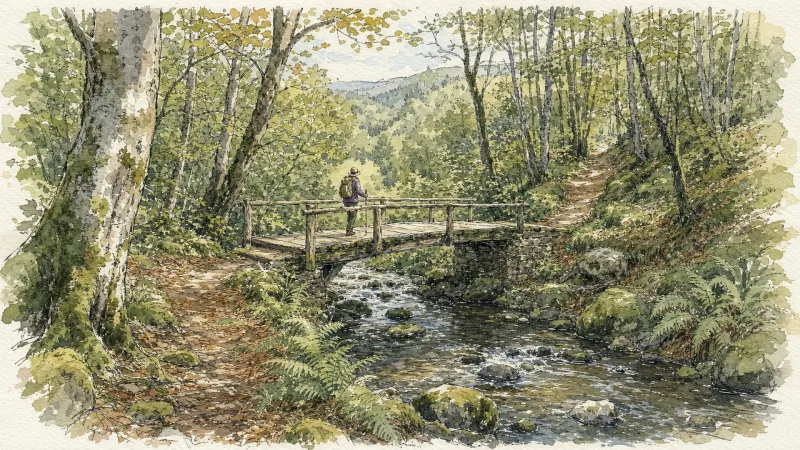
The Dore Gorges Walk
This 8.2 km loop starts and finishes at Mairie, Tours-sur-Meymont, with 243 m of ascent and an estimated duration of 2 hr 45 min.
The Dore Plain (Circuit No. 1)
This waymarked family loop, suitable for very young children, crosses Parc Lasdonnas in Courpière, then follows quiet streets and local roads towards Taragnat and the Dore plain. Broad, easy tracks follow. Take the greatest care when crossing the RD906 at La Sagne Basse. Short climbs and descents, mainly on local roads, lead to the carefully restored Tour du Maure. After Bellime, the route reaches Étang de la Fontaine Salée before returning to the medieval part of town.
The Dore Riverbanks
Discover the varied landscapes crossed by the Dore and explore villages and hamlets, their heritage and their viewpoints.
The Dore Riverside
An easy walk, well suited to families with young children. Between ponds and river, it also provides an introduction to aquatic habitats, where many migratory and resident birds can be observed.
The Dore terraces (Mayres)
Departing from the magnificent site of Notre-Dame de la Roche, this route will take you from one side of the Dore to the other, and enjoy numerous viewpoints over the village of Mayres, the Dore valley and the Monts du Forez.
The Dore terraces (Sainte-Marguerite)
A route of contrast, which first follows the bed of the river before rising to cross the hamlets of adobe houses, installed on the terraces at mid-slope and benefiting from numerous panoramas, in a very open landscape.
The Escoutoux Hillsides
Start: Climb into the village along the main street as far as the church (a small landscaped park is on your right). Turn right after the church. 50 m further on, leave the main road and take the very narrow path climbing through the woods on the left. Continue on this same path across the hillsides (just before entering the conifer plantation, viewpoint over the Chaîne des Puys and Sancy). 1 - At the junction, take the earth track on the right (ignore the track on the left) then, after about 150 m, leave the main track and take the path climbing to the left towards the hamlet of Lesvignes. (Just before Lesvignes, on the right, viewpoint over the Chaîne des Puys, Sancy, Clermont-Ferrand and the Thiers area). Ignore the track on the right and continue on the path straight ahead towards Lesvignes. In the hamlet, join the small surfaced road straight ahead (ignore the road on the left). Continue on this small road through the hamlet, then at the top leave the main road and take the path straight ahead. 2 - After 50 m, at the junction, cross the D102 and take the road towards Champaumont. In the hamlet of Champaumont, at the junction by a rammed-earth barn, take the earth track on the left (ignore the road descending to the right into the village). At the junction by the rammed-earth building (Chez Pateil) take the track on the right. (Take care at the junction with the Sainte-Agathe PR route, Topoguide Montagne Thiernoise). Continue on the main track to the D102. 3 - At the D102, follow it to the right for 10 m, then take the track heading left. 80 m further on, at the fork, ignore the track on the right and stay on the main track straight ahead. On the descent, at the fork, continue on the track to the right towards the hamlet of La Bénétie. (At the right-hand hairpin bend, views of Courpière, Clermont-Ferrand, the Chaîne des Puys and Sancy). In La Bénétie, descend on the small surfaced road. At the junction at the bottom of the hamlet (views of the Chaîne des Puys and Sancy, with the Monts du Forez and Pierre-sur-Haute on the left. 4 - Take the earth track contouring the hillside to the right towards Truchevent (panorama: summit of Pierre-sur-Haute, Grün de Chignore (Vollore-Ville), Courpière, Puy de Courdeloup, Colline de la Comté, Chaîne des Puys, Sancy and Massif du Cantal). At the fork, continue to the left in front of the houses of Truchevent. Continue descending on this same track towards Escoutoux. By the water tower, ignore the track descending to the left and continue straight ahead. At the junction on the left-hand bend, leave the main track and take the path straight ahead into the plantation. Descend to Escoutoux and return to the car park.
The Escures Stream
This route overlooks the Ambert plain, with fine views of the Forez mountains.
The family (circuit n°40)
Discover this trail through the heart of Livradois-Forez.
The Five Bell Towers Circuit
A walk exploring religious heritage and traditional rural buildings.
The Fortified Villages
Start: Take the street alongside the war memorial and fountain (a listed sixteenth-century monument) towards Espirat, pass the inn and, 100 m further on, turn right onto Rue Martagère. On leaving the village, take Rue de l’Aullière on the right. At the D 81b (views of Tour de Courcourt on the left, Château de Ravel slightly left, Espirat and the Monts du Forez straight ahead, and Petit Turluron with its chapel and Château de Mauzun on the right), follow it to the left, then take the first earth track on the right. At the end, turn left; 100 m further on, continue straight ahead. At the T-junction, turn left to return to the D 81b. Follow it to the right to its junction with the D 997. 1. Cross it (caution: fast traffic) and take the grassy track straight ahead. At the end of this broad track, after crossing the former railway line, turn right to reach the cemetery. 2. At the cemetery, take the road on the right, cross the stream and enter Espirat. By the gateway, take the street on the right alongside the fortified village. At the end of the fortifications, branch left into the first narrow street entering the fort. Pass the church on its left and continue straight ahead, passing beneath the gateway to leave the fort. On leaving, immediately turn right behind Salle Marcel Fournier (dovecote on the left), then continue straight ahead along Rue des Marronniers. At the Reignat sign, turn right alongside the fort walls. On leaving, pass behind the bar by taking Rue du Moulin on the right. Continue straight ahead on this street to leave Espirat (view of Château de Montmorin straight ahead). 3. Just before Moulin de la Verse, descend to the right on the track. At the next junction, turn left, cross the bridge and follow the Jauron stream. At the T-junction, turn right; cross the railway line to the right of a retting pit, then cross the D 997 (caution: fast traffic). Take the earth track straight ahead and climb to the reservoir (looking back, views of Espirat and Ravel straight ahead, Moissat slightly left, and the Monts du Forez and Château de Mauzun on the right). 4. At the reservoir, turn right (views of Chas straight ahead, the Chaîne des Puys and Puy-de-Dôme slightly left, and the Monts du Forez on the right). Continue straight ahead on this track; by the fine stone cross (view of Chas), descend towards the village. At the T-junction, turn right, then at the D 81 continue straight ahead into the village. At the junction, continue uphill on the D81 (towards Chauriat), then take Rue des Fichaux on the left. Turn onto the first narrow street on the right (Petite Rue des Fichaux, polychrome house). At the end, turn left (ignore Rue de la Source on the left), then 30 m further on turn right alongside the town hall; pass through the gateway on the right and enter the fort. Walk around the church, turn right alongside the school, then branch left to return to the war memorial.
The Fruit Tree Circuit
Some are a hundred years old or more, when they have escaped disease, land consolidation and untimely removal. They are the fruit trees of Livradois-Forez, which once grew alongside the vines before replacing them more than a century ago.
The Girauds-Faures Dunes
This walk leads to the continental dunes, a heritage site unique in Europe and designated as a Natura 2000 site.
The Grands Graviers pond
Departure: From the car park at the entrance to the Dore campsite in Puy-Guillaume, head towards the D63. Take it on the right for 10 m before, cross it to take the path opposite. At the next intersection, continue on the path to the right until you reach the Grands Graviers pond on your right (possibility of going around the pond via the road). 1 - Then take the path on the left and continue on the main path until the D44. Take it on the right for 100m before crossing it to take the tarmac road towards the village of “Peux”. 2 - At the entrance to the village of “Peux”, take the path on the left. Keep the main path which turns 90° to the left until you reach the D343. Cross it and continue on the road opposite until you reach the D906. Cross the D906 to take rue Jean Moulin opposite. 3 - At the next intersection, turn left onto rue Eugéne Phelip, keep the main road until the crossroads in the town center of Puy-Guilluame. Head opposite on rue Joseph Claussat. Continue straight until the roundabout. Then take the D63 towards Limons until you find the starting car park of the circuit.
The Grinding-Workshop Valley
A themed trail about cutlery making. The rouets were noisy workshops powered by the River Durolle. In the early 20th century, before electrification, almost 700 people worked here.
The Grün de Chignore
Across young woodland established in the 20th century, free of any sinister legends, this long loop climbs the slopes of Chignore and occasionally follows a Roman road. From the top, all of Auvergne opens out before you.
The Grüns Circuit
Start: From the community hall in Trézioux, take the road to the left towards Courpière. By the war memorial, turn right and continue to the village of L’Orme. Enter the village and turn onto the surfaced road descending to the left. Cross the village of “La Monnerie” and descend the track to the T-junction. Turn right, then right again at the next junction. Cross the village of “Espinasse” straight ahead to reach the D7. 1: Follow it to the left for 50m, then take the track straight ahead. Pass alongside the Grün de Paillat (an optional return trip on the right climbs to the summit, with views of the Chaîne des Puys, the Massif du Sancy and the Monts du Livradois-Forez) until you reach the D7 again. Turn onto the first track on the right and continue straight ahead to the village of “Bourchany”. In the centre of the village, turn onto the road on the left, then branch onto the track straight ahead. Keep to the main track to the village of Le Bost. In the centre of the village, turn onto the track on the right and continue to the surfaced road. 2: Follow it to the left and cross the village of Gatignoux on the right. Stay on the main track to the surfaced road. Follow it to the right for 50m, then turn onto the track on the left. Stay on the main track as it passes around Grün de Côte and continue to the next junction of several roads after the village of “Combas”. (The route can be shortened by 5.5 km by taking the road climbing to the right). 3: Take the road on the left and cross the village of Talley. Continue on the track descending straight ahead to the river. Turn onto the track climbing to the right and stay on the main track to the surfaced road. Take the road straight ahead, passing a reservoir on your left. 4: Turn right onto the D7 for 50m, then take the track on the right to the village of “Goile”. At the entrance to the village, climb the surfaced road on the left (views of the Chaîne des Puys and the Massif du Sancy) until you reach the D7 again. Follow it to the right and cross the village of “La Gérie”. At the entrance to Trézioux, turn onto the surfaced road on the right and continue straight ahead to return to the community hall where the walk began.
The Haute Dore
From the Vernet mill to the Piers mill, via the old Aubapeyre quarry, discover the numerous and melancholy traces of Haute-Dore's industrial past.
The Henriette Trail
Start: Cross the D112 and descend between the houses of L’Hirodie. Take the grassy track beside a channelled stream. Cross the footbridge over the Miodet and climb through woodland to interpretation panel No. 1 and the paved track. 1. Cross and climb through the wood opposite to panel No. 2. Continue right to a magnificent view of the Chaîne des Dômes and panel No. 3. La Guesle is 150 m farther on. 2. Turn left on the D112 for 600 m, then climb directly into the wood on the right to panel No. 4. At the track junction descend left between walls to Le Jaladis and panel No. 5. 3. Descend on the track right of the cross, pass a ruined house and continue for 450 m to the former Ganille silk mill and panel No. 6. Cross the footbridge over the Miodet. 4. Follow the road left for 50 m (short-cut available left), then take a path right climbing along the forest edge. Cross the road and continue on the path opposite. Rejoin the D112 and follow it left for 300 m to Vindiol. 5. Leaving the hamlet, pass right between the buildings before the last house and descend into the valley on a sunken lane branching left. On the climb it passes behind a pond and reaches the D105. Follow it uphill for 300 m to La Gravière, where Henriette kept her café. 6. Continue straight up the D996 for 250 m and take the first path left after a Douglas-fir plantation. Continue straight past the water reservoir to Vindiolet. 7. Leave the hamlet on the track left. One hundred and fifty metres after the last house, turn right beside a wood to panel No. 7. Continue on the track right, descending for 800 m to L’Hirodie.
The Jarpe Spring
This 3.5 km loop starts and finishes at Grandrif, with 139 m of ascent and an estimated duration of 1 hr 45 min.
The Jasserie Hawker
Undoubtedly one of the finest routes in Livradois-Forez. Across the magnificent landscapes of Les Hautes-Chaumes, you follow in the footsteps of the travelling hawker who, laden with trinkets as in days gone by, makes his rounds from one jasserie to the next.
The La Vaisse trail
This route follows beautiful paths, most of them through woodland.
The Lilion Trail
This 13.4 km loop starts and finishes at Sermentizon, with 423 m of ascent and an estimated duration of 3 hr 45 min.
The Lilion Valley (Circuit No. 11)
This very undulating waymarked route explores the attractive Lilion valley around Sermentizon. Its western section also offers beautiful panoramas of the Auvergne volcanoes.
The Lilion via Neuville (Circuit No. 14)
This waymarked route is an extended version of circuit No. 11, “The Lilion Valley”. Although longer, it is no more demanding physically or technically. Unlike the Forez side of the mountain-bike centre, this Bas-Livradois sector is technically much more accessible and often allows faster riding.
The Madet Valley
From the car park below the hamlet, descend the road towards Bouys. (1) In the valley, just before the farm, cross the bridge on the left and continue on the track climbing to the left. At the junction, climb the track at right angles on the right. Stay on this good track all the way to Arlanges (view of Château de Mauzun). In the hamlet (winegrowers’ houses), continue on the road (view to the right over the Madet Valley, the châteaux of Coppel, Busséol and Montmorin, Puy Saint-Romain, the Chaîne des Puys, Clermont-Ferrand, Billom and the two Turlurons). (2) 150 m before Le Pereyret, leave the road and turn right onto a track descending between two fences. Continue on this same track through the woods (seat-shaped rock). (3) At the next junction, descend to the right on a faint, fitted-out path (log steps: the descent is dangerous in wet weather). Stay on this same path to the stream, then turn left. (4) Use the footbridge to cross the Madet stream; climb the track on the left. (5) At the fork, descend to the left towards the Madet. At the mill ruins, take the path on the right. Climb above a rocky section, then at the fork turn left to descend to the river (the descent is fitted out on the right, but the steps are slippery in wet weather) and follow the stream. Beneath the ruined tower, at the fork, take the sometimes-paved track climbing in bends to the right and stay on this same track. (6) At the first houses of Les Loubatoux, take the track climbing to the right; at the road, continue straight ahead into the hamlet, then turn right. Follow the D 307 to the right. (7) Take the first track on the right (views of the Chaîne des Puys and the Massif du Sancy). At the junction (view straight ahead over the Madet Valley), continue climbing to the left (at the top of the hill on your left: panorama and orientation table). Continue on the same track, then at the junction turn left to the D 307. Follow it to the right to the village of Train (winegrowing village), then continue on the same road to the starting point.
The Marchaud pond
This route evolves in a characteristic landscape of the upper Livradois, with coniferous woods, ponds and rivulets, beautiful peasant architecture.
The Margeride Plateau
This 5.4 km loop starts and finishes at Les Granges (commune de Thiers), with 234 m of ascent and an estimated duration of 1 hr 45 min.
The Maures pond
From the picnic area, go down the road towards Coissard/Puyfoulhoux (ignore the road which goes to Champciaux on the right) (view of Coppel castle on the right). 300 m further, take the first path which rises on the left. (1) Cross the road and continue to climb opposite, the road becomes a path (view of the Coppel castle in the foreground, Clermont-Fd and the Puys chain in the background, back to you: view of the Montmorin castle and its church on the cliffside, Billom and the two Turleuros). (2) Cross the hamlet of Plaines and continue straight on the same small road. At a bend, continue straight on a stony path towards the Etang des Maures. (3) At the edge of the pond, at the road, turn right to follow the dike(beautiful house with its dovecote). Continue on the small road, leave a path on the left which runs along the pond and continue towards Segnoux. (4) In Segnoux, at the bread oven, turn right (leave the street which goes to the right) and continue opposite between the houses, the road becomes a grassy path and continue straight on. At the exit (view of the ruined castle of Coppel, the Puys chain, the two Turleuros on the left, the Limagne plain opposite, and the castle of Montmorin on the right), continue straight on on a sunken path through the woods. (5) At the first house of Serpanoux, turn left to enter the hamlet. 20 m further, leave the D 14 on the left and continue opposite to cross the hamlet. Continue on this good path to the road (view of the Montmorin castle and the church opposite and to the left: the ruins of the Coppel castle in the foreground, Clermont-Ferrand, the Puys chain and the Puy de Dôme in the background). (6) At the road, continue to climb opposite to reach the picnic area (possibility of a return trip to the castle from Montmorin (2 km, 30 min): 50 m before the picnic area, take a gravel path on the left to go up and access the castle).
The Montaigut Hill
This 6.9 km loop starts and finishes at Place du puits, Reignat, with 196 m of ascent and an estimated duration of 2 hr 15 min.
The Néron Trail
An easy walk at the edge of the Limagne plain, wandering through meadows along paths lined with oak and acacia.
The Olmes cross (circuit n°43)
Discover this trail through the heart of Livradois-Forez.
The Panoramas
A lovely short loop with magnificent panoramas of the Sancy volcanoes and the Livradois mountains. Along the way are an ancient Roman road, the Deux Frères viewpoint in the village of Échandelys, a cross and a privately owned château.
The Panoramas of Dore-l’Église
Set out on a panoramic walk to discover the Romanesque heritage of Dore-l’Église and beautiful, secluded hamlets with dry-stone houses.
The Papermakers’ Trail
This route follows in the footsteps of papermakers through the various mills along the way. They bear witness to the production of rag paper, which made this valley one of the birthplaces of French papermaking from the late 15th century.
The Peux hill - The St-Nicolas valley
This route allows you to discover a rich religious heritage and the St-Nicolas valley. In summary, a digestive and accessible walk.
The Pierre Folle Trail
A fairly energetic trail along the fault line, winding around the Moulin valley and offering fine glimpses of the mountains to the west.
The Pierre-sur-Haute Plateaus
This 14.8 km loop starts and finishes at Station de ski de Chalmazel, with 515 m of ascent and an estimated duration of 5 hr 30 min.
The Priory Mill
This 5.8 km loop starts and finishes at Saint-Anthème, with 190 m of ascent and an estimated duration of 1 hr 45 min.
The Puy de Mur tour
Departure: from the departure sign (Fontaine-lavoir), go left towards the village via rue de la Croix de Laire Basse then rue des Noyeraies. Take successively rue de la Paix, rue Marchidial, the stairs and rue de l'Ancienne Église. At the fork, go up to the left to reach the top of the mound (Chapelle) and the orientation table (view of the Chaîne des puys and Limagne). Cross the park, and go down the grassy path. Take rue de la Croix de Laire Haute on the right for 200 meters and turn right onto the first path to join the road (rue Chatel Vieux). 1. Go left for 50 meters then turn right onto the first path. Continue straight on until the road. Cross it, go straight on, then at the crossroads. At the end of the woods, leave the path on the left and continue (view of Limagne and Pont du Château) on this wide path for approximately 2 km until you reach a road. Take it on the left for 100 meters and take the path on the right (view of Sancy and the Chaîne des Puys) up to the first house. 2. Go up left; at the next intersection continue straight ahead. Rejoin the road, take it to the right for 100 meters and turn right onto a path (water reservoir). Follow it along the balcony and go up to the return point at the T-intersection. Turn left and left again into the clearing. Reach the top of Puy de Mur by a path on the left, which continues with stairs then with a second staircase on the right. (360° panoramic view). 3. Go back down 300m by the same path; At the end of the round trip, continue opposite towards Mezel, leaving the path on the right. At the first houses, take Chemin du Trat then opposite Rue du Chemin de Ronde; At its end, turn left onto rue Guyot Dessaigne. At the cross (view of the Val d'Allier, the Sancy and the Chaîne des Puys) go up this street on the left towards the top of the village (on the right, church and castle (12th – 16th century) up to rue Marmondieu. (On the left, at the corner of the car park, Departure from Mezel sign). 4. Follow this street and turn right onto rue de Font-Grande. Just before the roundabout, go left and immediately right. At the dovecote, at the fork, turn right. Continue on this path, go down towards the road and, just before it, turn left. At the intersection go down right. At the road, go right to reach the starting point.
The Queen’s Seat
The Queen’s Seat At the “Siège de la Reine”, a scree slope shelters a rock that appears to have been hollowed into the shape of a throne. The granite material and its position reinforce the impression of majesty… Geologically, the scree is explained by the nature of the underlying rock—heterogeneous granite with large crystals known as porphyries—and by erosion processes that break the granite into large blocks.
The Rammed-Earth Trail
Close to Château d’Aulteribe, on the opposite bank of the Lilion, this trail reveals many examples of rammed-earth construction, including different kinds of houses, barns and small heritage features.
The Roches Stream (Circuit No. 10)
A fairly demanding waymarked loop because of two long, steep climbs after passing below Château de Vollore. The woodland descent between them is very enjoyable, although rocky sections and ruts may make it difficult for less technically experienced riders. The return through Lamiraud is mostly shaded and presents little technical difficulty apart from the woodland section crossing a small stream east of Paris-les-Bois.
The Roman Road (Circuit No. 15)
A fine “climb then descend” route: save enough strength and concentration to enjoy the descent along the Roman road. It also crosses the Grün de Chignore massif through beech woods and granite rocks. The route begins on wide tracks before passing below the imposing Château de Vollore-Ville. A long climb in several sections reaches Sainte-Agathe and crosses the hamlets of Le Pommier, Bonnabaud, Purisse and La Vacherie, then the local ridges near the col de Frissonnet at 702 m. A further long woodland climb over Puy d’Oscot crosses the Chabany road and reaches the route’s highest point at 972 m. The reward is a magnificent mountainside descent, including the legendary, uneven paving of the Roman road. After Chossière, the straightforward return to the Quatre Vents nature centre passes close to Château de Vollore-Ville and its panoramic terrace. This route requires excellent fitness and strong technical ability to handle hazards in the beech woods: stones hidden beneath leaf litter even in spring, numerous off-camber sections in the first part of the descent, and granite paving made slippery by the many springs flowing across it.
The Rucheix municipal forest
D. From the wetland car park, go left on the road going up to Chantegrelle and turn left onto a motorable path. At the road, turn right for 250 m, then turn left onto a descending path. At the crossroads turn right and keep this main path to go down to the Gérize stream. 1. Just before the stream, turn right, climb a steep path to reach the charming hamlet of La Sauvedie. Cross the small village of La Sauvedie. Just outside the village, take a forest track on the left. Go past a house on your left and keep this track to enter the Rucheix municipal forest. 2. Leave a first path which goes up to the right and take the second 250 m further. Go up this path then arrive at the forest track and continue on the right. At the crossroads, turn right onto the descending path. At the crow's feet, turn left, follow the adobe farm. This path will take you to the village of Fougères. 3. Turn left onto a tarmac road, then turn right just before the hamlet Le Bouchet. Pass between the houses and continue always on the right, the road turns into a path. Arrive at the road, cross to take the small road opposite(view of Pierre-sur-Haute). At the crossroads, continue on the right, then at the next bend continue straight on a descending path. The latter comes out on the road a few meters before the cemetery. Go down to the right, then to the left, to cross the wetland and find the start.
The Sainte-Agathe Trail
Sainte-Agathe, a Sicilian legend rooted in the Forez This loop leads from Thiers to Lac d’Aubusson, then to Olliergues beside the Dore, before climbing through meadows and beech woodland to La Renaudie. It winds through villages and hamlets, crosses the Aiguebonne state forest, and descends to Sainte-Agathe and its church, rich in heritage associated with the saint. It then passes Château de Vaulx and finishes through the spectacular Vallée des Rouets beside the Durolle, returning to Thiers, capital of cutlery.
The Sauviat Plateau
Start: In front of the town hall, take the local road climbing straight ahead. 30 m after a stone cross, turn right onto the road towards Chigros (view over Sauviat). At the entrance to the hamlet, by the small wrought-iron cross, climb to the left on the grassy track. 1. At La Gardette, follow the road to the right to Le Breuil (views of Vollore-Ville and its château and the Forez ridges straight ahead). At the entrance to Le Breuil, continue on the road to the left and enter the village. In the village, turn left. After 200 m, take the track descending to the right along the valley bottom before it climbs gently towards the plateau after a bend. 2. At the junction, branch right onto the earth track (views of the Dore Valley and the Tours-sur-Meymont bell tower). At the road, climb to the left, then in the hamlet immediately turn right between the houses. At the fork, leave the road and take the surfaced track on the right. At the junction with a track, continue straight ahead. At the road, climb to the left (winegrower’s house recalling the former presence of vineyards). At the junction with another small road, ignore it and take the track heading right (view of the Forez ridges). Continue on the same track and reach a road. 3. Turn right onto this road. At the junction with another road (towards Champs), continue straight ahead. 200 m further on, take the track on the left between two fences. At the road, follow it to the left for 30 m, then immediately turn right (views of Château de Mauzun on the left and Grün de Chignore on the right). At the road, turn left to reach Le Chassaing. Cross the hamlet on the main road. 4. On leaving, by the wrought-iron cross, climb to the left on the road. At the fork, continue to the right for 30 m, then right again (towards Le Fraisse). Cross the hamlet, then 30 m later take the track on the left. By the lake, turn left to cross the bridge and follow the main track to Issard. 5. By two chicken houses (view of the upper parts of Thiers slightly to the right), continue straight ahead on the small road. 20 m further on, follow the road climbing to the left into Issard. In the hamlet, at the fork, follow the road to the right, then continue straight ahead. At the D 315, take the grassy track descending straight ahead and climbing again to La Bénetie. At the entrance to the hamlet, take the road on the left around it. On leaving (walnut tree), turn left onto the road, then 20 m further on turn left again. 6. 30 m further on, turn left into La Charreyre. Cross the hamlet and, on leaving, take the grassy track on the left descending between two fences (view of Sauviat and its church). Follow this narrow path down into the gorges. On meeting a track, continue straight ahead. At the road, climb to the right. Pass the cemetery on its right (off-route: panoramic view of the dam and the Dore Valley). Cross the square to reach the church. Descend the narrow street straight ahead (passing a fine cross) to return to the town hall.
The St-Aventin Chapel
From the Beauregard-l'Evêque town hall, opposite the departure sign, go left. Turn right onto rue de l’Ecole, then left onto rue du Château. Turn left again on rue du Sauplant until you reach Grand-Rue. Turn right until you reach Place de l’Eglise. Then take rue de la Poste on the right. At the intersection, turn left, then right at the intersection. Turn right again into rue Sous le Château. After 30 m, turn left into the parallel street overlooking (castle). Keep to the right until you reach the belvedere cross (view of the Tour de Courcourt, the Limagne plain, the chain of puys). (1) Go down the grassy path to the road, follow it to the left. At the T intersection, leave the village on the right. Turn right at the first intersection, left at the second. Go down towards the Jauron stream. Cross the bridge and continue opposite. Cross the agricultural estate of Saint-Pardoux (building with turrets). Leave the road to go up on the first path on the right until you reach a T intersection. (2) Turn right (view of the Allier) and continue straight ahead(Saint-Aventin chapel). Cross the stream again. Proceed to the second path on the left and take it. Go straight. At the crossroads on the banks of the Allier, go right into the woods. At the fork, turn right. After 50 m, at the T-intersection, turn right and go up towards the exit of the woods. Continue until the intersection. (3) Then go up to the left. In 50 m, turn right onto the grassy path which leads to the road. Go back left into the village. At the fork, turn right onto Chemin de Chantagret towards the stadium. Go around it on the left. At the crossroads with the Grand-Rue, reach the starting point on the right.
The Suquets Circuit
This 12.0 km loop starts and finishes at Saint Etienne sur Usson, with 315 m of ascent and an estimated duration of 3 hr 45 min.
The Terraces
Start from Place de la Victoire. Descend the steps alongside the community hall, which lead into Parc de Lasdonnas. At the bottom of the steps, follow the path on the left. Continue to the junction with Rue du 11 Novembre (formerly Rue des Tanneries), then turn right. Head towards the bridge and take the steps climbing to the right. Cross the Dore River on the pavement beside the D 906, then after 30 m descend the steps again on the right alongside the bridge. Pass beneath the bridge and continue on the narrow path. You arrive in front of Chapelle du Pont (a historic monument). Cross the square, then reach the D 58 via Rue Jules Romains. Follow the D 58 to the left, then pass beneath the railway bridge. 1. 20 m after the bridge, take the road on the right towards Camping des Taillades (Allée des Taillades). At the fork, continue to the right on the surfaced road (campsite-swimming pool). Pass alongside the campsite and continue on the same road. 2. 250 m further on, just after a white house, ignore the road on the right leading to Le Chambon and take the track straight ahead. Continue for about 150 m and, when the track becomes a road, turn right. By the lake, continue on the track to the right to reach the hamlet of Le Salet; cross the bridge on your right, then immediately turn left. 10 m further on, at the fork, follow the narrow path alongside the stream (well springs). 3. Retrace your steps, then take the first track on the right climbing through the woods. At the road, turn right. In Puissauve, ignore the road heading left and continue through the village. 150 m further on, just after the blue house, turn left. Pass between the houses and follow the track through the fields. 4. At the junction, turn left (fine 360° viewpoint: Château de Vollore-Ville and Puy de Chignore on your right, the Forez ridges behind you and the Chaîne des Puys straight ahead. You can also see Thiers and Courpière). Follow the D 7 to the left and, 100 m further on by the iron cross, take the road on the right, then immediately turn left. Reach the television relay mast. 5. Take the road to the left in front of the relay mast, Rue de Montiouyol (viewpoint over Courpière). At the fork, continue on the road to the right and descend for 300 m. Join another road and follow it to the left. Descend through the hamlet of La Côte Bonjour to the “Stop” sign. The town of Courpière, seen from Le Bouchet. Take Avenue du Grün de Chignore to the right and follow it to the railway bridge (point 1). Return to the starting point by the same route used on the outward journey.
The three sites (circuit n°60)
Discover this trail through the heart of Livradois-Forez.
The Three Valleys
Departure - From the departure sign go down a small street below and to the right of the D24. Turn immediately right onto a grassy path between 2 low walls. Continue downhill and at the 1st T-junction, turn right and at the 2nd left. At a place called “Le Cerf” cross a stone bridge. Climb through the undergrowth, leaving the path on the right. Continue the ascent to the D24. 1 - Go up it for 20 m and take the path on the left. Continue, ignoring two paths on the left until you reach the hamlet “Le Ceilloux”. At the exit join the D33, take it on the left until Peslières (near the church, a German cannon dating from the 14-18 war). At the exit of the village, go up the tarmac path on the right to Lospeux. Pass in front of the cross on the right, continue to climb the path. Cross several hamlets until you reach the D702. 2 - Cross it, head on the tarmac path to the left of the sawmill. Then at the granite cross, take the middle path and walk through the woods. At the T-junction, turn left onto the forest path. Leave 2 paths on the right. Proceed to the D33 (leaving the woods, viewpoint over the Cézallier mountains, the Monts Dore and the Chaîne des Puys; orientation table on the D33 on the left at 200 m). 3 - Go down a wide path opposite. At the D132E turn left. 400 m after leaving the hamlet of Edmesse, turn right onto a dirt road. At the crossroads, continue straight on until the D266E. 4 - Take the tarmac path opposite. Continue right. At the first house on the right of the hamlet of La Voissière, go down to the right on a path. Cross a first stream on a granite slab, turn left, take a bridge which crosses the Chateauneuf stream. After the bridge, turn left and go straight on, ignoring the path on the right. At an intersection continue right until the crossroads after the hamlet of Rodel. 5 - Turn left. At the fork stay left. 500 m after the place called Charbonne go up to the right in the forest. At a crossroads, continue straight ahead. At the next crossroads of 5 paths (storage area), go down a wide path on the left. Continue straight ahead. At the cross turn left on the road to reach the starting point.
The Tour of the Cunlhat Country in Livradois
This route is designed for experienced hikers given the distance to be covered requiring a good day of walking or half a day for the more sporty who would opt for the “trail” mode.
The treasure house (circuit no. 41)
Discover this trail through the heart of Livradois-Forez.
The upper Arzon valley
Discover this trail through the heart of Livradois-Forez.
The Vic-le-Comte Basin
This 9.9 km loop starts and finishes at Vic-le-Comte, with 277 m of ascent and an estimated duration of 3 hours.
The Virgin’s Bed
From the village of Rossias, take the track that climbs to the left of a wooden shed. At the T-junction, turn right to reach the surfaced road. (1) At the small road, turn right. At the fork, continue on the same road, bearing slightly left. About 400m further on, ignore the road descending to Les Grangettes and continue on the same road. (2) 500m further on, follow the road that climbs steeply to the left towards a forester’s house; pass alongside it and continue on this small road, which soon becomes a track. At the junction, continue straight ahead on the forest track. (3) On reaching a bend in the D42, take the gravel track climbing to the left. It becomes a forest track; continue to follow it. At the crossroads of four tracks, climb straight ahead. (4) After the climb, on a flatter section, leave the broad track for a narrow path on the right, then, 150 metres further uphill, turn left by a concrete boundary marker. Now follow a ditch marking the boundary between the departments of Puy-de-Dôme and Loire. (This very old boundary follows a medieval frontier marked by carved boundary stones). (5) Leave the ditch and turn left to reach the rocky outcrop, with the Virgin’s Bed at its summit (the summit can be reached: take care, the rocks are slippery) (views of the Alps, the Monts du Forez and the Chaîne des Puys). At the foot of the outcrop, take a narrow path to the right and continue to a clearing (Croix de Saint-Guillaume), where several tracks meet. (6) Take the track on the left that descends (Warning: do not take the track on the left just before the clearing). At the junction, continue on the same track. (7) At the next junction, turn left as far as the houses of La Sagne, turn left, then at the crossroads turn right. Take the first track climbing to the right, followed by a narrow path descending to the road on the right. Turn left and cross Sugier. The road becomes a track and descends towards the village of Rossias.
The Waterfall
Discover Livradois-Forez on a hike through its mid-mountain landscape.
The Year 1000 Trail
Start: In front of the lakeside restaurant, follow the D105 uphill to the left, away from the village, for 400 m. Cross the Pissoux stream and take the first road left. 1. Continue on the path right to Le Sardier. Follow the edge of the hamlet and continue straight to Bouffoux. Ignore descending tracks and climb to the fountain. 2. Leave the hamlet on the track above the granite troughs. At the four-way junction, descend left to Mas du Bost. 3. At the entrance to the hamlet, turn right up a sunken lane. At the fork, keep left through the woods. After 300 m, at another junction in the forest, descend left. 4. At the stream, turn left towards the interpretation panels. Go around the wooded mound to regain the path. Cross another stream and continue, ignoring the descending path left. Pass a drinking-water reservoir and turn left to Les Faïdides. 5. Descend through the hamlet and leave on the road left of the fountain. Follow it back to the start.
Thiers, Capital of Cutlery (Circuit No. 16)
An extended version of circuit No. 10, “The Roches Stream”, this waymarked loop reaches the upper town of Thiers across the Forez foothills above Escoutoux. It then winds through the streets of this cutlery town, exploring medieval Thiers and Place du Pirou before following the former city walls and crossing the gardens of the old hospital beside the Durolle. You can also discover remains of the old forges and factories that harnessed the river and helped establish Thiers’ reputation. With the arrival of electricity, most firms left the cold, damp Durolle valley for better working conditions on the plain. The route continues through lower Thiers, then heads towards the banks of the Dore and the outskirts of Courpière. To respect residents and stay safe, limit your speed on the steep streets while riding through Thiers.
Tour de Courcourt
One of the finest viewpoints in this guide. In clear weather, Tour de Courcourt overlooks all the Auvergne massifs, the châteaux and the Limagne plain.
Tour des margerides thiernoises (circuit route n°19)
Discover this trail through the heart of Livradois-Forez.
Tour du Haut-Livradois et Abbayes (circuit route n°20)
Discover this trail through the heart of Livradois-Forez.
Tour of Livradois-Forez
This route of nearly 120 km, crossing most of the towns established in the Forez and Livradois mountains, has earned quite a reputation! In turn, you can admire the Chaîne des Puys–Limagne Fault from the col des Supeyres and the col du Béal, the Alps from the Forez mountains, and the Dore basin from the Livradois mountains. You will discover the natural environments that make the regional natural park in Auvergne so rich: the high moorland of Les Hautes-Chaumes, peat bogs, alluvial forests, beech woods and small mid-mountain rivers. You will also notice the discreet imprint of people in the high-altitude jasseries, pass the round town hall in Ambert, and have the opportunity to taste Fourme d’Ambert cheese and patia. Everything encourages you to switch off. On the Tour of Livradois-Forez, you can truly enjoy the present moment.
Tour of Puy de la Tête
This 8.0 km loop starts and finishes at Chabreloche, with 212 m of ascent and an estimated duration of 2 hours.
Towards Croix de Séra
This 10.2 km loop starts and finishes at Saint-Remy-sur-Durolle, with 385 m of ascent and an estimated duration of 3 hr 30 min.
Vallée des Usines Interpretation Trail
Discover a succession of former industrial sites along the turbulent Durolle. Interpretation beside the river explains the papermakers, tanners and cutlers who shaped the history of the medieval town.
Vers la plaine de la Limagne (circuit route n°27)
Discover this trail through the heart of Livradois-Forez.
Via Allier (V70), from Vichy to Langeac
The route follows the Allier for 455 km, from its confluence with the Loire near Nevers to Langogne in Lozère, close to its source. Auvergne’s cycle route begins near the celebrated Bec d’Allier, where the Allier meets the Loire and Via Allier meets the Loire à Vélo. It follows the river southwards through countless treasures to the upper Allier gorges, near the source hidden in the Cévennes mountains.
Vichy par les contreforts de l'Allier (circuit route n°12)
Discover this trail through the heart of Livradois-Forez.
Virée à Thiers (circuit route n°22)
Discover this trail through the heart of Livradois-Forez.
Virée en Haut-Livradois (circuit route n°5)
Discover this trail through the heart of Livradois-Forez.
Walk for everyone
Saint Jean d’Heurs has long been open to everyone young or old, very or less mobile, from here or elsewhere. This walk for everyone, short and without great difficulty, illustrates this state of mind and allows you to discover the woods and fields of this end of Varennes and in the distance, the Puy de Dôme, the Sancy or Pierre sur Haute.
Walk in Bas-Livradois (route route n°25)
Discover this trail through the heart of Livradois-Forez.
Weekend Circuit: Égliseneuve-près-Billom–Saint-Jean-des-Ollières
Explore this weekend circuit through the Madet valley, past Château de Mauzun and above Étang des Maures, with fine views of the Chaîne des Puys, the Monts Dore and the Forez mountains.
Woodland and Granite (Circuit No. 17)
A very immersive waymarked route through wild, unspoilt countryside. Fairly steep tracks climb between Montmiot and Foncuberte, followed by a narrow woodland trail towards Vollore-Montagne. The route then follows rocky tracks that can be physically demanding over several difficult sections. It descends on quiet, attractive tracks with fine views of this mountain area, then heads towards Aubusson-d’Auvergne along a fairly steep path emerging above the ruins of the former Château de Montgon. After briefly crossing Aubusson, the route circles Lac d’Aubusson, reaches Tournebize and La Souche, crosses the Espinasse stream valley, and returns via Champblanc.
Trail Safety
Weather near Le Monestier
Live conditions
—
Feels like
—
Wind / gusts
—
Visibility
—
Updated: —
Your Basecamp in Le Monestier
Nestled in the high peaks of the Livradois-Forez, our properties in Le Monestier offer the perfect starting point for your mountain adventures and historic discoveries.

Ancienne École
A characterful retreat to slow down and reconnect

Maison Marthe
A spacious stone house for family stays

Chez Amélie
A welcoming stone farmhouse made for time together
Check availability
Ready to explore the Livradois-Forez? Check availability for our character properties below.