
Elevation Profile
343–556 m
Departure: in front of the village hall. Park in the parking lot. Go down the village street and take 30 m further down on the right towards Charmène. At the entrance to Charmène, take the path on the right, going around the small body of water. Then join a tarmac path that you go up to the right to arrive at Chavaroche.
1.Continue straight then left on the path between the old buildings and continue on this path which becomes grassy, goes down in the middle of the meadows to find the bitumen at a farm (viewpoint over the Forez). Continue to descend for 500 m. Turn right to take the path which leads into the woods; go down to the stream then go back up. Arriving at the summit, continue to the right to reach the Croix du Sangle crossroads.
2. Then go down 50 m to join the D 304 (Courpière-Domaize) which you follow towards Domaize for 200 m. Then head towards the village of Le Sangle on your left. On the square, at the entrance to the hamlet, take the path on the right (in front of a building) which leads between the meadows. Leave the first path on your right, and take the second. Go down through the woods to the Sauviat dam (like the people from St Flour who worked at the EDF factory did). Join the road just before the bridge over the Dore.
3. Climb this very steep little road for 500 m. Take a small path on the left (former Chemin de Domaize) which goes deeper into the woods, passes by a place called “le Cimetière des Donkeys” and joins the road at a place called Moulin Neuf. Take your right for 30 m and turn left to go up to Fontbertasse.
4. Cross this hamlet. At the exit, leave the road and take the dirt road on the right which will take you to Le Clos. Just before this village, turn completely left onto a path between meadows. Continue on this path on a slight hill until the small crossroads of the Croix de Pintrand (you have just passed the highest point of the town: 561 m. Viewpoint over the Puys chain and the Forez mountains). Take the road on your right which goes down to the village passing through Chassaing. When you are at the crossroads in front of the school, the starting point is 50 m on your left.
At a Glance
- Duration
- 3.0hrs
- Distance
- 10.1km
- Elevation +
- +318 m
- Elevation -
- -310 m
At a Glance
Live Weather
Departure / Arrival · Saint Flour l'Etang
Live conditions
—
Feels like
—
Wind / gusts
—
Visibility
—
Updated: —
Field notes and images
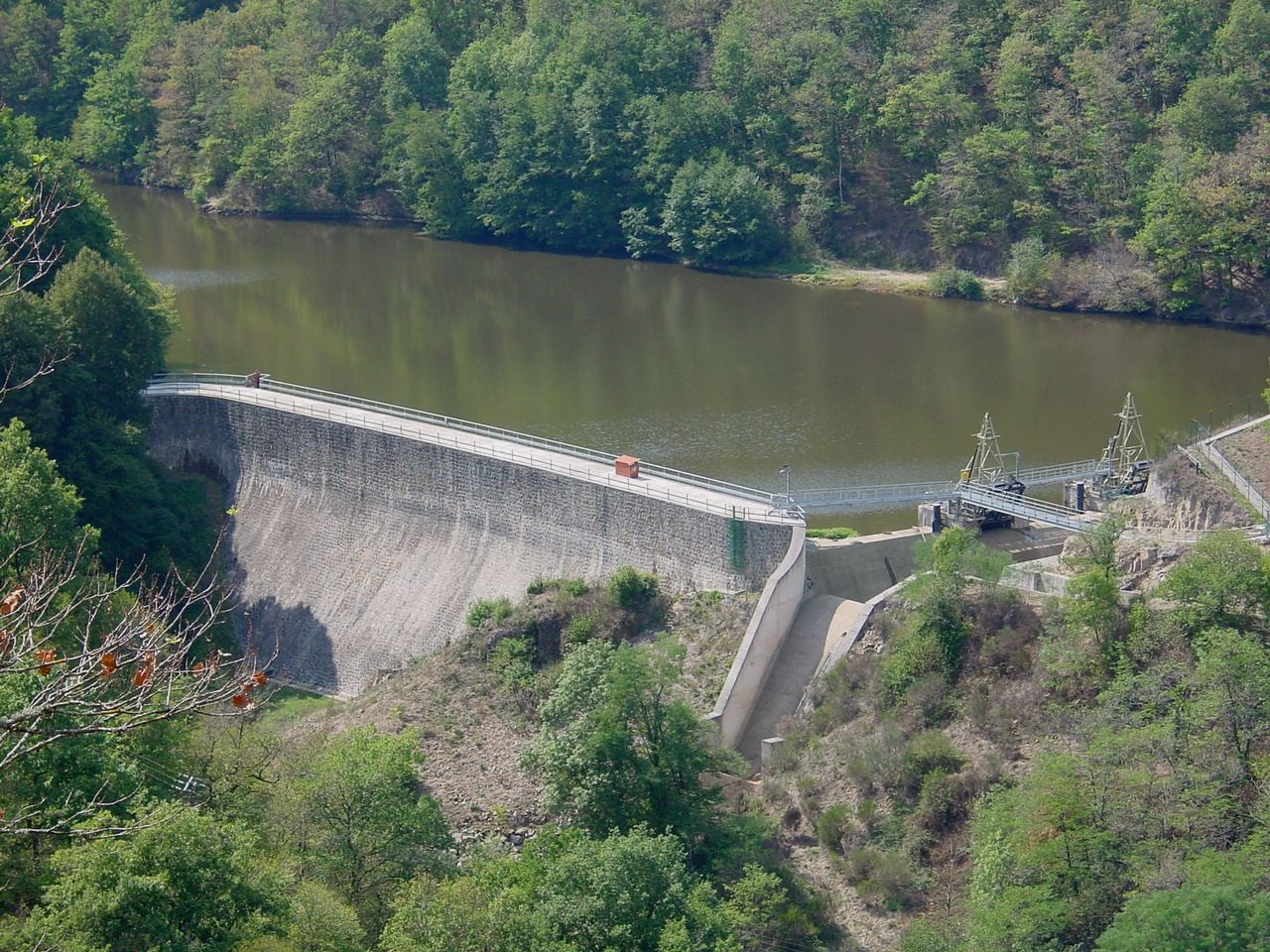
Barrage de Sauviat
Captured by Cedric Proust
Explore Nearby
Des Hautes-Chaumes au Livradois (circuit route n°8)
Discover this trail through the heart of Livradois-Forez.

Entre Comté et Pays d'Issoire (circuit route n°17)
Discover this trail through the heart of Livradois-Forez.

Le château de Mauzun (circuit route n°9)
Discover this trail through the heart of Livradois-Forez.