
Elevation Profile
618–812 m
Departure: From the church square in Auzelles. Go down to the left of the church, then take the first path on the right after the bridge, turn at a right angle after the last Auzelles house onto a good path which leads to the Pradier cross.
1. Upon entering the village, turn left and, 50 m further, turn right onto the D996. Follow it for 300 m, then take a path on the right between low walls. Arriving on a tarmac path, take it on the left then take a grassy path on the right (next to a large henhouse) until you reach the D996.
2. Cross the D996 and continue on a good path. At the first crossroads, continue straight through the woods to come out on the D112E. Take it on the left for approximately 250 m, then turn onto the first path on the left which leads to La Frissonnette.
3. Then turn right until you reach the road. Take it to the right and turn left onto a path which goes down to the D112E.
4. Turn left on this road for 200 m. In front of the Mahut, turn left onto a tarmac path towards Les Boissières (chemin des Puys). Leave it on the right at the 1st crossroads (chemin de la Prulhière), follow the tarmac for 800 m then take a grassy path on the left to the road to the village of La Pruhlière. The crossing to reach the middle of the village, pass to the left of the cross and go down opposite under the houses. Turn right to take a long grassy path. Take the next path on the left to the village of Besset Bas.
5. Continue opposite and turn right to take the D112 for 200m. Take a path on the right which goes down into the Miodet valley. Facing the stream, go up the path on the left and reach the hamlet of Chabanette.
6. At the exit of the hamlet, turn right and reach the Chabanette inn. At the crossroads, take the road on the left for 100 m. After the first house, follow the path which goes to the right above Miodet. At the small wooden bridge, go straight towards the road which goes up to the village. Take it to the right for 100 m, turn left onto Impasse du Boulanger then right to reach the church.
At a Glance
- Duration
- 3.3hrs
- Distance
- 10.9km
- Elevation +
- +296 m
- Elevation -
- -296 m
At a Glance
Live Weather
Departure / Arrival · Auzelles
Live conditions
—
Feels like
—
Wind / gusts
—
Visibility
—
Updated: —
Field notes and images
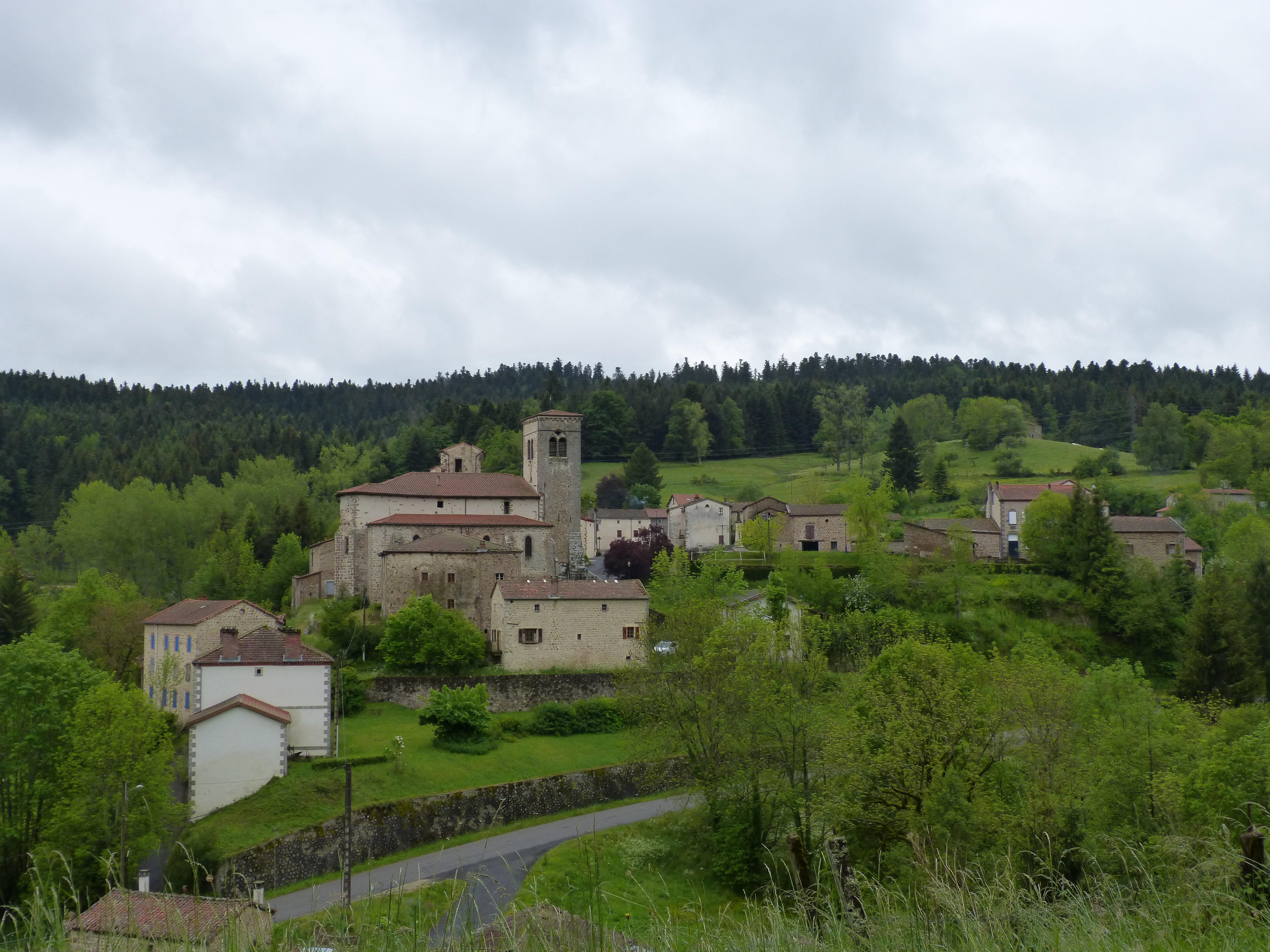
Bourg d'Auzelles
Captured by MDT
Explore Nearby

Dore Loop
The Livradois-Forez Regional Natural Park, a land of grassland and woodland, promises a memorable journey between valleys and ridges.

Circuit n°46 Le Val de Mende
Secteur Cunlhat
Circuit n°47 Tour de Cunlhat
Secteur Cunlhat