
Elevation Profile
388–522 m
Start: From the information panel in the car park, take Chemin des Mûres around the tennis court. At the first fork, climb to the right. At the junction (two-sided stone cross), continue straight ahead, ignoring the side tracks (views of Chauriat, Château de Bard and Petit Turluron). Continue straight ahead until you have passed an enclosed, tree-filled property (pine trees).
1. Immediately after the property, descend at right angles to the left. At the T-junction, continue to the left until you enter Chauriat. Continue straight ahead, pass Croix de Mission (Place Pasteur), cross Boulevard de la République and climb Rue des Banches to the town hall. Turn right onto Rue des Cuvages and immediately take Espace Antoine Rudel du Miral on the left to Place Lafayette (Maison Rudel [town hall], church, traditional buildings). Descend Rue du Commerce to the right. Cross Boulevard Marx Dormoy. Climb Rue des Plantades straight ahead, then its continuation, Chemin de Bard, to a stone cross.
2. After the cross, turn left and continue along a long contouring track (panorama from the Chaîne des Dômes to the Sancy) to a junction. Climb to the left towards Puy Benoît as far as a fork.
3. Continue climbing straight ahead. At the highest point of the track (view from Puy Saint-Romain to the Forez), begin a gentle contouring descent to the first junction overlooking Chauriat.
4. Turn right at right angles, then left to the road. Cross it and immediately take the track on the right. Continue straight ahead along the hillside. At the fork, continue to the right, still following the hillside. At the iron cross, climb to the left. Pass Ferme du Pileyre and continue to a junction with another PR walking route.
5. Continue level, including at the first vines (view from the Forez to Beauregard-l’Évêque). Before the descent towards Vertaizon, branch left onto the path leading to the summit of Puy de Pileyre (panorama over the surrounding puys and Pierre-sur-Haute, the highest point of the Forez (1634 m)). Then descend on a zigzagging path through the volcanic rock piles. On reaching a track, follow it to the left to a junction.
6. At the T-junction, continue climbing to the left, then after 50 m take a grassy track on the right (along the route, views from Chauriat to the Sancy). At the first junction, descend to the right as far as Chemin des Chausses. Follow it to the right and continue straight ahead along Chemin de Servignat. Descend the first track on the left to return to the starting point.
At a Glance
- Duration
- 3.0hrs
- Distance
- 9.7km
- Elevation +
- +249 m
- Elevation -
- -243 m
At a Glance
Live Weather
Departure / Arrival · Chauriat
Live conditions
—
Feels like
—
Wind / gusts
—
Visibility
—
Updated: —
Field notes and images

Vignes vers le puy de Pileyre
Captured by Maison du Tourisme
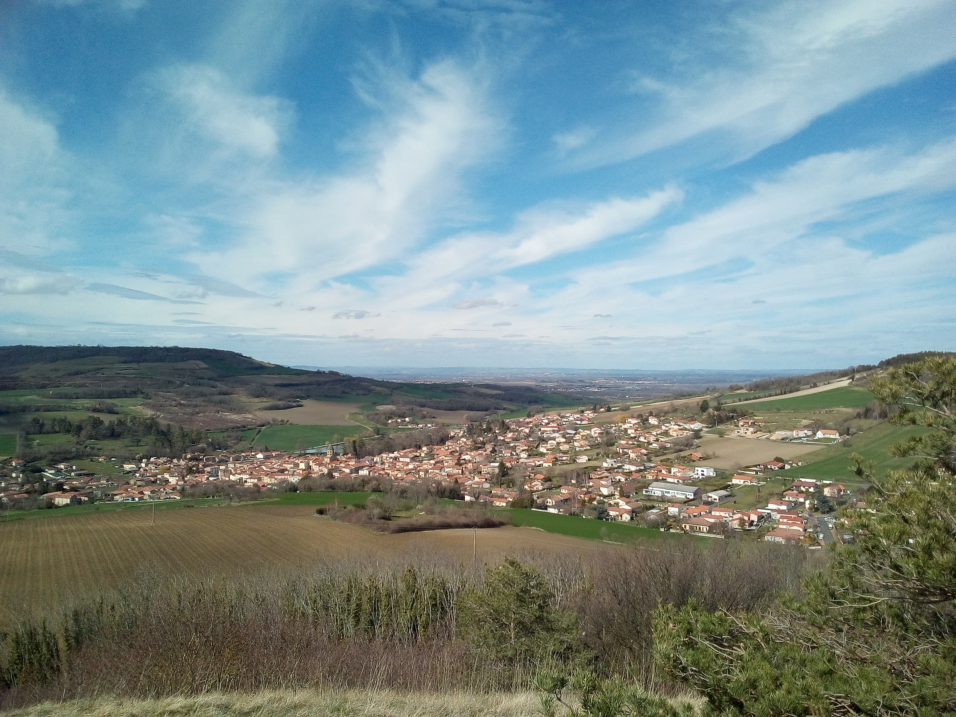
Vue sur Chauriat
Captured by Billom Communauté
Explore Nearby
Chauriat, a Petite Cité de Caractère
Chauriat, a village more than a thousand years old, welcomes you. Built around the churches of Sainte-Marie and Saint-Julien, the town was strongly shaped by the Middle Ages and has continued to grow around many hidden treasures.
Entre Dore et Allier (circuit route n°1)
Discover this trail through the heart of Livradois-Forez.
GR®89 Le Chemin de Montaigne
Discover this trail through the heart of Livradois-Forez.