
Elevation Profile
388–398 m
Départ : Du panneau de départ, boulevard de la République, remonter à droite jusqu’au carrefour. S’engouffrer dans le centre bourg par la rue du commerce à droite.
1. 40 m après, bifurquer à droite par la rue des remparts (panneau Le fort villageois). La suivre tout droit puis à droite pour déboucher sur le boulevard de la République. Partir à gauche, en passant devant la croix (panneau La grande enceinte et son fossé). Poursuivre sur 60 m.
2. Au niveau de la fontaine (panneau Les maisons vigneronnes), prendre à droite en direction de Mezel par la route de Saint-Bonnet. 50 m après, obliquer à gauche rue de Saint-Bonnet. Déboucher sur l’avenue de la République, suivre à gauche puis immédiatement à droite place des Caves.
3. Poursuivre à droite par la rue des Cuviers. Monter quelques escaliers avant de tourner à droite pour rejoindre la rue du commerce (panneau Ralph Stackpole). Tourner alors à droite puis à gauche rue de l’Abbaye (panneau L'église Sainte-Marie). Faire le tour de l’abbaye en montant à gauche par les escaliers pour déboucher sur la place de Lafayette (panneaux La halle aux blés métallique, L'église Saint-Julien).
4. Reprendre la rue du commerce à droite puis de nouveau à droite par la rue du cloitre. Prendre à gauche rue de la poste pour tomber sur la maison du peuple. Faire le tour par le parvis à droite (panneau La maison du peuple) et continuer à gauche par le boulevard Marx Dormoy puis boulevard de la République en face pour retrouver le point de départ.
At a Glance
- Duration
- 1.0hrs
- Distance
- 0.9km
- Elevation +
- +10 m
- Elevation -
- -4 m
At a Glance
Live Weather
Departure / Arrival · Chauriat
Live conditions
—
Feels like
—
Wind / gusts
—
Visibility
—
Updated: —
Important Advice
Follow the red signs.
Field notes and images
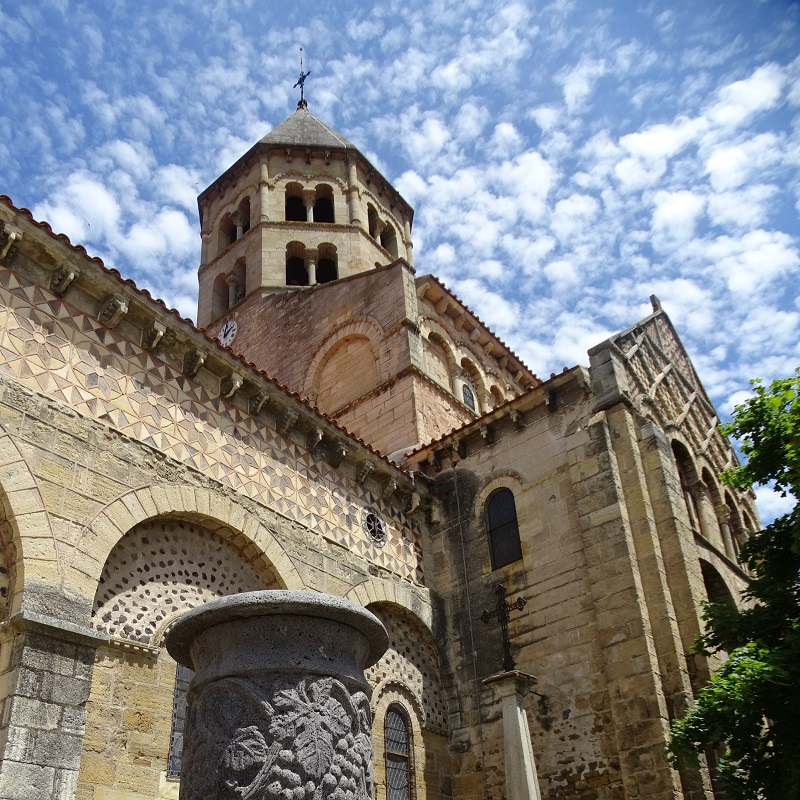
L'Église Saint-Julien
Captured by CC Billom Communauté
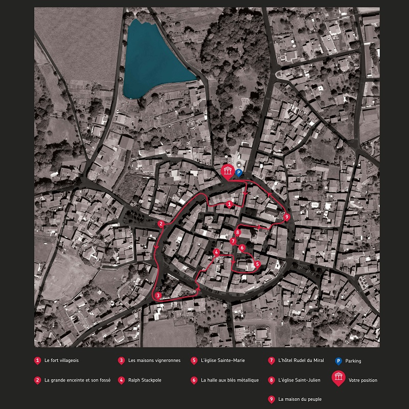
Panneau de départ
Captured by CC Billom Communauté
Explore Nearby
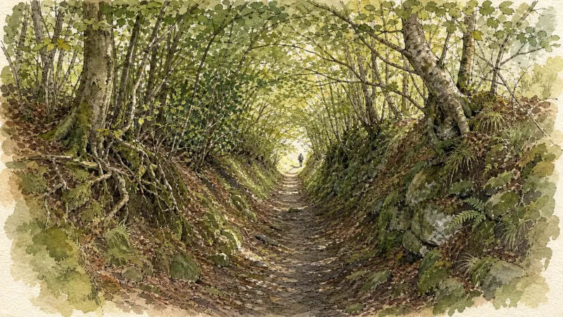
Puy de la Poule
Start: From the start information panel in the car park beside the sports ground on Chemin de la Côte, cross the road and take the track straight ahead. Fifty metres after the farm building, branch right and continue on the track (views of Cournon, the Sancy and Puy de Mur). At the fork, descend to the left. At the T-junction, turn left, then after 10m descend to the right. Follow the Allier on the left, then climb to the left to reach the surfaced track. Follow it to the right to a junction beneath the high-voltage line. 1 - Turn left (water catchment area on the right), continue and, on the bend (picnic area), go straight ahead. At the next junction, turn left into the woods, cross a stream and pass beneath two power lines. At the junction facing the village of Mezel, turn right, pass alongside a ruined building and continue to the road. Cross it and head towards Saint-Bonnet. Leave the road and, after the warehouses, descend to the right on a track. Continue to the road (dog training centre). 2 - Follow it to the left for 40 m, then take the track on the right and stay on this main track, keeping left at the next two junctions and heading towards Saint-Bonnet. Reach the road opposite the community hall, turn right, then left onto Rue de la Fontaine Madeleine, then right as far as Rue des Granges. Follow it to the right to the stop sign at the next junction, then take Rue du Château on the left to the church porch. 3 - Take the street that passes around the church to the left and above it. Pass a water tower and climb on a surfaced track to the château entrance. Take the track on the right opposite the entrance. Pass alongside the farm and, at the high point (view of the Chaîne des Dômes), continue to the fork and turn right. At the junction, turn right beneath the power line, then after 80m climb straight ahead to the left (view of the Forez) to a fork. Turn right across the plateau (ignore the descent that leads directly to Mezel) (view of the Livradois-Forez). Pass around a cirque and reach the road. 4 - Turn right, then after 40m climb the leftmost track (another yellow PR route is on the right). Descend to the left on the track, pass above the château and descend into Mezel (dovecote). Continue to Place de la Fontaine, turn right onto Rue de la Font-Grande, left onto Rue Marmondieu, then left before the château. One hundred metres further on, pass beneath the porch on the right, pass the church entrance, take the passage on the right and continue along the left side of the château (12th- and 16th-century château). Descend to the left along Rue Guyot Dessaigne, then left again at Place de l’Église; descend the small staircase just after the market hall, Passage des Buissonnières. Descend Rue de la Balalong to a mission cross (viewpoint). Turn left onto Rue Côte de Peine, then Rue Célestin Tourres. Turn right onto Chemin de la Côte to return to the starting point.
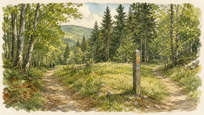
Puy de Pileyre
This 8.6 km loop starts and finishes at Chas, with 233 m of ascent and an estimated duration of 2 hr 30 min.

The Chauriat Hillsides
Start: From the information panel in the car park, take Chemin des Mûres around the tennis court. At the first fork, climb to the right. At the junction (two-sided stone cross), continue straight ahead, ignoring the side tracks (views of Chauriat, Château de Bard and Petit Turluron). Continue straight ahead until you have passed an enclosed, tree-filled property (pine trees). 1. Immediately after the property, descend at right angles to the left. At the T-junction, continue to the left until you enter Chauriat. Continue straight ahead, pass Croix de Mission (Place Pasteur), cross Boulevard de la République and climb Rue des Banches to the town hall. Turn right onto Rue des Cuvages and immediately take Espace Antoine Rudel du Miral on the left to Place Lafayette (Maison Rudel [town hall], church, traditional buildings). Descend Rue du Commerce to the right. Cross Boulevard Marx Dormoy. Climb Rue des Plantades straight ahead, then its continuation, Chemin de Bard, to a stone cross. 2. After the cross, turn left and continue along a long contouring track (panorama from the Chaîne des Dômes to the Sancy) to a junction. Climb to the left towards Puy Benoît as far as a fork. 3. Continue climbing straight ahead. At the highest point of the track (view from Puy Saint-Romain to the Forez), begin a gentle contouring descent to the first junction overlooking Chauriat. 4. Turn right at right angles, then left to the road. Cross it and immediately take the track on the right. Continue straight ahead along the hillside. At the fork, continue to the right, still following the hillside. At the iron cross, climb to the left. Pass Ferme du Pileyre and continue to a junction with another PR walking route. 5. Continue level, including at the first vines (view from the Forez to Beauregard-l’Évêque). Before the descent towards Vertaizon, branch left onto the path leading to the summit of Puy de Pileyre (panorama over the surrounding puys and Pierre-sur-Haute, the highest point of the Forez (1634 m)). Then descend on a zigzagging path through the volcanic rock piles. On reaching a track, follow it to the left to a junction. 6. At the T-junction, continue climbing to the left, then after 50 m take a grassy track on the right (along the route, views from Chauriat to the Sancy). At the first junction, descend to the right as far as Chemin des Chausses. Follow it to the right and continue straight ahead along Chemin de Servignat. Descend the first track on the left to return to the starting point.