
Elevation Profile
690–953 m
Departure: From the village of Viscomtat, at the intersection of the D42 and the D321 (parking on the esplanade, 50 m below the Post Office), take the D321, which goes up to the exit of the village in the direction of Sainte-Agathe.
1. Walk past the car garage then, just after it, take the tarmac path on the left towards La Barrière (view of the basin where the town of Viscomtat is located). At the top of the hill, take the grassy path opposite between the two roads to Chez Bertrand (remains of an old chestnut alley).
2. Walk past the isolated barn and continue on the path rising slightly to the right (viewpoint on the right over the Puy de Montoncel). At the next crossroads, turn onto the left path to reach Montférie.
3. In the center of the hamlet, continue on the dirt road opposite between the houses. Follow this path bordered by a small stream (ruins of a mill).
4. At the road, follow it to the left for a few meters and turn right into the woods. At the intersection, continue to go up to the right. Before arriving at Le Pertuis, at the forest track, take it on the left for more than 1 km (view of Viscomtat and the Puy de Montoncel), then go back down via the second small, barely visible path which goes down to the left to Ojardie.
5. In the hamlet, go down slightly to the left; pass in front of the wash house then follow the small road which goes down. Take the D42 on the right, then, leaving the village, take a path on the left. At the crow’s feet, continue on the path on the right until you reach the D42.
6. Just before joining the D42, take the small asphalt road which goes down slightly to the left to cross the village of Le Rabéré and go back up to the D42. Take it on the left. In the village of Mondière, take the second road on the left just after the wash house (no entry sign). In the town of Viscomtat, find the D42 which you take on the left to find the car park.At a Glance
- Duration
- 2.8hrs
- Distance
- 7.7km
- Elevation +
- +296 m
- Elevation -
- -298 m
At a Glance
Live Weather
Departure / Arrival · Viscomtat
Live conditions
—
Feels like
—
Wind / gusts
—
Visibility
—
Updated: —
Field notes and images
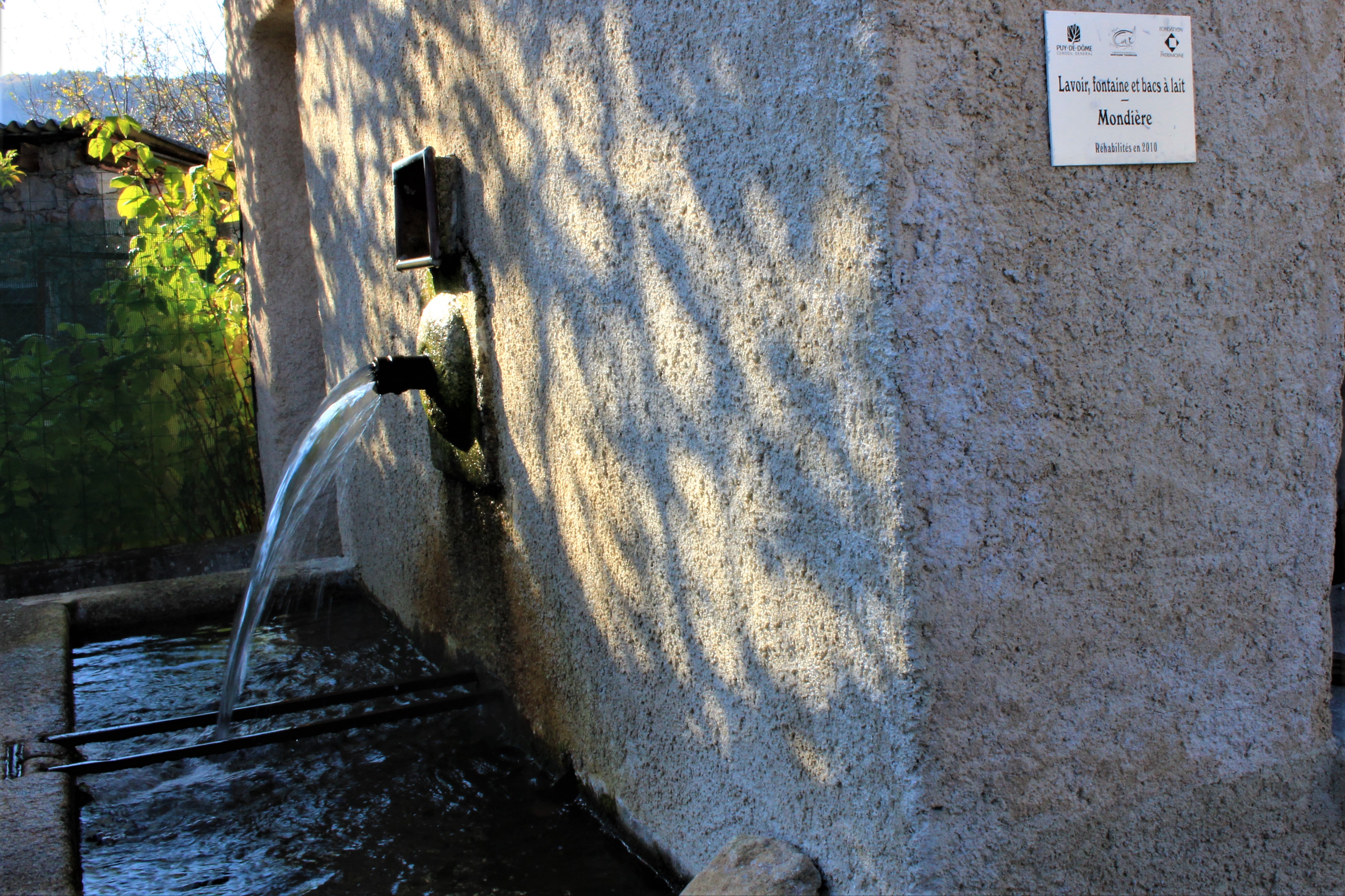
Fontaine à Mondière
Captured by Maison du Tourisme Sébastien Giraud
Explore Nearby
The Bridges Circuit
Start: From the church in La Renaudie. Descend the main road (D102), then continue straight ahead at the junction onto the D41 (towards Le Brugeron). Follow the D41 to the Croix de Ste Agathe. Take the road on the right towards Le Clef (view of the village of La Renaudie). At the entrance to the hamlet, just after a barn, take the stony track on the right; pass the renovated house and continue along the grassy track. Continue for approximately 800 m from Le Clef, then turn sharply right to cross the Rioubet stream. Climb the same track to La Chossonie. 1. Just after the first house, leave the road for the track descending slightly to the left. At the fork, continue right (view of the Chaîne des Puys). At the entrance to La Vialle, immediately climb to the right. At the top of the village, cross the D41 and take the track opposite between 2 low walls. On the climb, leave the track and turn left (view of the Sancy massif and the Chaîne des Puys). Continue straight ahead, then turn left near the cross. 2. On reaching the hamlet of Thérias (on a bend), follow the road to the left for 50 m, then turn right towards Les Gouttes at the junction. 20 m farther on, at the cross, leave the road and take the track on the left. At the junction, take the small road opposite (towards La Chaugne). 15 m farther on, leave this road for the track on the right. Cross the stream and continue straight ahead. Pass alongside a hamlet (Les Champs-Elysées) and, at the junction, continue on the same track opposite to Le Garret. 3. In the village, climb the small road opposite to reach the D41. Cross it and take the track opposite. At the fork, continue straight ahead. In the hamlet of Le Cheix, go around the house and continue through the forest to the ruins of the village of Vironesse. 4. At the ruins, continue along the main track for approximately 250 m, then turn onto the first track on the right. Remain on the same track to the Pale stream. Follow the stream on its left-hand side (the track is very wet in places) to reach the D 317. 5. Follow it to the right for 500 m. On reaching the hamlet of La Goutte, take the D 102 to the right (towards La Renaudie). 150 m farther on, on the bend, turn left and follow the right-hand edge of the field. At the junction, take the track on the right. Follow this climbing track for 1.5 km, then turn left at a crossroads of 4 tracks. Remain on the main track until you reach a road. 6. Follow the road to the right for 200 m, then turn right. Beside a ruin, continue straight ahead; follow the Couzon stream. Ignore the forest track branching right and remain on the same track to a ford. 7. Just before the ford, take the track bearing right. Follow the road to the left, then take the first track on the left. At the fork, continue straight ahead. At the junction of several tracks, turn left and then immediately right. Follow the same track to a road. 8. Follow it to the left, then turn left at the next junction. 150 m farther on, turn left again and cross the fields. On reaching the D 101 at the entrance to the village of La Chambonie, beside the cemetery, turn right for 5 m and then immediately take the road on the right. Follow it for 500 m. 9. Beside a small wrought-iron cross, just before an isolated house, turn right and climb through the woods. At the top of the hill, take the clearest track on the right. On leaving the woods, turn sharply left. 10. Follow the road to the right. Cross the hamlet of Le Verdier and remain on the same road. Follow the D 41 to the right. At the large junction, leave the D 41 and take the D102 to the right (towards La Renaudie). Enter the village and return to the church.
Des Margerides au Grun de Chignore (circuit route n°7)
Discover this trail through the heart of Livradois-Forez.
Du col de la Loge au col du Béal (circuit route n°6)
Discover this trail through the heart of Livradois-Forez.