
Elevation Profile
296–409 m
Departure: In Ste-Marguerite, at the EDF transformer station, take the small road towards the banks of the Dore which runs alongside two ponds. At the crossroads, take the path on the left.
1 At the next intersection, turn right, leaving Mayoux on the left, then take the path on the left 10 m further, at the crow's feet. Cross the Minat stream and continue on the same path. At the crow's feet, take the path which goes slightly to the right. Continue on this path, leaving the path which goes left towards the hamlet Chez Mary.
2 At the crossroads, keep the main path (leave the path on the left then the one on the right, viewpoint: Monts du Forez and Pierre-sur-Haute). At the fork (viewpoint: castle and town of Vollore-ville, Grün de Chignore), continue straight on along the banks of the Dore. Then at the intersection, head straight ahead to the hamlet of Olme on the tarmac path.
3 At the junction with the D319, take the road opposite towards the hamlet of Boérias. In the hamlet of Boérias, keep the main road on the left without entering the hamlet (adobe houses and barns).
4 After the last houses of the hamlet of Farradias, take the path furthest to the left. In the hamlet of Pomparias, at the first house, take the first path on the right; then at the intersection take the road on the left (ignore the road on the right towards Fouilhoux and the one on the left), continue straight on.
5 50 m further, take the road on the right towards Busset. After 250 m, follow the road on the left to enter the hamlet of Busset (viewpoint: Chaîne des Puys). Cross Busset (panorama: Puys chain, Forez mountains, Grün de Chignore, Vollore-Ville castle, Maubec fortified house) and leave the hamlet, always keeping the same road. 200 m further, at the intersection take the road on the right, continue for 50 m on this road then take the first track on the left (viewpoint: Chaîne des Puys).
6,800 m further on, leave the track to take the path on the right lined with oak trees (vines). Arriving at the D320, take it on the right towards the hamlet of Giliberts and take the first road on the left (just after the two adobe houses), go down into the hamlet via the small road then, at the crow's feet, turn right to follow the path which leaves the hamlet of Giliberts. Continue on the main path (ignore the paths on the right). At the crossroads, continue on the path slightly to the left. At the road take the grassy path opposite.
7 At the intersection turn left, cross the hamlet of La Fontaine (leave the path on the left), continue straight towards the hamlet of Coutural. Cross the hamlet of Coutural taking the main road (viewpoint: Hauts de Thiers).
8 At the stop sign, turn left towards Crohat. At the fork, leave the road which goes to Crohat, continue towards the water tower opposite. At the water tower, leave the main road (leave a tarmac path going down to the right), and take the grassy path on the right alongside the water tower. At the crossroads, take the path on the left. At the D319 (ste-Marguerite road crossroads, classified as a historic monument) turn right to reach the car park.
At a Glance
- Duration
- 3.0hrs
- Distance
- 13.4km
- Elevation +
- +207 m
- Elevation -
- -204 m
At a Glance
Live Weather
Departure / Arrival · Sainte-Marguerite (Escoutoux)
Live conditions
—
Feels like
—
Wind / gusts
—
Visibility
—
Updated: —
Field notes and images
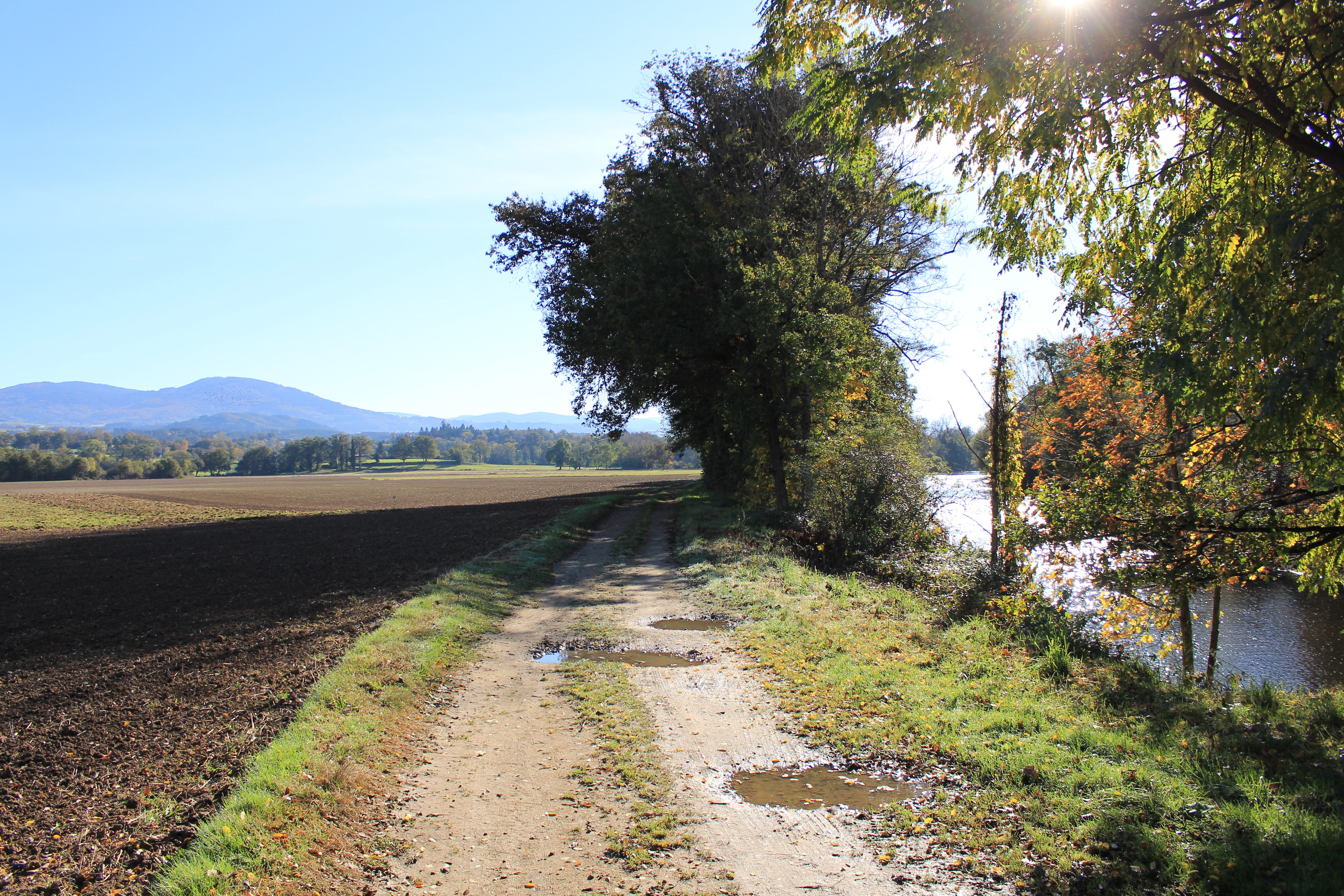
Chemin longeant la Dore
Captured by Maison du Tourisme Sébastien Giraud
Explore Nearby

Quatre Vents Challenge (Road Circuit No. 14)
One of the shortest circuits designed as a loop from the national cycle-touring centre, this route uses many quiet minor roads. Follow the directions carefully to avoid losing the route. Take particular care on the road after Néronde, especially when turning left off the D906.
Cité Thiernoise (circuit n°49)
Discover this trail through the heart of Livradois-Forez.
Découverte des villages
Départ : A la sortie du parking, prendre à droite l’allée du stade. En haut de la côte, à l’intersection, monter à gauche jusqu’au lieu-dit Le Calvaire (croix et table d’orientation, point de vue : Roc du Guet, Pierre Pamole, Pierre-sur-Haute, Grün de Chignore, monts du Livradois, monts du Cantal dans le lointain, chaîne des Puys, massif du Sancy, Clermont-Ferrand, au premier plan, bourg de St-Rémy). Emprunter le chemin à droite derrière les croix (bois de bouleau). A la route goudronnée, l’emprunter à droite. Au carrefour (croix de Mission dite «croix Rouge»), continuer tout droit. A la patte d’oie, rester sur le chemin montant à droite. 1 - Au croisement avec une route goudronnée, monter le sentier en face. Garder le chemin décrivant une courbe à droite puis à gauche. Au croisement, à la croix en fer forgé, continuer tout droit. A l’intersection suivante, emprunter la route goudronnée à gauche. Traverser le hameau de Barnerias (deux fontaines, ignorer les chemins partant à droite et à gauche). 200 m après le village, dans le virage, à la patte d’oie, emprunter le sentier qui monte à gauche. Au carrefour suivant (bois de chênes), prendre à gauche. Continuer en face sur le chemin qui redescend. Au carrefour suivant, tourner sur le chemin carrossable à droite. 2 - Au carrefour en bas de la descente, tourner à droite (point de vue : plaine de la Limagne, Clermont-Ferrand, le Puy de Dôme, le Sancy, le massif du Cantal, les butes volcaniques de la Comté). A la patte d’oie suivante, laisser le chemin qui descend et prendre celui le plus à droite, ignorer la sente qui part à droite. Traverser la route pour entrer dans le village de Chabrol (dans le village : bâtiments avec linteaux et jambages en granit blanc), descendre dans le village. A la maison au toit à quatre pans, descendre à droite de celle-ci. A 200 m après le hameau, au carrefour, tourner à gauche (point de vue : monts du Livradois). Passer à côté de la maison isolée du Cheix. 200m après Le Cheix, à la patte d’oie, quitter le chemin principal et descendre sur le chemin à droite. 3 - Au carrefour, laisser le chemin partant à droite et continuer toujours tout droit sur la piste principale (point de vue : massif du Sancy, Clermont- Ferrand, chaîne des Puys). A l’entrée du village de Morel suivre la route à droite (point de vue : monts de Forez, chaîne des Puys, massif du Sancy, massif du Livradois). Au carrefour, prendre la route à gauche en direction du hameau de Prudent, continuer tout droit (ignorer la route à droite). Au carrefour suivant, monter à gauche pour entrer de nouveau dans Morel (habitat traditionnel en granit). A la sortie du hameau de Morel, continuer sur la route tout droit (point de vue : Pierre Pamole, Grün de Chignore, Roc Blanc, rocher du Calvaire au-dessus du village de St-Rémy). 4 - Arrivée à la D325, la traverser et emprunter le chemin bordé de chênes. Au carrefour suivant, prendre à droite puis 50 m plus loin, à la patte d’oie, continuer sur le chemin à droite. Au croisement, prendre la route à gauche. Au carrefour, continuer tout droit. Au deuxième carrefour, à la croix, tourner à droite direction Thiers sur la D201 (passer au-dessus de l’autoroute). Après le pont, prendre à gauche. 50 m plus loin, ignorer le chemin qui monte à droite et emprunter le chemin qui longe l’autoroute, garder le chemin (laisser celui qui part à droite). Passer sous l’autoroute par un tunnel à gauche. Au bout du chemin, prendre à droite par un chemin très raide puis à la route l’emprunter à gauche. Emprunter une sente herbeuse à droite. A la route, prendre à droite, puis à gauche pour retrouve