
Elevation Profile
523–556 m
Departure: From Esplanade Robert Lacroix. Pass in front of the station, continue passing in front of the bust of Alexandre Vialatte and follow avenue de la gare. Turn left, cross the railway (Agrivap tourist train) and follow Avenue de la Dore. Cross the Dore.
1. Cross the D906 at the pedestrian crossing, pass in front of la Piéta,climb the path passing behind the Volvic stone mission cross,continue the climb to the right, enter into the Bois de Boulogne. Join a track and take it to the right. Pass in front of the old water tank intended for locomotives. After 200 m, the path winds uphill. Pass in front of an orientation table, continue climbing. At the top, continue on the main path (view of Ambert and the summits). After 400 m, at the crossroads, continue opposite, steep descent. At the crossroads of 6 paths, turn on the second path on the left to find D906.
2. Cross it (be careful, fast traffic) and take a grassy path opposite it going down towards the Dore. Then turn right and follow the river. Continue to the footbridge and cross the Dore. Take the path on the right which follows this stream. Cross the railway line and the Robert Lacroix esplanade, continue opposite via rue Pierre de Nolhac. Cross avenue Emmanuel Chabrier, follow it to the right for 100 m and turn left into rue du petit Cheix which runs along the stream.
3. Follow the marked path of the Poule Rouge on the right, ending on the left on Avenue du Docteur Chassaing (possibility of going back and forth on the path of the Donkey Blue on the right). Follow it to n°2. Turn left and follow the buildings until you reach the gate in front of the chapel of Notre-Dame de Layre. Pass in front of the entrance to the Convent of the 4 Dominicans. Cross rue du midi. Pass in front of theLycée Blaise Pascal. Head opposite to the Public Finance center. Leave it on the left and follow rue Blaise Pascal. Pass in front of theMaison des Jeunes, the Henri Pourrat school group. Take left to enter Place Charles de Gaulle. Cross it, passing in front of the kiosk. Continue passing in front of the lava fountain of Volvic (on the other side of avenue de Lyon, place du Livradois, monument in memory of Henri Pourrat). Turn left, cross rue Michel de l’Hospital. Follow Boulevard Henri IV, pass in front of the entrance to thepublic garden.
4. Cross the boulevard in front of the town hall annex, leave the round town hallon your right, pass in front of the Tourist Office, reach the Place du Pontel. Cross it, turn left into rue de la Fileterie then turn right into rue du Château. Leave it on the right for rue des Chazeaux, pass in front of la maison de la Fourme, place du Chateletand leave the square to join rue du Château. At the bottom of the street, cross Place des Minimes, turn right, head towards Place Saint-Jean, pass in front of the church. Cross Boulevard Sully and take Avenue Foch. Return to avenue de la gare, take it on the left and reach the car park.At a Glance
- Duration
- 1.5hrs
- Distance
- 5.1km
- Elevation +
- +59 m
- Elevation -
- -59 m
At a Glance
Live Weather
Departure / Arrival · Ambert
Live conditions
—
Feels like
—
Wind / gusts
—
Visibility
—
Updated: —
Field notes and images
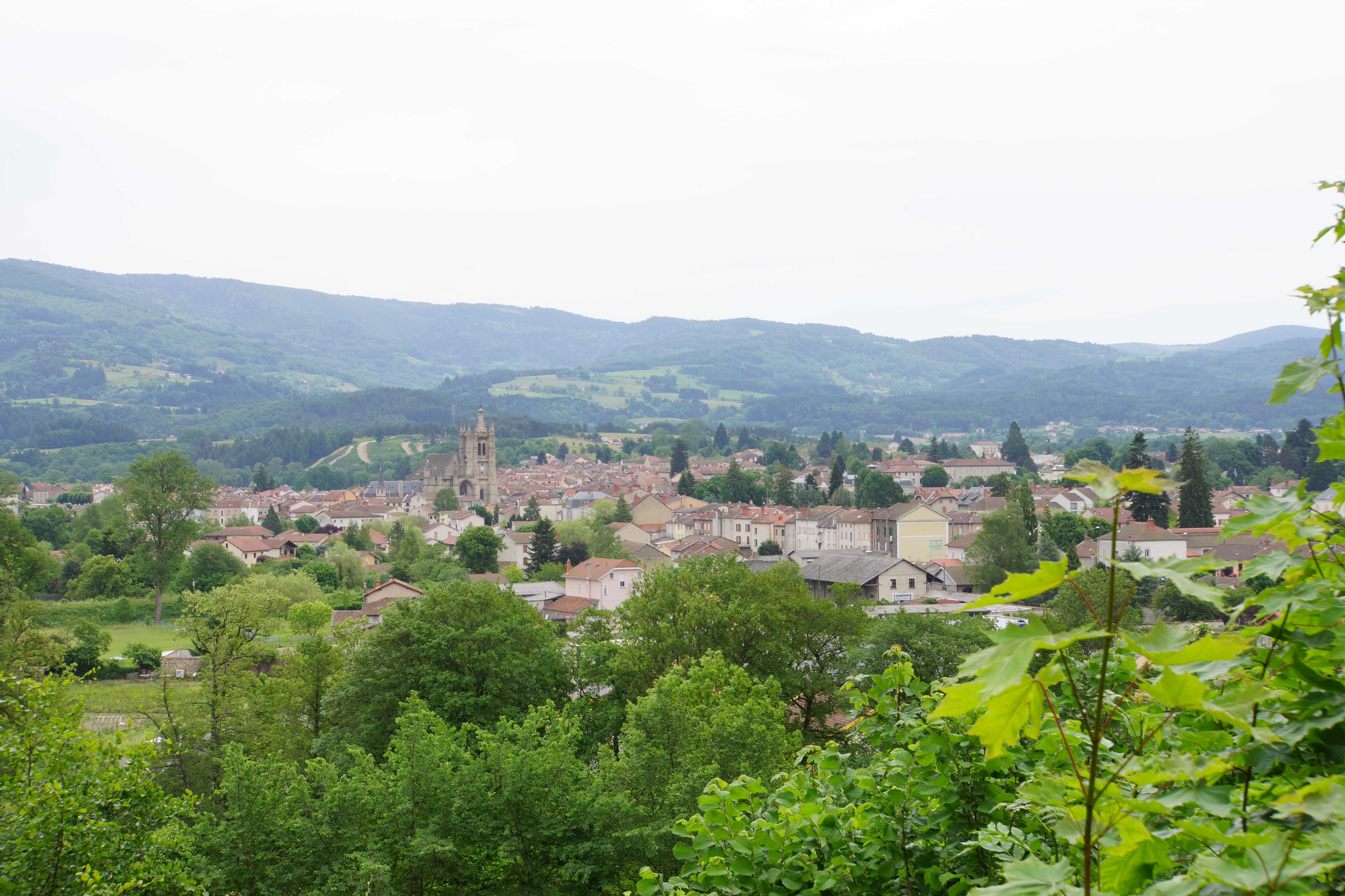
Vue sur Ambert
Captured by Maison du Tourisme Sébastien Giraud
Explore Nearby
Forez circuit - Discover local skills and crafts (loop no. 6)
This circuit invites you to discover the skills and crafts of the Livradois through the themes of water and nature.
Circuit enduro n°1 Myrstihl
Discover this trail through the heart of Livradois-Forez.
Circuit enduro n°2 Fougeair
Discover this trail through the heart of Livradois-Forez.