
Elevation Profile
574–767 m
From the church square (information panel for the Sentier des Piqueurs: traders, sham beggars and bourgeois houses). With your back to the church, follow the street straight ahead and, 20 m further on, descend the street on the right just before the bakery. At the end of the surfaced section, continue descending straight ahead on the grassy track (view of Puy de Courdeloup). At the road, continue to the right. At the bottom, by a house, follow the road to the right. At the fork, turn right to the D 7.
(1) Cross it and take the track opposite between two fences. At the junction, turn left. At the fork, continue to the left. A few metres further on, climb to the right (views of the village of Saint-Jean-des-Ollières, Puy de Courdeloup to the left and Château de Mauzun to the right). At the junction, descend to the left (view of the Monts du Livradois slightly to the left).
(2) At the entrance to Le Mas du Bost (fine buildings), turn left. By the cross, descend to the left and, 70 m further on, turn right. Continue to the D 7. Follow it to the right for a few metres, then take the road climbing to the left. 100 m before the quarry entrance gate, take the path on the right into the woods. At the junction, continue to the right.
(3) At the road, turn left and continue to Pailler (views of the Massif du Sancy, Cézallier, the Monts du Cantal and the Monts du Livradois). On leaving the hamlet, plunge down a track on the left. At the fork, continue descending to the left. Cross the stream and climb back up on the same track. Pass alongside the houses of Montrouy and turn left onto the road.
(4) At Le Couderchet, stay on the main road (bread oven). 20 m before the wrought-iron cross, branch onto the track climbing to the left. At the fork, continue to the right as far as La Garde. Turn left onto a good track.
(5) In the next village, turn left to reach the orientation table at Pic de la Garde (10-minute return trip) (panoramic view); at the reservoir, continue to the left. Retrace your steps, then descend to the left between two ruins. At the D 253, turn left. At the Saint-Jean-des-Ollières village sign, follow a path on the left bordered by low walls. At the wash house, turn right to climb into the village. At the school, turn left to return to the church.
At a Glance
- Duration
- 4.0hrs
- Distance
- 12.3km
- Elevation +
- +355 m
- Elevation -
- -353 m
At a Glance
Live Weather
Departure / Arrival · Place de l'église, Saint-Jean-des-Ollières
Live conditions
—
Feels like
—
Wind / gusts
—
Visibility
—
Updated: —
Field notes and images
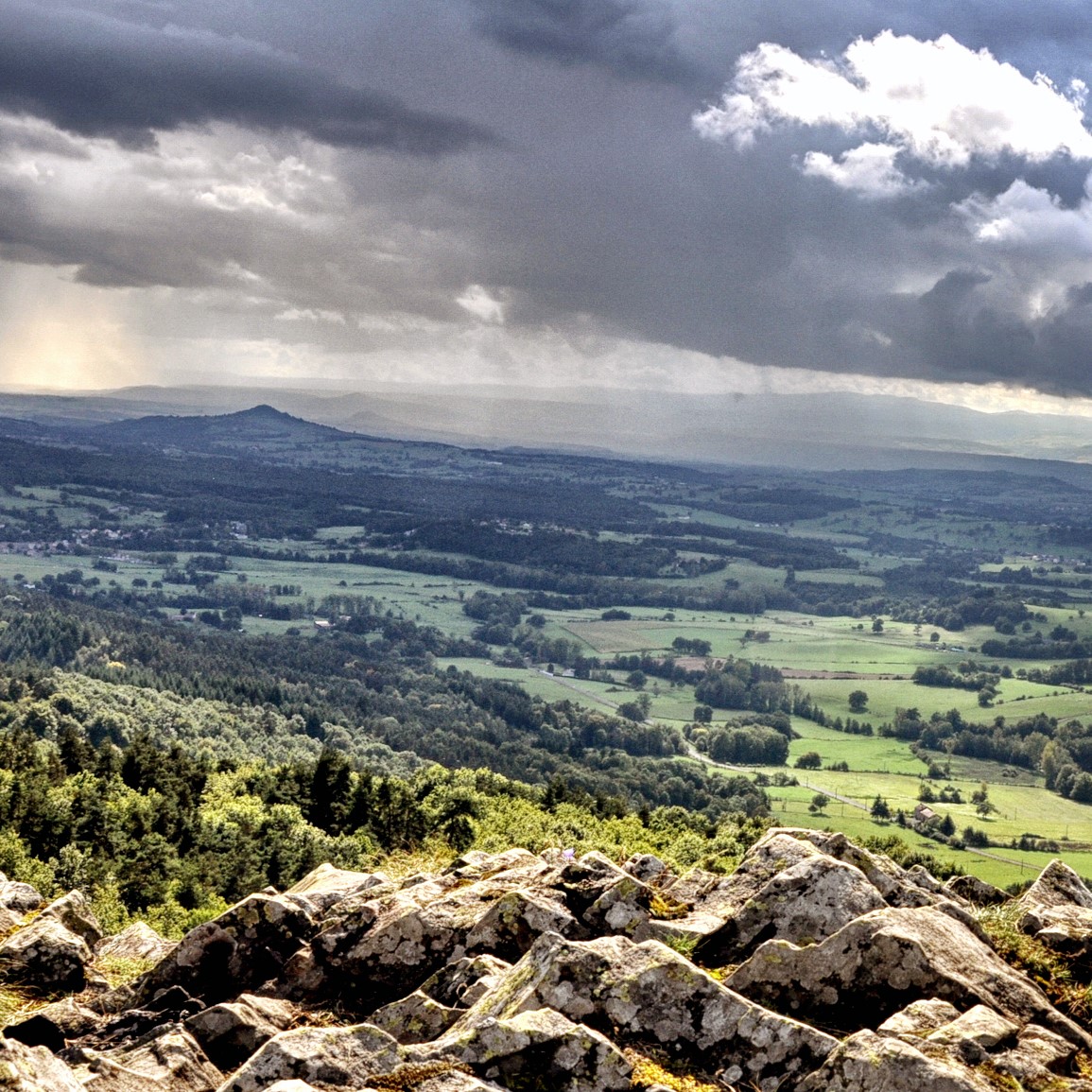
Panorama depuis le Pic de la Garde
Captured by Daniel Debost
Explore Nearby
Livradois Circuit — The Châteaux of Livradois (Loop No. 4)
This circuit offers a journey through time, from the Gallo-Roman period to the age of knights.

Weekend Circuit: Égliseneuve-près-Billom–Saint-Jean-des-Ollières
Explore this weekend circuit through the Madet valley, past Château de Mauzun and above Étang des Maures, with fine views of the Chaîne des Puys, the Monts Dore and the Forez mountains.
From Les Ribes to the Miodet
The fine fortified church of Saint-Dier, granite villages with immaculate coudercs, and the lively Miodet, once lined with mills, are the highlights of this walk through livestock-farming country.