
Elevation Profile
858–1005 m
Departure: From the church, go up the main street on the left towards the castle. Turn left into a street then immediately right into the alley which becomes a path (viewpoint on the left over the Château de Viverols). Find the road again and follow it to the right until you reach the D205.
1. At Maisons-Neuves, take the D205 on the left for
30 m, then turn left again on a descending path. Turn left onto the road, then right onto the path. At the fork, stay left. Go along then cross
the Ligonne stream to Gorce and cross the village.
2. At the exit, take the left path. At the intersection,
turn left onto the forest road. At the bend, turn right onto a path that rises into the woods. At the next fork, go back down to the right along a stony path until you reach a road.
3. Turn left onto the D111. After 50 m, abandon it
for a wide path on the left. At the intersection, turn left onto the path which again joins the D111 and Étruchat.
4. Cross the hamlet then at the exit, turn left at the cross. Cross the Ligonne by the bridge to return to the church square via the alleys of Viverols (medieval historic center, the Stone Bridge, house of the bell founder).
At a Glance
- Duration
- 2.0hrs
- Distance
- 7.0km
- Elevation +
- +184 m
- Elevation -
- -185 m
At a Glance
Live Weather
Departure / Arrival · Eglise de Viverols
Live conditions
—
Feels like
—
Wind / gusts
—
Visibility
—
Updated: —
Field notes and images
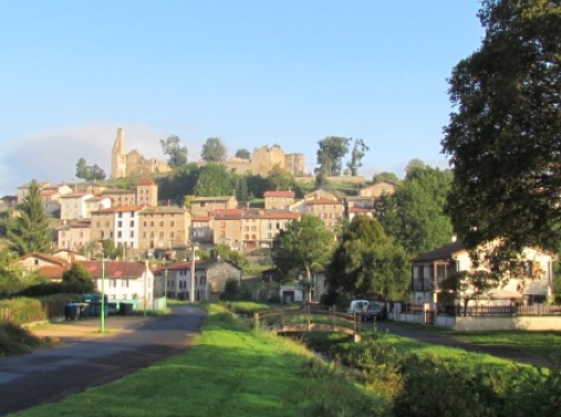
Viverols
Captured by CC ALF
Explore Nearby

Dore Loop
The Livradois-Forez Regional Natural Park, a land of grassland and woodland, promises a memorable journey between valleys and ridges.
Circuit n°10 Cols du Dansadoux et de Pramort
Discover this trail through the heart of Livradois-Forez.
Circuit n°11 Les Orgues de Montpeloux
Discover this trail through the heart of Livradois-Forez.