
Elevation Profile
313–318 m
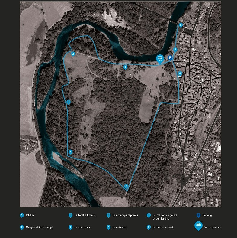
Départ : Du panneau de départ au bord de l’Allier, suivre les berges en vous éloignant du bourg (panneau L'Allier). Dépasser le château d’eau en ignorant le chemin de gauche. 200 m après, délaisser le chemin principal pour un sentier qui rentre dans la ripisylve à droite. Il ressort, par une boucle dans la ripisylve, un peu plus loin sur le chemin principal (panneau Manger et être mangé).
1. Virer alors à droite et poursuivre sur le chemin qui devient sentier en longeant une clôture et l’Allier. Ignorer un peu plus loin le sentier de gauche et s’engouffrer à nouveau dans la ripisylve. Continuer sur 450 m avant de retrouver les bords d’Allier (panneaux La forêt alluviale et Les poissons).
2. Continuer à gauche en serpentant. Le sentier s’éloigne du bord avant de bifurquer à droite et de revenir près de l’Allier. Poursuivre sur 300 m jusqu’à rejoindre une piste (panneau Les champs captants).
3. Obliquer à gauche sur la piste. Elle tire droit sur 450 m jusqu’au stade. Peu avant la fin du stade, prendre à droite pour rejoindre Dallet.
4. Virer à gauche au Quai de l’Allier et continuer jusqu’au pont en passant devant le parking. (panneaux Les oiseaux, La maison en galets et son jardinet, Le bac et le pont).
5. Retourner sur vos pas avant de reprendre à droite au parking jusqu’au point de départ.
At a Glance
- Duration
- 1.0hrs
- Distance
- 2.9km
- Elevation +
- +4 m
- Elevation -
- -5 m
At a Glance
Live Weather
Departure / Arrival · Dallet
Live conditions
—
Feels like
—
Wind / gusts
—
Visibility
—
Updated: —
Important Advice
Follow the blue signs.
Field notes and images
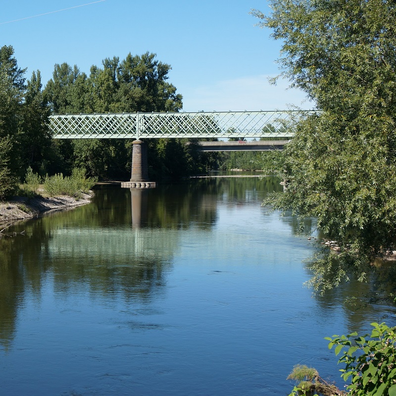
Pont vert de Dallet
Captured by Denis Cibien
Panneau de départ
Captured by CC Billom Communauté
Explore Nearby

From the Allier to Puy de Mur
This 5.7 km loop starts and finishes at Dallet, with 187 m of ascent and an estimated duration of 1 hr 45 min.
The Puy de Mur tour
Departure: from the departure sign (Fontaine-lavoir), go left towards the village via rue de la Croix de Laire Basse then rue des Noyeraies. Take successively rue de la Paix, rue Marchidial, the stairs and rue de l'Ancienne Église. At the fork, go up to the left to reach the top of the mound (Chapelle) and the orientation table (view of the Chaîne des puys and Limagne). Cross the park, and go down the grassy path. Take rue de la Croix de Laire Haute on the right for 200 meters and turn right onto the first path to join the road (rue Chatel Vieux). 1. Go left for 50 meters then turn right onto the first path. Continue straight on until the road. Cross it, go straight on, then at the crossroads. At the end of the woods, leave the path on the left and continue (view of Limagne and Pont du Château) on this wide path for approximately 2 km until you reach a road. Take it on the left for 100 meters and take the path on the right (view of Sancy and the Chaîne des Puys) up to the first house. 2. Go up left; at the next intersection continue straight ahead. Rejoin the road, take it to the right for 100 meters and turn right onto a path (water reservoir). Follow it along the balcony and go up to the return point at the T-intersection. Turn left and left again into the clearing. Reach the top of Puy de Mur by a path on the left, which continues with stairs then with a second staircase on the right. (360° panoramic view). 3. Go back down 300m by the same path; At the end of the round trip, continue opposite towards Mezel, leaving the path on the right. At the first houses, take Chemin du Trat then opposite Rue du Chemin de Ronde; At its end, turn left onto rue Guyot Dessaigne. At the cross (view of the Val d'Allier, the Sancy and the Chaîne des Puys) go up this street on the left towards the top of the village (on the right, church and castle (12th – 16th century) up to rue Marmondieu. (On the left, at the corner of the car park, Departure from Mezel sign). 4. Follow this street and turn right onto rue de Font-Grande. Just before the roundabout, go left and immediately right. At the dovecote, at the fork, turn right. Continue on this path, go down towards the road and, just before it, turn left. At the intersection go down right. At the road, go right to reach the starting point.

Via Allier (V70), from Vichy to Langeac
The route follows the Allier for 455 km, from its confluence with the Loire near Nevers to Langogne in Lozère, close to its source. Auvergne’s cycle route begins near the celebrated Bec d’Allier, where the Allier meets the Loire and Via Allier meets the Loire à Vélo. It follows the river southwards through countless treasures to the upper Allier gorges, near the source hidden in the Cévennes mountains.