
Elevation Profile
653–935 m
From the car park, take the path that goes down then pass under the railway line and go down to the road. Turn right, then after the last house of Merle, follow the track on the right for 300 m.
(1) Take the first path on the left going up steeply. Take the path on the left on the hillside for a good kilometer. At the road, turn right, cross Compains.
(2) At the exit of Compains, follow the path on the left after the agricultural buildings. Always continue on the same path. At the road, turn left and join la Marcherie. Cross the hamlet and continue until the D 201 (view of the Arlanc plain and the Monts du Forez).
(3) Cross the D 201 and take the path which goes down on the left(view of Mayres, the Arlanc plain and the Monts du Forez). In Mas Marchet, follow the D 201 on the right and cross the hamlet. At the last house, before a right turn, go down the tarmac path on the left which quickly becomes a grassy path. At the crow's foot, continue right until the D 906a.
(4) Turn left for 10 m, cross the road then take the path immediately to the right. Cross the street, then follow the forest track slightly to your left(view of the Monts du Forez). At the road, continue opposite to enter Cubelles. Cross the hamlet and always keep the same road.
(5) 150 m further, turn left to enter Les Combaux. At the entrance to the hamlet, follow the path on the left. At the crow's feet, stay on your right. At the intersection towards the first ruins of Gardaillat, take the path going down on the left to La Dore. Take theVarre Bridgeand go up this path to the Procureur.
(6) Cross the D 38 and the railway line and, 30 m further, go up opposite towards Besset (view of the Arlanc plain and the Monts du Forez). In Besset, continue opposite on the same road.
(7) At the D 38, continue slightly to the right and, 250 m further, follow the path on the right alongside a plantation. Cross the pine wood, then rejoin the D 38. Take the path opposite for 100 m, then go down left along the field to reach the chapel.
At a Glance
- Duration
- 3.3hrs
- Distance
- 10.5km
- Elevation +
- +418 m
- Elevation -
- -403 m
At a Glance
Live Weather
Departure / Arrival · Chapelle Notre-Dame de la Roche, Mayres
Live conditions
—
Feels like
—
Wind / gusts
—
Visibility
—
Updated: —
Field notes and images
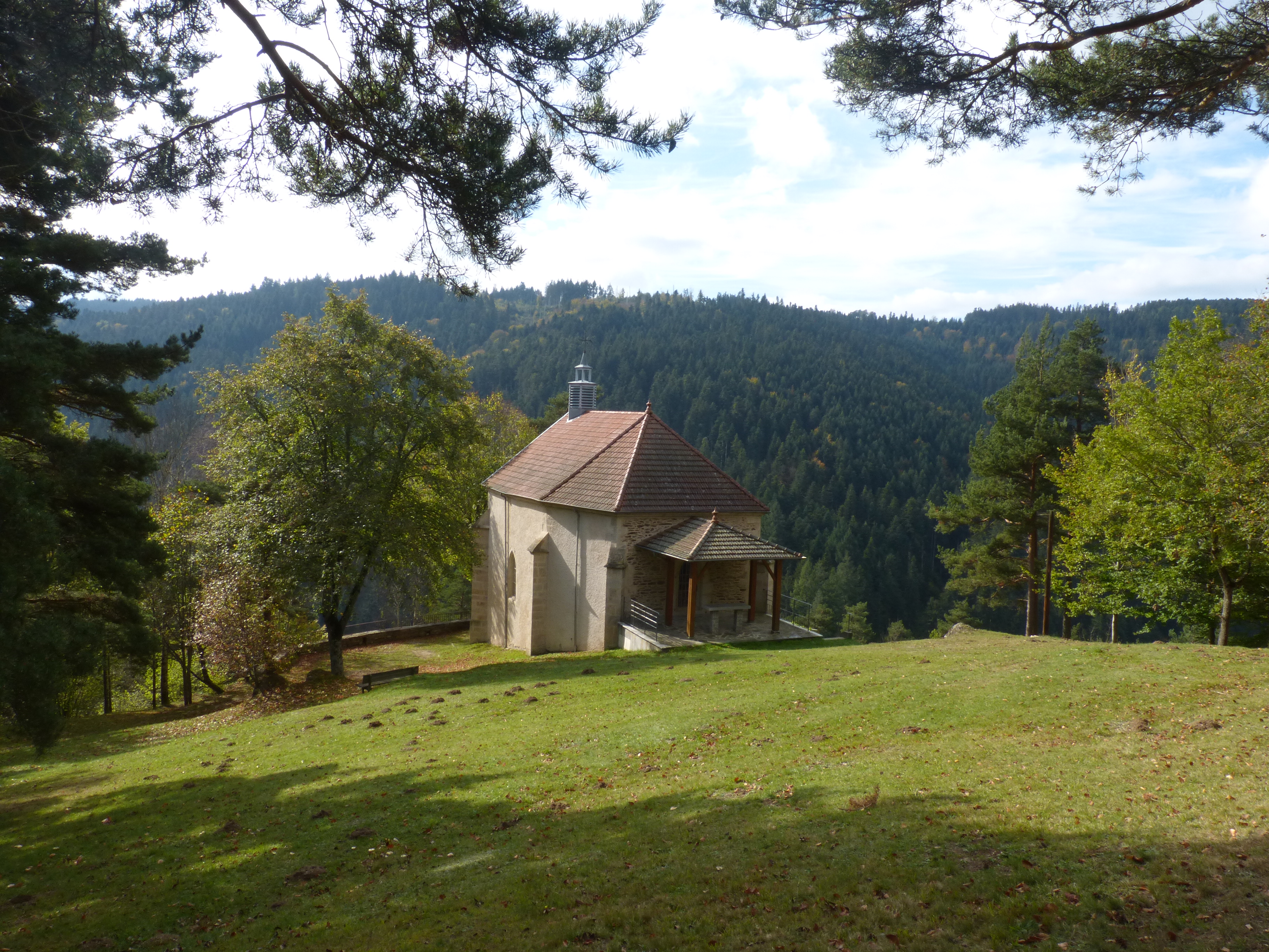
Chapelle Notre Dame de la Roche
Captured by MDT
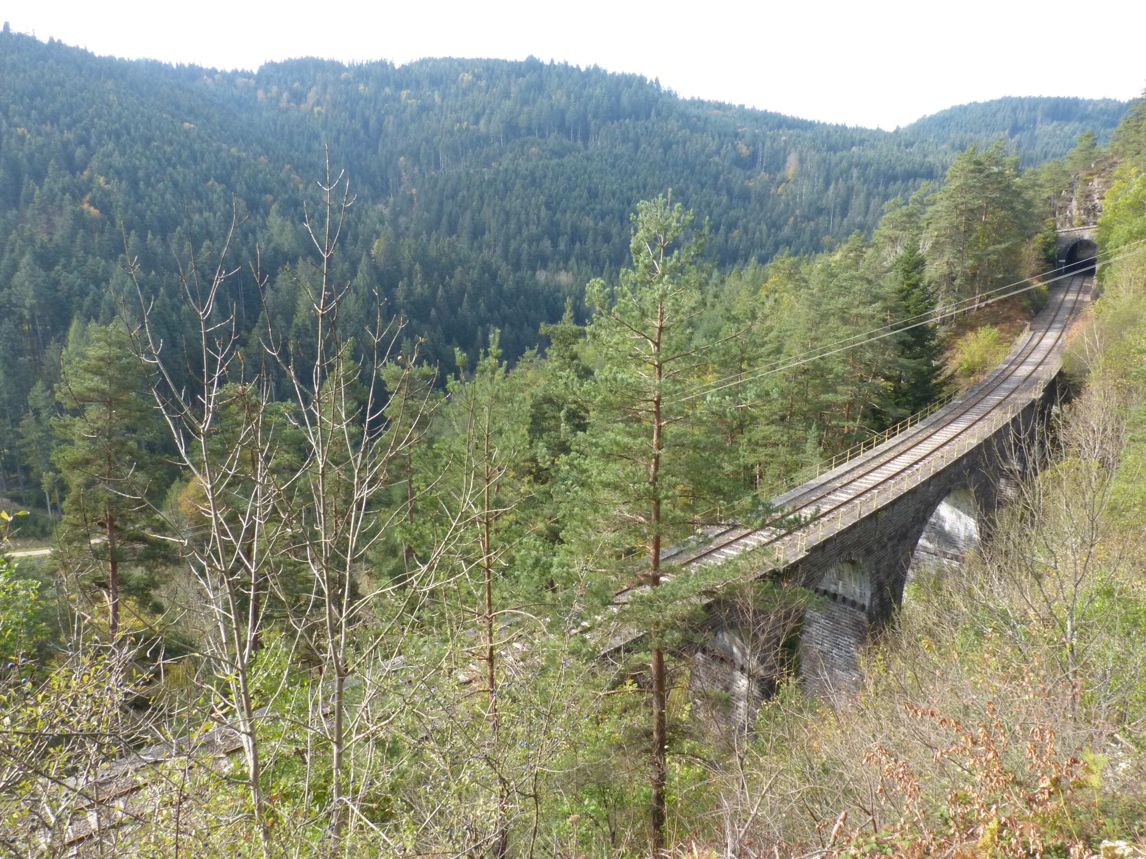
Viaduc
Captured by MDT
Explore Nearby

Dore Loop
The Livradois-Forez Regional Natural Park, a land of grassland and woodland, promises a memorable journey between valleys and ridges.
Circuit n°37 Le Procureur
Discover this trail through the heart of Livradois-Forez.
Circuit n°38 Aller/retour à La Chaise Dieu
Discover this trail through the heart of Livradois-Forez.