
Elevation Profile
531–1047 m
Départ du camping de Vollore-Ville, à 1 km du bourg, en direction de Sainte-Agathe. Descendre vers le plan d’eau par le chemin longeant le camping ; le suivre sur 400 m. Tourner à gauche vers Chossière. A Chossière, longer le lavoir par la gauche, puis monter la route à droite. La quitter dans le virage et suivre le chemin en face. A l’intersection, virer à gauche vers la source captée (vue sur la chaine des Puys).
(1) Traverser la Chaize-Haute (vue sur le Grün de Chignore) et prendre un chemin dans les bois. Monter par la voie pavée ; plus haut, franchir un ruisseau. Aux deux carrefours suivants, continuer en face, puis tourner à droite vers Rochemulet (vue sur la plaine de la Limagne, la chaîne des Puys et le massif du Sancy). Prendre la route à gauche, puis la première piste à droite.
(2) A 100 m, monter à gauche une sente peu visible, dans les bois. Au chaos rocheux, suivre le sentier dans la lande. On retrouve un chemin plus marqué, que l’on quitte sur un replat pour grimper à droite à travers la lande. En haut de la côte, longer le bois à droite (vue sur les Bois-Noirs). 20 m plus loin, descendre dans ce bois et rejoindre une piste forestière. La suivre à gauche en ignorant les autres pistes. Au sortir de la forêt, descendre la route forestière à droite.
(3) Au carrefour descendre le chemin à gauche (propriété privée). Aux ruines du Chouvel, monter à droite. A la patte d’oie, continuer à gauche. Monter le chemin à droite de la maison forestière du Naud et continuer tout droit. (Après 300m, possibilité d’aller-retour jusqu’à la croix du Chignore en empruntant le chemin montant à gauche. Continuer ensuite en face et tourner sur un sentier de droite montant à la croix (vue sur les Monts du Forez, les Monts du Livradois, la Chaine des Puys et le Massif du Sancy)). A la maison forestière d’Ayguebonne, prendre le sentier à gauche. A l’intersection, suivre le chemin plat à gauche. Après les éboulis, au niveau d’une plate-forme, descendre le sentier à droite à travers bois. A l’intersection, continuer entre 2 murets. A 300 m environ, virer à droite.
(4) A Lacoux, tourner à droite en l o n g e a n t un p ré. Aux premières ruines du Châtelet, tourner à gauche, puis tout de suite à droite. A Fargevieille, prendre le chemin à droite. 200 m plus loin, descendre le chemin à gauche. Traverser la D 312. Le chemin en face rejoint le point de départ.
At a Glance
- Duration
- 5.5hrs
- Distance
- 15.7km
- Elevation +
- +662 m
- Elevation -
- -664 m
At a Glance
Live Weather
Departure / Arrival · Camping Vollore-Ville
Live conditions
—
Feels like
—
Wind / gusts
—
Visibility
—
Updated: —
Important Advice
Forestry work is disrupting the section between points 3 and 4. Follow the route shown in the app or guidebook carefully.
Field notes and images
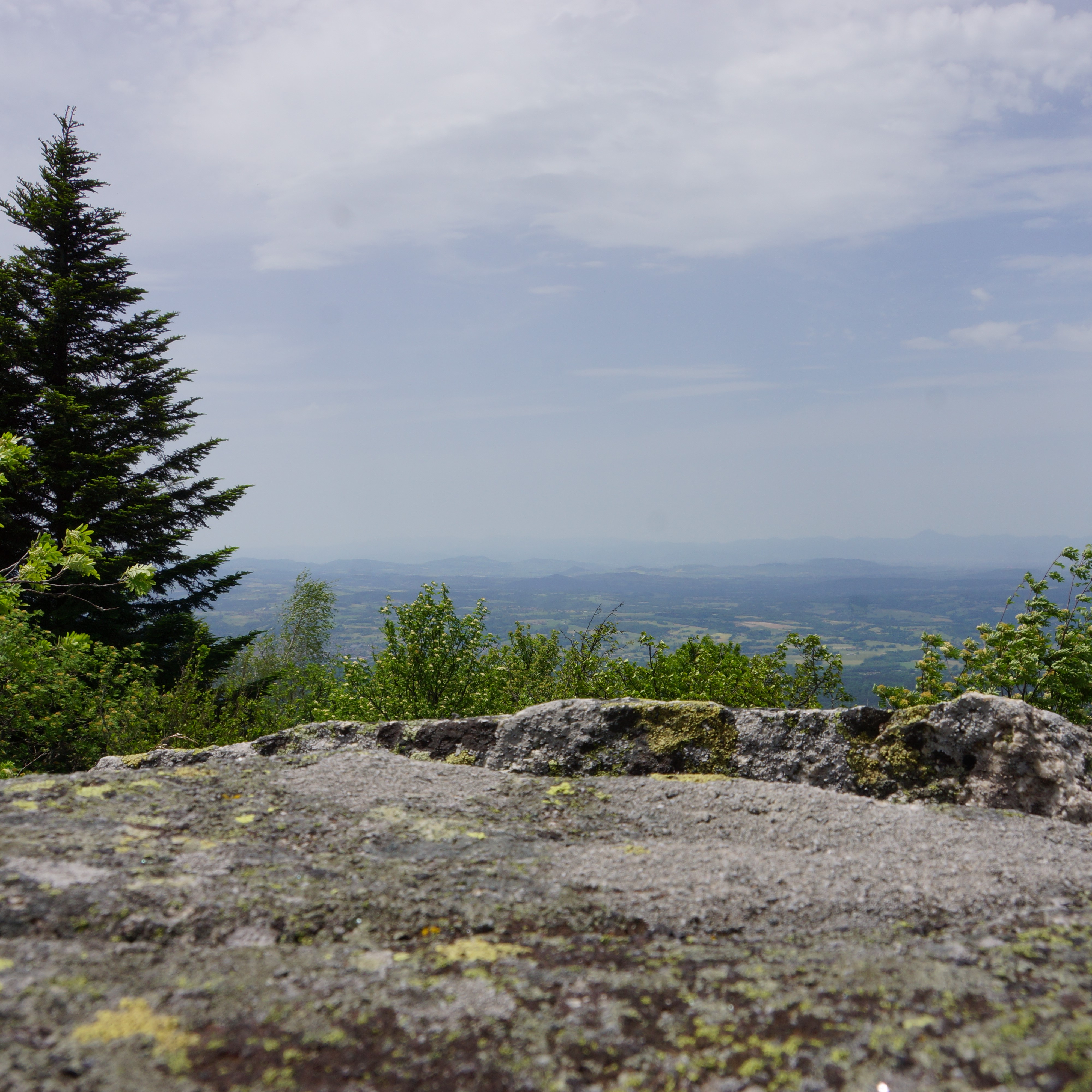
Vue depuis le Grun de Chignore
Captured by Maison du Tourisme Sébastien Giraud
Explore Nearby

Quatre Vents Challenge (Road Circuit No. 14)
One of the shortest circuits designed as a loop from the national cycle-touring centre, this route uses many quiet minor roads. Follow the directions carefully to avoid losing the route. Take particular care on the road after Néronde, especially when turning left off the D906.
The Bridges Circuit
Start: From the church in La Renaudie. Descend the main road (D102), then continue straight ahead at the junction onto the D41 (towards Le Brugeron). Follow the D41 to the Croix de Ste Agathe. Take the road on the right towards Le Clef (view of the village of La Renaudie). At the entrance to the hamlet, just after a barn, take the stony track on the right; pass the renovated house and continue along the grassy track. Continue for approximately 800 m from Le Clef, then turn sharply right to cross the Rioubet stream. Climb the same track to La Chossonie. 1. Just after the first house, leave the road for the track descending slightly to the left. At the fork, continue right (view of the Chaîne des Puys). At the entrance to La Vialle, immediately climb to the right. At the top of the village, cross the D41 and take the track opposite between 2 low walls. On the climb, leave the track and turn left (view of the Sancy massif and the Chaîne des Puys). Continue straight ahead, then turn left near the cross. 2. On reaching the hamlet of Thérias (on a bend), follow the road to the left for 50 m, then turn right towards Les Gouttes at the junction. 20 m farther on, at the cross, leave the road and take the track on the left. At the junction, take the small road opposite (towards La Chaugne). 15 m farther on, leave this road for the track on the right. Cross the stream and continue straight ahead. Pass alongside a hamlet (Les Champs-Elysées) and, at the junction, continue on the same track opposite to Le Garret. 3. In the village, climb the small road opposite to reach the D41. Cross it and take the track opposite. At the fork, continue straight ahead. In the hamlet of Le Cheix, go around the house and continue through the forest to the ruins of the village of Vironesse. 4. At the ruins, continue along the main track for approximately 250 m, then turn onto the first track on the right. Remain on the same track to the Pale stream. Follow the stream on its left-hand side (the track is very wet in places) to reach the D 317. 5. Follow it to the right for 500 m. On reaching the hamlet of La Goutte, take the D 102 to the right (towards La Renaudie). 150 m farther on, on the bend, turn left and follow the right-hand edge of the field. At the junction, take the track on the right. Follow this climbing track for 1.5 km, then turn left at a crossroads of 4 tracks. Remain on the main track until you reach a road. 6. Follow the road to the right for 200 m, then turn right. Beside a ruin, continue straight ahead; follow the Couzon stream. Ignore the forest track branching right and remain on the same track to a ford. 7. Just before the ford, take the track bearing right. Follow the road to the left, then take the first track on the left. At the fork, continue straight ahead. At the junction of several tracks, turn left and then immediately right. Follow the same track to a road. 8. Follow it to the left, then turn left at the next junction. 150 m farther on, turn left again and cross the fields. On reaching the D 101 at the entrance to the village of La Chambonie, beside the cemetery, turn right for 5 m and then immediately take the road on the right. Follow it for 500 m. 9. Beside a small wrought-iron cross, just before an isolated house, turn right and climb through the woods. At the top of the hill, take the clearest track on the right. On leaving the woods, turn sharply left. 10. Follow the road to the right. Cross the hamlet of Le Verdier and remain on the same road. Follow the D 41 to the right. At the large junction, leave the D 41 and take the D102 to the right (towards La Renaudie). Enter the village and return to the church.

Forez Circuit — Les Hautes-Chaumes (Loop No. 5)
This route reveals nature that is still wild in places: Livradois-Forez and its vast, rolling upland plateaus, including Les Hautes-Chaumes.