
Elevation Profile
438–709 m
Start - From the information panel at the bottom of the car park, descend the main street. Turn left, cross Place de l’Ancienne Poste and follow Rue des Coufferts. Cross the bridge (mill leat, or "béal"), take Petite Rue des Coufferts straight ahead, then turn left onto the D214 for 200 m and left again onto the D144. Climb the track on the left (views of Sauxillanges, the Val d’Allier, Puy de Dôme and the Massif du Sancy) and continue to the D144.
1 - Follow the D144 to the right. After the transformer, climb steeply to the left through the woods. At the T-junction, turn left. At the crossroads, turn right towards Ventre. Enter the hamlet on the left. Descend the first track on the left to the fork by the pond.
2 - Turn right, then immediately left. At the bottom of the hollow, ford the stream. Climb to the right through the woods. After the clearing, follow the edge of a conifer wood. At the road, turn left towards Chabreyras (view of the Chaîne des Puys). Cross the hamlet, keeping left, then take a broad earth track on the left. Ignore the side tracks until the D144.
3 - Follow it to the left for 200 m. Bear right onto a forest track. At the fork, turn left. Follow the steeply descending path towards the Chaméane River. Cross the wooden bridge and the D49 at Civadoux. Pass between the inn buildings (a former oat mill) and climb back into the woods. At the junction, turn right. Follow the edge of the pastures (views of the Monts Dômes and the Massif du Sancy). On leaving the hamlet of Bonnefont, descend the track on the left to the D706.
4 - Turn right and, at the hairpin bend, take the track on the left leading to Saint-Quentin-sur-Sauxillanges. Cross the road and then the square, pass the church (Romanesque church with a bell gable) and continue straight ahead on the lower track alongside an enclosing wall, ignoring the adjoining tracks. At La Coierie, follow the D49 to the right for 20 m, turn left, cross the footbridge over the Chaméane stream and follow the path to the right. Descend the wooden steps on the right, cross the bridge downstream from the confluence of the Astrou and Chaméane streams, then continue alongside the Eau-Mère. In Sauxillanges, continue straight ahead on the same road and, at the end of the cul-de-sac, turn right onto Rue des Tanneries; rejoin Rue des Coufferts on the right and return to the starting point
At a Glance
- Duration
- 4.0hrs
- Distance
- 13.0km
- Elevation +
- +546 m
- Elevation -
- -546 m
At a Glance
Live Weather
Departure / Arrival · Sauxillanges
Live conditions
—
Feels like
—
Wind / gusts
—
Visibility
—
Updated: —
Field notes and images
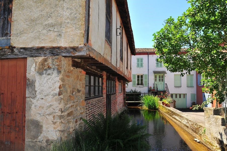
Captured by Agglo du pays d'Issoire
Explore Nearby

Châteaux and Villages in Queen Margot Country (Loop No. 7)
This 60.5 km loop starts and finishes at Sauxillanges - Place de la Promenade, with 1062 m of ascent and an estimated duration of 4 hr 30 min.
Circuit Chabonne
Discover this trail through the heart of Livradois-Forez.
Circuit des moulins
Discover this trail through the heart of Livradois-Forez.