
Elevation Profile
939–1046 m
Departure from the Saint-Bonnet-le-Bourg town hall car park. Go down to the church via the main street and take the first street on the right. Go up towards the road, follow it for 150 m, then turn right onto a dirt road going under the conifers.
(1) 30 m before the D 999A, turn left onto a dirt road. 700 m later, turn left at the crossroads, then, at the next corner, turn right. Reach La Bardelle by a tarmac path that you take on the left(view of the Marchaud pond and the Forez ridges).
(2) Turn right into the hamlet. Cross the dike of the Etang de Marchaud and go up to the left.
(3) At the Vialettes farm, continue opposite on the road. At the entrance to the hamlet of Losfonds, turn left onto the first tarmac path, then go down a grassy path. At the first Montel building, go down the tarmac path on the left. Continue on a path between two low walls, then, at the crossroads, turn right.
(4) At the hamlet of La Rouveyre, follow the road on the left for 500 m. Take a path to the right, then turn left.
(5) Behind the Champ farm, take the first path on the right and continue straight through the forest until you reach the departmental road.
(6) Take the D 260 on the left for 50 m. Go up to the left in the hamlet of La Grange and continue on the dirt road. Cross the road and reach Saint-Bonnet-le-Bourg via a grassy path which runs along a wall. Take the first street on the right and return to the start.
At a Glance
- Duration
- 3.0hrs
- Distance
- 10.4km
- Elevation +
- +224 m
- Elevation -
- -226 m
At a Glance
Live Weather
Departure / Arrival · Mairie de Saint-Bonnet-le-Bourg
Live conditions
—
Feels like
—
Wind / gusts
—
Visibility
—
Updated: —
Important Advice
Route impacted by forestry work. The marking may be discontinuous. Please follow the trail carefully.
Field notes and images
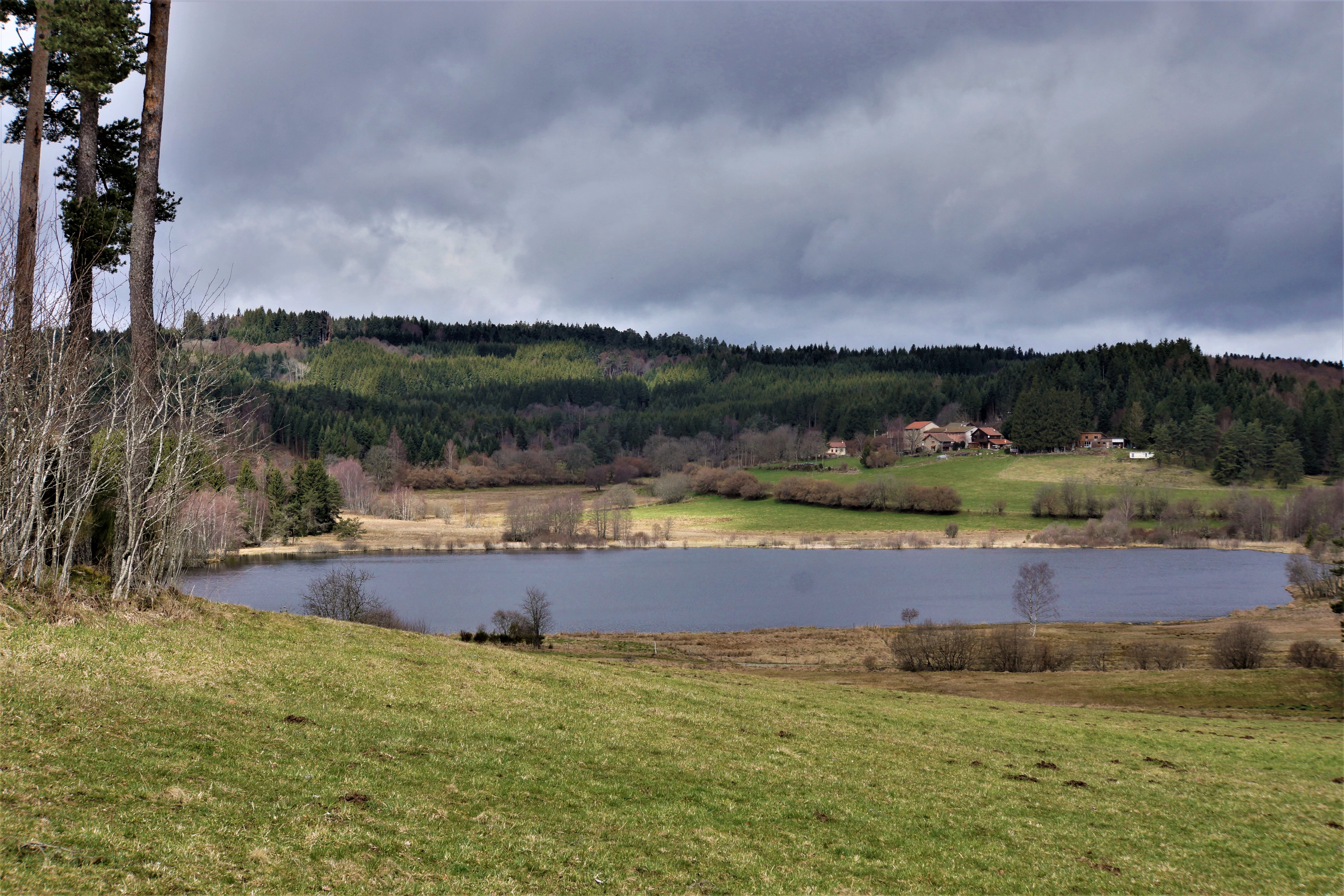
L'étang de Marchaud
Captured by Maison du Tourisme Sébastien Giraud
Explore Nearby
Ridge walk
A circuit in the highlands of Ste-Catherine (14th century church) with panoramic views of the Dôme mountains, the Dore and Cézallier mountains as well as two beautiful crosses in the hamlets of Moulin à vent and Peslières.

Dore Loop
The Livradois-Forez Regional Natural Park, a land of grassland and woodland, promises a memorable journey between valleys and ridges.
Circuit n°40 Bellevue et le bois de la Vierge
Secteur Saint-Germain-l'Herm