
Illustration in progress
The Église Saint-Jean stands as a silent witness to a sophisticated aesthetic rarely encountered in such rural altitudes. Within its Romanesque shell, the interior holds a startling revelation: 12th-century murals that deviate from typical Western motifs, instead whispering of Byzantine influence. These pigments, dormant behind layers of history until their late 20th-century resurgence, cast a celestial light upon the heavy Auvergne stone. To walk through the nave is to experience a convergence of East and West, where the austerity of the architecture provides a canvas for delicate, ancient artistry that survived the centuries in total obscurity.
The narrative of the land is inextricably bound to the rise and fall of the Aycelin dynasty and the subsequent noble houses that claimed the keeps of Montaigut and La Molière. At the heights of the commune, the vestiges of the Château de Montaigut command the horizon, marking the former seat of a family whose influence rippled across the French court. Further down the slopes, the Château de la Molière reveals a complex architectural lineage, its 13th-century foundations having been touched by the hands of the d’Urfé and Montmorin-St-Hérem families. Each stone wall and gated entrance serves as a physical record of the shifting alliances and feudal prestige that once governed these high pastures.
Beyond the architectural monuments, the territory unfolds in a tapestry of forty-seven hamlets, a dispersed arrangement that echoes the agrarian rhythms of the Middle Ages. The terrain is defined by a rigorous contrast between the fertile, arable stretches that occupy nearly ninety percent of the soil and the dense, dark clusters of forest that cling to the steeper gradients. Wandering through localities such as Les Végheants or Thermorel, one senses the enduring connection between the local climate—a bracing mix of oceanic and mountain influences—and the rugged character of the landscape. It is a place where the density of the woods meets the openness of the plateau, offering a quiet, intellectual immersion into the deep history of the Livradois-Forez.
Local profile
At a Glance
- Population
- 606
- Demonym
- —
- Altitude
- 326–531 m
- Forest
- 10.1%
residents
local residents
lowest to highest
commune coverage
Did You Know?
“The 12th-century murals in the local church remained concealed for centuries until their fortuitous uncovering and restoration in the 1990s, revealing a rare Byzantine influence in the heart of the Auvergne.”
Cultural Heritage
A quiet village with authentic Auvergne charm.
Recent Wildlife & Flora Log
Nature observations recorded within 5km of Glaine-Montaigut.
Bucaneve
Milà reial
Alpine Squill
Red-Belted Bracket
Peltigera hymenina (Ach.) Delise
Green-veined White
Green Long-horn
Brimstone
Addersmeat
Common Periwinkle
Explore Nearby
Complement your visit to Glaine-Montaigut by exploring these neighboring villages.
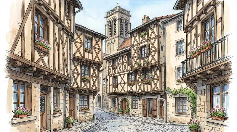
Billom
A medieval merchant capital known as the "Tuscany of Auvergne," where timber-framed architecture and a prestigious academic past define the landscape.
Bongheat
A sophisticated transit point between the Limagne plains and the Livradois highlands, characterized by feudal towers and golden arkose stone.
Bort-l'Étang
A stoic agricultural landscape where the "ford of the raven" reveals a history of profound resilience and quiet architectural dignity.
Égliseneuve-près-Billom
A landscape of scattered hamlets and rolling meadows where Revolutionary history meets the quiet intensity of the Livradois-Forez.
Neuville
A pastoral commune where the fourteenth-century towers of Château de Cheix stand guard over rolling prairies and the intellectual legacy of Pierre Teilhard de Chardin.


