
Illustration in progress
Ascending the winding arteries from the valley floor, the air sharpens as one enters the high-altitude domain of Lérigneux. Positioned between the crystalline flows of the Cotayet and Trézaillette rivers, the terrain is defined by a formidable mantle of spruce and fir that blankets nearly half the commune. This is the realm of the Écureuils—the local nickname for the inhabitants who have adopted the squirrel as their silent guardian. An afternoon spent traversing the granite-strewn paths reveals a landscape where the rural silence is punctuated only by the wind through the high-canopy forests and the rhythmic rush of mountain streams.
The village occupies a site of ancient significance, tracing its etymology back to the Gallo-Roman estate of Lerignacum. At the Gâs de Genétoux, the earth still whispers of a prehistoric oppidum, though the physical remains have long since dissolved into the soil. Throughout the Middle Ages, the community existed without the protection of a keep or ramparts, tethered instead to the distant châtellenie of Châtelneuf. This lack of fortification fostered a resilient, agrarian stoicism that endured for centuries, eventually manifesting in the simple, sturdy architecture of the Église Saint-Jacques-le-Majeur, where the names and photographs of thirteen local sons are etched into the stone, serving as a somber testament to the village’s enduring spirit.
On the morning of August 7, 1944, the village quietude was shattered by the gears of fifty-five military vehicles as Vichy and German forces descended upon Maquisard strongholds. The ensuing Battle of Lérigneux remains a defining chapter of local lore; despite being vastly outnumbered by hundreds of militiamen, the Resistance fighters utilized the dense woodland cover to secure a decisive victory. Today, a more peaceful vigilance is maintained at the Col de Baracuchet. Here, at the LPO bird observatory, travelers can witness the silent migration of raptors across the mountain pass, observing the sky from a vantage point that commands a sweeping view of the Forez plains and the distant Auvergne peaks.
Local profile
At a Glance
- Population
- 173
- Demonym
- Écureuils (informal)
- Altitude
- 875–1344 m
- Forest
- 45.4%
residents
local residents
lowest to highest
commune coverage
Did You Know?
“The residents are affectionately known as "Les Écureuils" (The Squirrels), a mascot adopted due to the village's deep immersion in the surrounding woodland.”
Cultural Heritage
A quiet village with authentic Auvergne charm.
Recent Wildlife & Flora Log
Nature observations recorded within 5km of Lérigneux.
Hairy Violet
Cowslip
Wood Spurge
Dove pincushions
Common Kestrel
Cottongrass
Speckled Yellow
Froghopper
Geranium sylvaticum L.
Dyroderes umbraculatus (Fabricius, 1775)
Trails around Lérigneux
Discover physical challenges and natural beauty in the immediate vicinity.
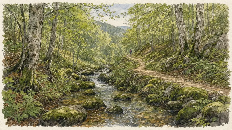
Circuit n°13 Boucles des 7 cols (départ Col des Pradeaux)
Discover this trail through the heart of Livradois-Forez.

GR®3 — The Forez Mountains
The GR®3 is a legendary long-distance trail following the Loire, one of Europe’s last wild rivers, for 1,200 km. It begins at the river’s source on Mont Gerbier de Jonc and continues to its estuary near Guérande. The section across the Forez mountains unfolds through a succession of striking panoramas, peat bogs, moorland, winding rivers and vast open spaces.
Explore Nearby
Complement your visit to Lérigneux by exploring these neighboring villages.
Roche (Roche-en-Forez)
A high-altitude destination where volcanic peaks meet the somber history of the French Resistance amidst ancient shepherd huts.
Saint-Anthème
A high-altitude sanctuary in the Monts du Forez, where medieval ruins and a "cathedral of the mountains" overlook the pastoral Hautes-Chaumes.


