
Elevation Profile
553–763 m
Départ : Depuis la place de la mairie de Tours-sur-Meymont, emprunter le D225 à gauche sur 50 m. Au carrefour, prendre la route goudronnée en direction de Saint-Gervais-sous-Meymont. Emprunter ensuite le premier chemin descendant à gauche longeant le verger conservatoire de Tours-sur-Meymont. Au carrefour de 4 chemins, continuer tout droit et garder le chemin principal jusqu’au ruisseau de Minchoux.
1. Traverser le ruisseau et emprunter un sentier entre 2 champs après 50 m de montée. Au carrefour en “T”, tourner sur le chemin de droite. Traverser le village de la Calendre et continuer sur le chemin principal jusqu’à la route goudronnée. La traverser et emprunter la route montante en direction du village de Bouget.
2. A la croix, dans le village, continuer sur le chemin à droite. 200 m avant l’entrée du village des Fraisses, emprunter le chemin de droite. Au carrefour en “T”, dirigez-vous à gauche. 100 m plus loin, au second carrefour en “T”, em prunter la route goudronnée à droite. A la sortie du village, emprunter le chemin descendant à droite. Traverser le ruisseau et, au carrefour de 4 chemins, continuer en face, (possibilités d’aller-retour à la vierge de Piedmont) jusqu’au village de Vol.
3. Emprunter la route goudronnée à droite. Au carrefour continuer tout droit avant de prendre le premier chemin descendant à gauche. Continuer sur le chemin principal jusqu’au village de Campines. Au carrefour, continuer à droite sur le chemin carrossable. A la patte d’oie, continuer à monter à gauche jusqu’au carrefour de 4 chemins.
4. Emprunter la piste à droite et garder la jusqu’à la D225 (Vue sur la chaîne des Puys et le massif du Sancy). Traverser la D225 et continuer toujours tout droit jusqu’au village de la Gorce. Rentrer dans le village à droite. Au centre du village, emprunter la route à droite et continuer tout droit. La route devient chemin. Au carrefour en “T”, dirigez-vous à gauche. Emprunter ensuite le premier chemin à gauche jusqu’à la D259.
5. Traverser la route pour rentrer dans le village de Bourdelles. Continuer sur le chemin en face jusqu’à la route goudronnée. La prendre à droite pour remonter dans le village de Tours-sur-Meymont. A l’église, emprunter la D225 à droite pour retrouver le parking.
At a Glance
- Duration
- 4.5hrs
- Distance
- 13.5km
- Elevation +
- +363 m
- Elevation -
- -364 m
At a Glance
Live Weather
Departure / Arrival · Tours-sur-Meymont
Live conditions
—
Feels like
—
Wind / gusts
—
Visibility
—
Updated: —
Field notes and images
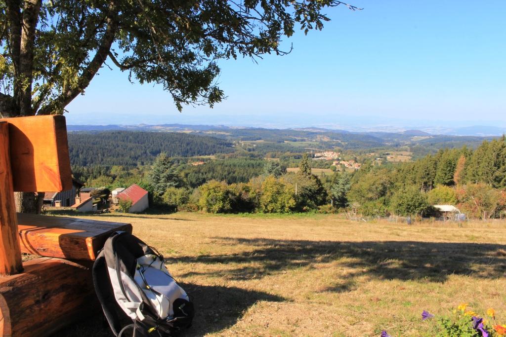
point de vue en Livradois-Forez
Captured by Maison du Tourisme
Explore Nearby
Around the Maison du Parc
Departure: From the Parc Livradois-Forez house, in Saint-Gervais sous-Meymont, go up and through the village. At the exit, go up the path on the left. Leave another one on the left. 1. On a small plateau, turn right towards the houses of Combe. Go up the D254 on the left for 50 m. 2. Leave the road and go down the path on the right, then climb under the chestnut and hazel trees, on the right, after a stream. Follow the D254 on the right(view of the Dore and the foothills of Forez: grün de Chignore). 3. At Griolles, go down the path on the right. At the first split, climb to the left in the woods, then continue along the edge. 4. Turn right into Lauphant(well)and go up the small road to the plateau(view of the Forez). 5. After crossing Le Bouchet, go down the small road on the left, then follow the D254 on the right. At the crossroads, take the D259 on the left, towards Olliergues. 6. After 300 m, go up the path on the right behind a farm shed, in the woods. Always keep the same path to exit the woods (view of the Dore valley, Forez and the Puys chain). 7. At the iron cross, turn right, then immediately left along the woods until Pradat. 8. In Pradat, go up the path on the left. At the crossroads, turn left onto the perpendicular path(view of the Château de Blanchisse). Always keep the same path (view) until you reach a small road; follow her in front. 9. Before the first house in Guimoye, go down the path to the right, full slope, in the woods. 10. Cut the D259 to take the path on the left; sometimes paved, in deciduous woods, it passes a stream and small waterfalls. 11. Take the road on the right. Cross the Constancis and the Thiaudat straight on. At the fountain, go up the path on the left. 12. Turn and go down the perpendicular path, on the right. At the Croix des Pouillades, take the road on the left. At the exit of the second bend, go down the grassy path on the right. Returning to point 1, in the middle of the meadows, go right to dive towards the Maison du Parc.

Boucle Dore
Le Parc Naturel Régional Livradois-Forez, pays de l'herbe et de l'arbre, vous promet un séjour inoubliable entre vallons et crêtes.
Circuit n°44 Les Cimes du Livradois
Secteur St-Amant-Roche-Savine