
Elevation Profile
324–535 m
Ce circuit balisé très valloné permet de découvrir le joli vallon du Lilion sur le secteur de Sermentizon. Sur sa partie ouest, ce circuit permet aussi de profiter de très beaux panoramas sur les volcans d'Auvergne.
At a Glance
- Duration
- 2.5hrs
- Distance
- 21.5km
- Elevation +
- +521 m
- Elevation -
- -521 m
At a Glance
Live Weather
Departure / Arrival · Courpière
Live conditions
—
Feels like
—
Wind / gusts
—
Visibility
—
Updated: —
Field notes and images
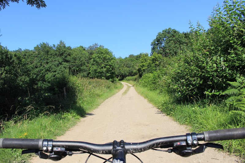
chemin
Captured by Maison du Tourisme
Explore Nearby

Around the Couzon valley (circuit n°8)
Very nice, varied marked circuit, which alternates descents and climbs on paths presenting several technical passages (deep ruts, slopes, small screes). In particular, you should be particularly vigilant during the first descent between Ollières and the Mégain bridge, especially if you have not had the opportunity to warm up a little beforehand. The circuit then runs along the western part of Lake Aubusson before passing near the Notre-Dame d'Espinasse chapel built just above a miraculous spring from which water springs which can treat and cure certain skin diseases such as eczema...
Around the towers and castles
Departure: Take the alley to the left of the town hall which runs alongside the village hall. 20 m further, at the fork, take the path on the left between the stone houses. Cross the D 303, and take the road opposite. In the village of Audigier, turn right to pass between the houses. At the fork, at the exit of the hamlet, continue right on the path. At the Sardiats stream, continue on the same path (view of the Château de Mauzun on the left). 1. At the D 20, take it on the right for 400 m; then at the next crossroads, turn right towards Puy Gentil. At the hamlet, go up left to the D 152. Take it on the right to enter Neuville (view on the left of Clermont-Fd, the Chaîne des Puys and the Château de Ravel). In Neuville, opposite the church, turn left then immediately right after the fountain (direction Les Peux); then 10 m further, turn left (view on the left of the ruined Neuville tower). 2. At the next crossroads, turn right. Cross the village of Peux (view of the Mauzun castle slightly on the left, the Puys chain and the Sancy massif, Billom, Clermont-Fd). In the hamlet of Pireyre, at the crossroads, turn left. At the last houses, leave the road and take the path which goes up to the left (view of the Mauzun castle, Bongheat in the foreground and the Sancy massif in the background on the right, Château des Salles, Billom, Clermont-Ferrand, the Limagne plain and the Puys chain completely on the right). At the crossroads of 5 paths, take the opposite direction and pass next to the Château du Cheix. 3. At the D 303, take it on the right. 200 m further, turn left to enter the village of Herment. At the exit, continue to the right on the road which becomes a grassy path (view of the Mauzun castle on the left) then follow the D 303 on the left. At the level of the lake, take the sunken path which rises to the left and continue on this same path to Bel Air (100 m after Bel Air: view of the Mauzun castle opposite, the Sancy massif and the Puys chain slightly to the right). 4. At the crossroads, at the road (view of Thiers on the left, the Forez mountains opposite, the Mauzun castle, Sancy massif and Puys chain on the right) turn right. At the D 7, follow it for 50 m and turn immediately right. Cross the hamlet of La Montagne. 5. At the entrance to Mauzun, turn right, and, at the wrought iron cross, immediately go up to the left to pass between the houses then turn right to join the D 20. Take it on the right, skirt the chapel then the covered market. At the next crossroads, turn right onto the D 20 (direction Bongheat). At the Place des Grolles, (possibility of going up to the Château de Mauzun) take the path between two houses at the back of the square. At the crossroads (nice view), go down opposite and continue on this same path. 6. At the fork, continue to descend to the left (ignore the stony path). Walk along the cemetery, and at the road, turn left to enter Bongheat.
Fairy Walk
Departure: church square. Walk past the church then follow the road to the railway line. Before this, turn right and follow the street for 500 m. Head towards the D 906. Cross it to take the road opposite, be careful of fast traffic (direction la Brousse). Turn left and join La Brousse. 1. In the hamlet, take the path on the left, just after the fountain. Continue on this same path to the village of Chaumies (viewpoint over the Forez mountains). At the first houses, take the path opposite. The path becomes a road that we always follow. At the last house, leave the road and take the path opposite. Leave the first path on the right which goes down into the woods. 2. At the top of the hill, at the crow's feet, take the path on the right (viewpoint). Go down towards the stream and continue along the same path. Arriving at the road, turn right towards the hamlet of l'Eschalier. At the first houses, turn left to join the road. Cross it to take the small road opposite. 3. At the transformer, turn right onto the road then, 150 meters further, follow the D44 on your left for approximately 1.5 km. 4. At the cross, continue to the right on the D 308 and join the D 906 (be careful of fast traffic). Cross it to reach the church square in Néronde-sur-Dore.